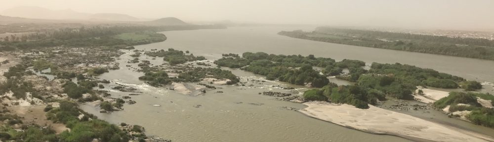

Location of the MUAFS concession in the Middle Nile Valley.
The area which is the focus of new fieldwork planned within the Munich University Attab to Ferka Survey Project (MUAFS) is a stretch along the Nile including various islands between Attab and Ferka in Northern Sudan, within the general region of the southern Second Cataract, being located just south of the Dal Cataract. This area of investigation can be regarded as “periphery” to two of the main Egyptian centers of the region, to Amara West and Sai Island.
The area between Attab and Ferka was already surveyed and published by André Vila in the 1970s, resulting in the discovery of rich multi-period sites comprising both settlement and funerary remains (from Paleolithic to Medieval times). All of these sites need to be revisited and in particular checked in regards of dating. At selected sites excavations will be conducted and an in-depth study undertaken, resulting in fresh data for the long dureé approach of the project and especially the question of border studies. The methods and documentation techniques for fieldwork in Sudan include magnetometer survey, drone photography and image based modelling approaches tested already extensively within the ERC AcrossBorders project.
The project is hosted by the LMU Munich and received its initial funding by LMU Munich‘s Institutional Strategy LMUexcellent within the framework of the German Excellence Initiative and the Adele Hartmann Programme for Julia Budka.
Since April 2020, the ERC project DiverseNile is carried out under the umbrella of the MUAFS project.