Outlook for upcoming research at Kosha West

My personal favorite landscape in the MUAFS concession area is the left riverbank of the districts Ginis and Kosha which is also rich in archaeology. Beautiful sand dunes and tamarisks dominate the strip along the Nile; desert and rocky outcrops shape the hinterland.

Despite of Covid-19 and the unclear situation regarding our next field season in Sudan, we are of course planning for the ERC DiverseNile project. One of the main tasks for the next season will be test excavations at habitation sites at Kosha West.

If one looks at our new distribution map of sites dating to the New Kingdom, Pre-Napatan and Napatan times, it is striking that the most downstream ones are three sites in the district Kosha West.
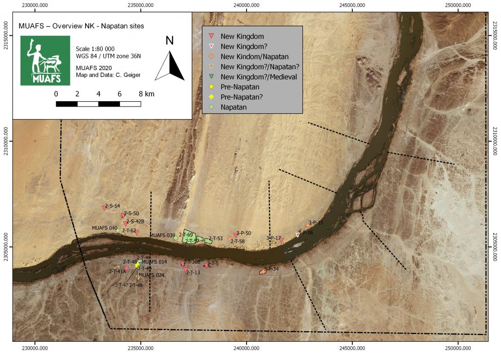
Distribution of New Kingdom, Pre-Napatan and Napatan sites in the MUAFS concession.

These are remains of structures/dwellings, situated on three isolated mounds on the dune area with tamarisks. The distance to the Nile is 100-150m. This group of habitation site was already noted by André Vila in the 1970s and he attributed all of them to the Egyptian New Kingdom. This is, however, not the case.
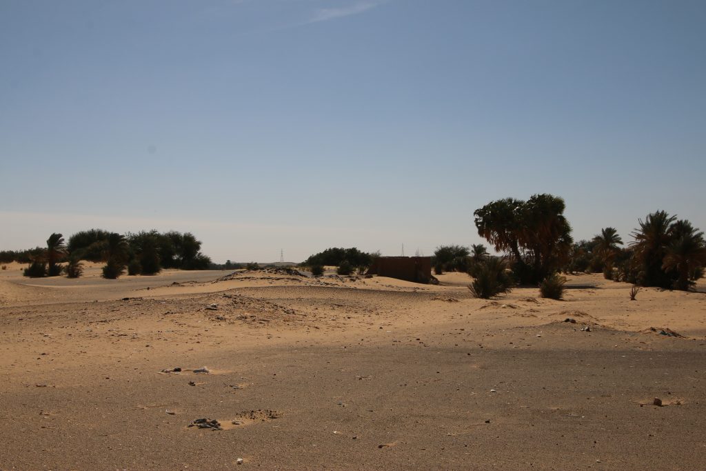
Overview of site 3-P-17.

3-P-17 is traceable with some mud bricks and scattered stones on a mound, the total extension of the site is at present a bit unclear. According to the surface pottery we recorded last year, this site can be attributed to the early 18th Dynasty.

The remains of 3-P-16 are located on a circular mound with a diameter of c. 50m. In the south-eastern part of the mound large amount of mud bricks seem to have once formed a fortification. The dating of this structure must remain unclear for now; the surface material suggests indeed a New Kingdom date, but there were also some Medieval sherds.
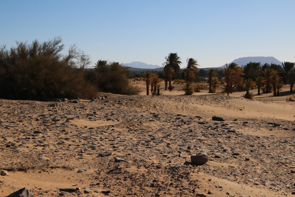
Surface at site 3-P-15.

The third habitation site, 3-P-15, comprises a mound of c. 55-100m, the surface is covered by schist blocks and sherds. The appearance of the site is very similar to 3-P-16. In the northeastern part, remains of mud bricks are visible. 3-P-15 is especially intriguing because it shows a continuation from late Ramesside times well into the ninth and maybe even the eight century BC according to the surface ceramics we documented. A more precise dating and a concise characterisation will require excavations – but a New Kingdom only date as suggested by Vila seems were unlikely.
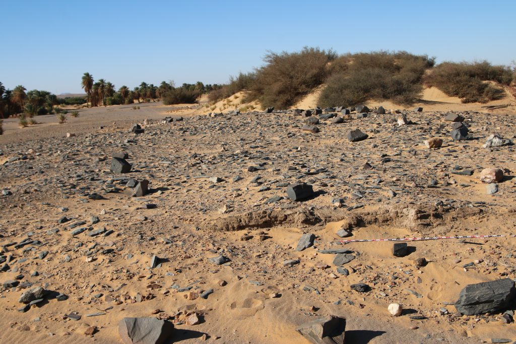
Mud brick remains at site 3-P-15.

For now, we keep our fingers crossed that the Covid-19 situation in Sudan – and of course everywhere else! – will soon improve and everybody stays healthy. Insha’allah our planned fieldwork will be possible somewhen in the near future – there are definitly plenty of things to be checked and discovered between Attab and Ferka!

An update: Kerma sites in the Attab to Ferka region

The last weeks were busy, among other tasks with completing data for our GIS project in order to create new maps based on our survey results. As I have shown in my OREA e-lecture, Cajetan has created site distribution maps according to periods – simply fantastic to work with!

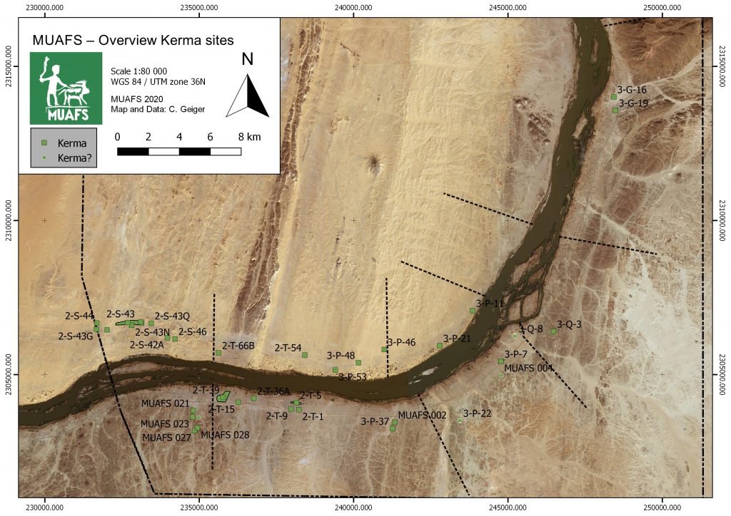
Since the ERC project DiverseNile will focus on Bronze Age remains, the sites currently labelled as ‘Kerma’ are of much interest. The present map also includes some unclear sites where a proper dating and/or association with the Kerma culture remains to be checked.

Kerma sites in the Attab to Ferka region identifed by the MUAFS project (status: 2020)

Brigitte Gratien, one of the leading experts on the Kerma culture, recently pointed out the general problems related to Kerma remains outside of the heartland of the Kerma kingdom at the Third Cataract:

As everybody knows, writing about Kerma north of the Third Cataract is not so easy. Most of the excavations were done a long time ago and the results come mostly from the Nile valley. Where are the borders of the Kerma state or kingdom? What are the stages in the expansion of Kerma to the north, and what was the nature of the links and relationship with the other Nubian cultures and with Egypt?’(Gratien 2014, 95)

The Attab to Ferka region and renewed excavations at Kerma sites in the area have much potential to address these questions and problems which will be of first priority for the DiverseNile project. In general, very little rural settlements have been investigated up to now in northern Sudan, creating a lack of means to contextualise the central sites like Kerma or Sai Island. Sai is regarded, due to the strong Kerma presence on the island prior to the New Kingdom and especially the very large cemetery with huge tumuli, as northern stronghold of the Kerma kingdom. But how does this presumed function of the island relate to the periphery of Sai? What do we know about Kerma dwellings in the area?

This brings us back to the MUAFS concession and to our newly established distribution of ‘Kerma’ sites. Camps, settlements and cemeteries of the Kerma culture were recorded at both riverbanks. Except for two large Kerma tumulus cemeteries associated with the Kerma classique period in Ferka East, 3-G-16 and 3-G-19, all of the sites are clustered in the southern districts of Attab, Ginis and Kosha, thus quite close to Sai Island.

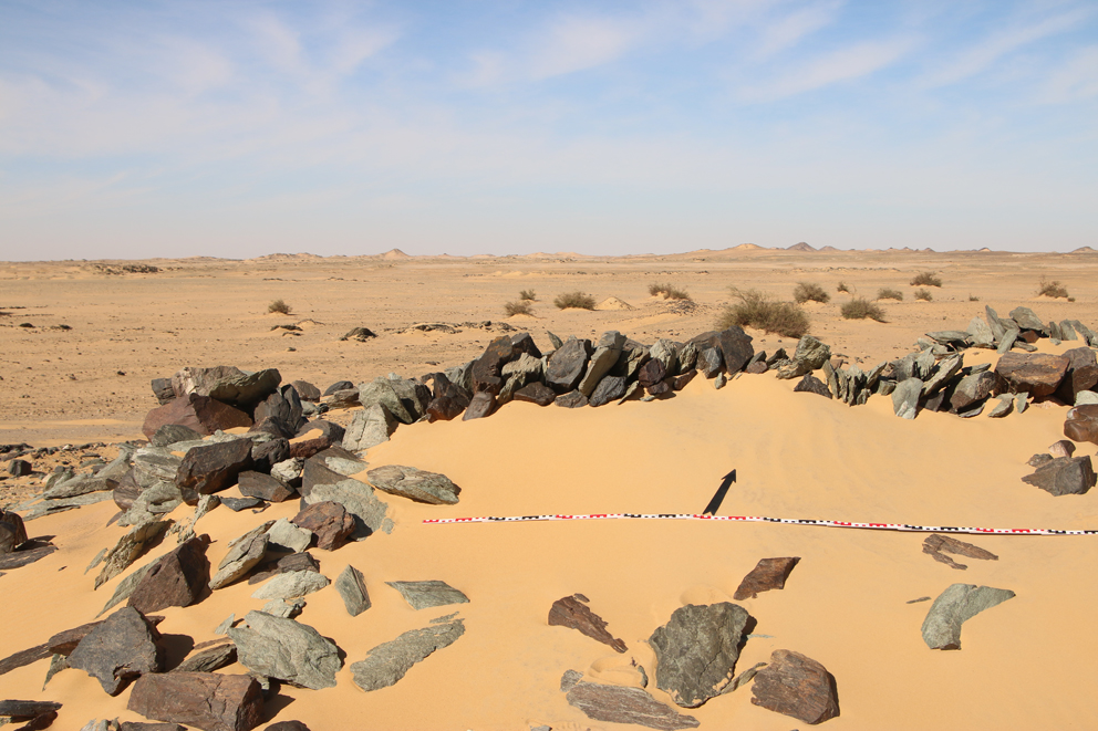
Dry-stone architecture datable to the Brone Age at Attab West.

Of particular interest are 1) stone structures in the Attab West district associated with 18th Dynasty pottery but of unclear cultural attribution since also Nubian material culture was present (Budka 2019, 24‒25) and 2) various settlement sites in the district of Ginis East. The latter were partly investigated by our text excavations earlier this year.

It is still too early, but sites like GiE 001 and the ‘watchtowers’ in Attab West will hopefully allow a comparison of ‘provincial’ Kerma remains like Gism el-Arba (Gratien et al. 2003; 2008) and H25 near Kawa (Ross 2014) with the capital of the Kushite kingdom, Kerma itself (Bonnet 2014). At least some of the questions regarding Kerma north of the Third Cataract are likely to be answered in the next years.

References

Bonnet 2014 = Bonnet, C. 2014. La ville de Kerma: une capitale nubienne au sud de lʼEgypte. Paris.

Budka 2019 = Budka, J. 2019. ‘Towards Middle Nile Biographies: The Munich University Attab to Ferka Survey Project 2018/2019’, Sudan & Nubia 23, 13‒26.

Gratien 2014 = Gratien, B. 2014. ‘Kerma north of the Third Cataract’, in J. Anderson and D. Welsby (eds), The Fourth Cataract and Beyond. Proceedings of the 12th International Conference for Nubian Studies. British Museum Publications on Egypt and Sudan 1. Leuven, 95‒101.

Gratien et al. 2003 = Gratien, B., Marchi, S., Thuriot, O. and J.-M. Willot 2003. ‘Gism el-Arba, habitat 2. Rapport préliminaire sur un centre de stockage Kerma au bord du Nil’, Cahiers de Recherches de l’Institut de Papyrologie et d’Égyptologie de Lille 23, 29-43.

Gratien et al. 2008 = Gratien, B., Marchi, S., Sys, D. and R.-P. Dissaux 2008. ‘Gism el-Arba – Habitat 2, Campagne 2005–2006’, Kush 19 (2003-2008), 21-35.

Ross 2014 = Ross, T.I. 2014. ‘El-Eided Mohamadein (H25): A Kerma, New Kingdom and Napatan settlement on the Alfreda Nile’, Sudan & Nubia 18, 58‒68.