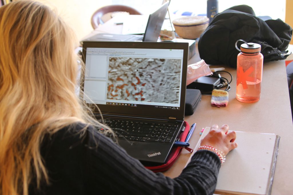
We are currently processing the data from our first season – while I am busy with assessing the potential of the individual sites for research questions, Marion works on the interpretation of the results from the geophysical survey and Cajetan composes new maps illustrating our findings. Additionally, the processing of the drone photographs that Cajetan took, assisted by Franziska and Valentina, is still ongoing.
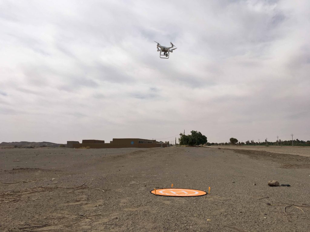
A large part of the concession on the East Bank was completely covered with the drone of type Phantom 4Pro, kindly lent to the project from the Department of Archaeology and Cultural Studies of the LMU. Compared to the AcrossBorders project, for which we were using a kite for aerial photography, this was really a great advancement, especially in terms of the extensive reach the drone can cover!
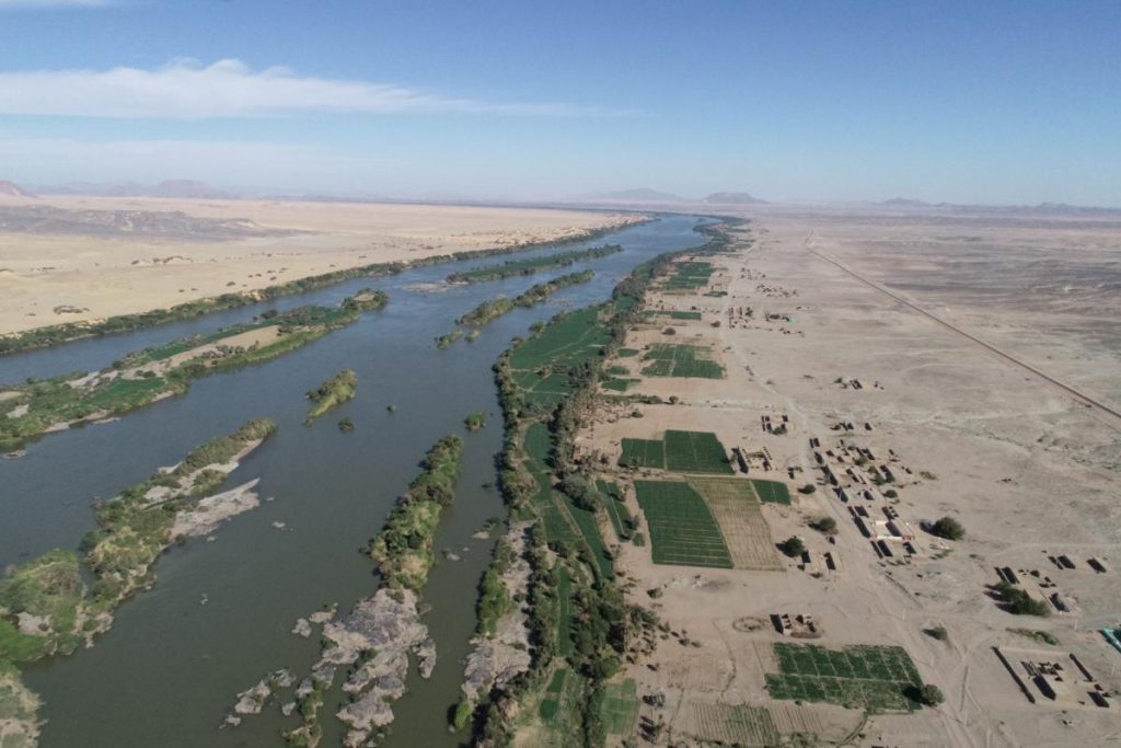
The aerial photographs allow not only georeferenced orthophotos of selected sites, but especially to establish a digital landscape model of parts of the MUAFS concession. In combination with the results from magnetometry, these surface models, especially from Ginis East, offer plenty of possibilities for interpreting our multi-period sites within their environmental surroundings. Great advances thanks to this first very successful season!
From the Nile back to the Isar, from sun and sand back to clouds and snow, from desert walking back to desk work, emails, meetings and teaching – although our travel back from Attab via Khartoum via Istanbul to Munich took more than 30 hours, it feels like a very sudden transposition.
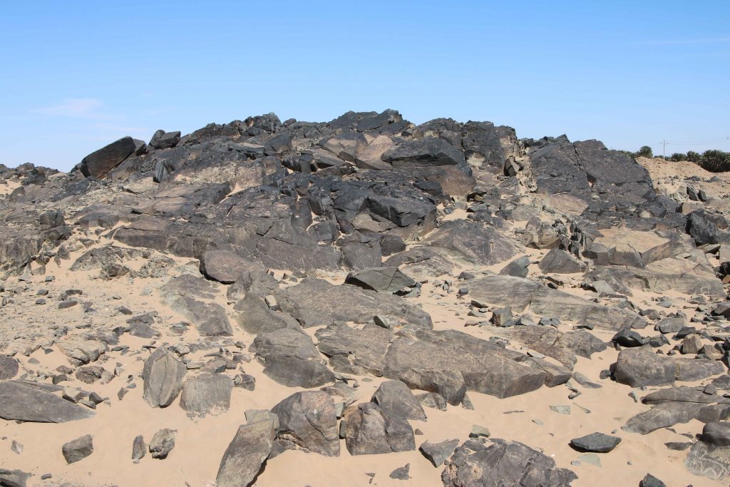
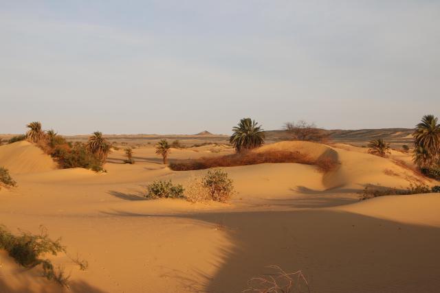
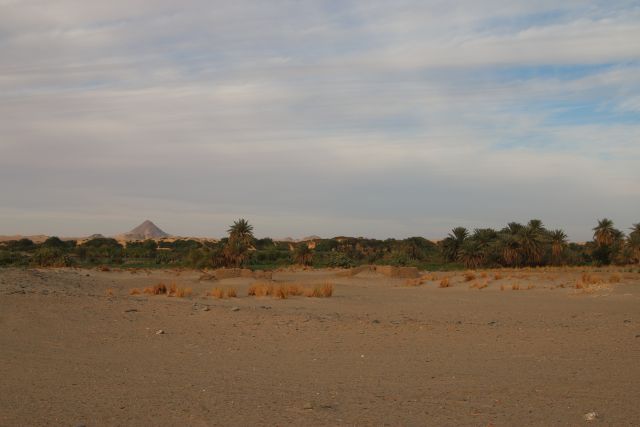
Landscape view of our concession area in northern Sudan.
Our first season of the MUAFS project was successfully closed and all of the principle goals were achieved thanks to the great support of NCAM and our inspector Huda Magzoub.
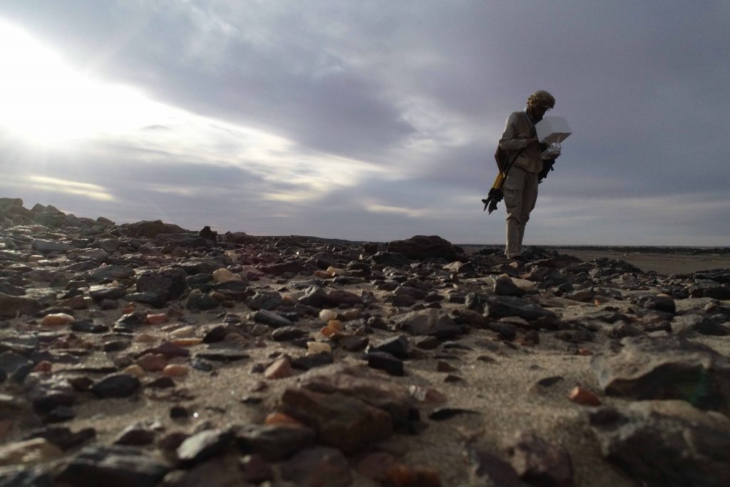
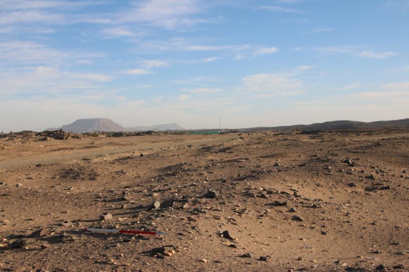
The principal goal of the first season was a new survey of the concession area, which was already recorded by Andrè Vila in the 1970s and published in his volumes 3-6. Altogether, 119 sites by Vila were re-identified and documented in the area between Attab East and Ferka East and Attab West and Mograkka West. For some of these sites, the dating can now be corrected, especially for Khartoum Variant and Abkan sites, Pre-Kerma sites, Kerma, New Kingdom and Napatan sites. Diagnostic stone tools and pottery fragments were collected from relevant sites. Other findspots of pottery and lithics that were previously not recorded by Vila, were documented as GPS waypoints and will be integrated in the new map of the area to be composed based on the results of our first season.
One particular focus was on the state of preservation of the sites
nowadays – unfortunately, at almost all sites, we observed modern destruction
and/or plundering. Especially drastic were destructions because of road
building, the electricity posts and modern gold working areas (in particular at
Mograkka West).
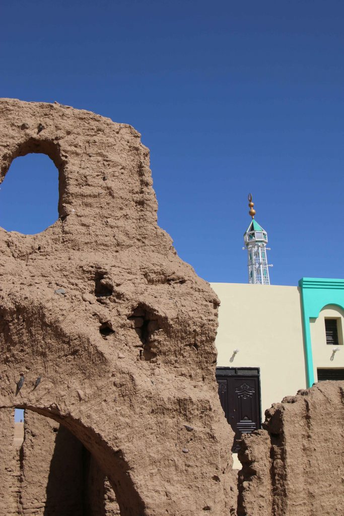
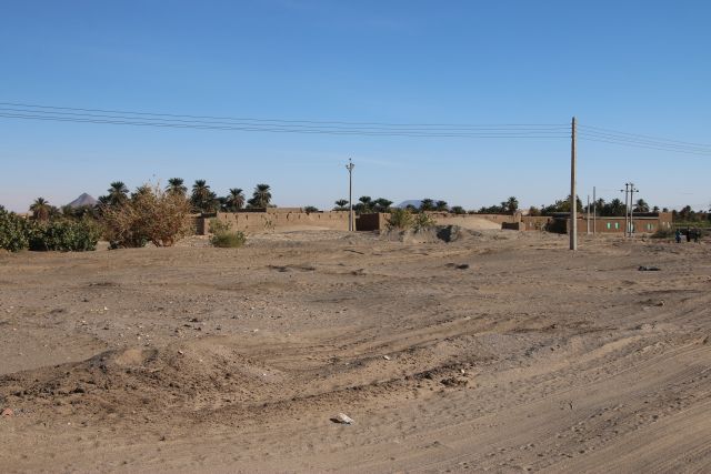
Major changes were observed compared to the state of preservation in times of Vila – one particularly illustrative example is Vila’s Kerma Period site 2-T-36B, partly overbuilt by modern houses and reduced because of the new electricity posts. Another example from the well-attested Christian period in our concession area is the church of Mograkka (2-L-2). While Vila documented it as single monument on a small hilltop, it is now embedded in newly built modern houses of the expanding village. The church new next-door neighbor is a modern mosque erected in the last years. Unfortunately, most of the Christian rock art, located by Vila in the immediate surroundings, are presently covered by modern debris from recent chanel works.
Detail of the well-preserved Church at Mograkka East with its new neighbour.
At other places, especially between Mograkka and Kosha, Neolithic and Post-Meroitic as well as Christian rock art was relocated by us. The most frequent motifs are cattle pictures and other animals like gazelles, hippos, ostriches and elephants.
Rock art site at Mograkka West.
The focus of our work in the first season was the east bank and here in
particular the district of Ginis. We conducted aerial photography of large
parts of the east bank, covering the area between Attab and Ginis by the drone
kindly lent to us from the Department of Cultural and Ancient Studies of LMU
Munich. These data will enable a digital elevation model and detailed
orthophotos. A survey system with measuring points using the GPS Antenna was
set up in this area as well, securing future work according to this
coordination.
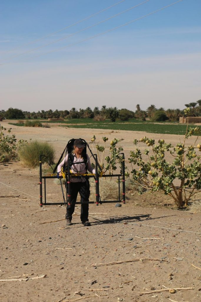
A geophysical survey of four sites from the Kerma period and the New Kingdom was realized by Marion Scheiblecker in Ginis East, using the Magnetometer of the type Ferex Foerster. New site labels were created for these find spots (GiE 001 for Vila 2-T-36B: Kerma and New Kingdom settlement, GiE 002 for Vila 2-T-13: New Kingdom cemetery, GiE 003 for Vila 2-T-39: Kerma cemetery and GiE 004 for Vila 2-T-5: Kerma settlement). The respective results are very promising and can serve as firm basis for a focused excavation of these important sites in the upcoming seasons.
In sum, the first season of the MUAFS project was very successful, providing new and partly unexpected results (like the strong presence of Napatan sites in the region), highlightening the rich potential of the concession area for detailed work from the Mesolithic period up to Christian times and allowing us to plan the next working steps. For now, we consider the Kerma and New Kingdom sites already investigated by magnetometry as of prime priority for further fieldwork.
We will be busy in the next week working on the collected data from our field season and setting up a strategy for the next years of work between Attab and Ferka. Of course we will keep you updated!
Wow – it has been an amazing first season in my new concession up north between Attab and Ferka! Today, we left our house at Attab East and arrived safely in Khartoum – in just a few hours, we will board the plane back to Munich via Istanbul.
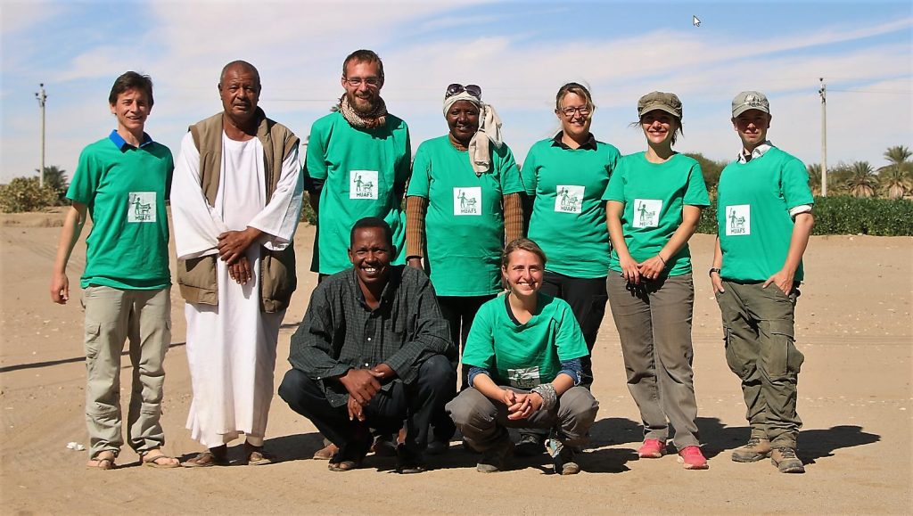
A proper summary of our results will follow as soon as I got some sleep. But for now, my amazing team deserved loads of thanks – for making a great season full of important new data possible and for all the individual commitment in many respects!
Many thanks
goes as always to our dear friend and NCAM inspector Huda who was a great
support, helping with surveying in the desert and on the east bank, with
ceramics and with the geophysical survey. Our two Mohammeds – the cook and the
driver – enabled us to focus on our scientific work, taking care of all
logistics in challenging times and providing us with plenty of delicious food.
Looking already now very much forward to the second season of the MUAFS project and coming back to the beautiful landscape full of archaeology covering several millennia of history just downstream of the Dal cataract.
Just one
last visit to Abri and to WLAN, before it goes back to Khartoum! Has been a
great first short season of the MUAFS project with plenty of intriguing data
and impressions!
We
documented many impressive sites in the last two weeks – altogether, I managed
to re-identify and check 119 sites, which Vila recorded in the 1970s. For some
of these sites, the dating is of much interest. A slightly revised dating as
compared to the published data adds fresh information about several periods of
presence in this part of the Nile valley, for example during the Napatan
period.
Of prime
interest this week was the Kerma period and here in particular settlement sites
and cemeteries. Various large tumuli cemeteries, especially of the Kerma Moyen
and Kerma Classique periods, are located at the East Bank; we found several
older and smaller ones on the West Bank.
Ginis East was once again of particular importance and two more sites were investigated by magnetometry this season. GiE 003, labelled by Vila as 2-T-39, is a huge tumulus cemetery comprising probably more than 150 tombs, stretching from East to West and now partly destroyed by modern pathways and streets. A similar site is 2-P-7, located further upstream at Kosha East. There, the tumuli are quite dismantled, but various ceramics including Egyptian imports can still be found and suggest a Kerma Moyen date as prime phase of use for this cemetery.
Kerma cemetery 2-P-7
Marion’s
work with the Ferrex Foerster magnetometer revealed amazing results at GiE 004,
a Kerma settlement documented by Vila as site 2-T-5. The main structure of the
site and its multiple circular huts, possible enclosures for animals and fences
are clearly visible on the magnetogramm. The site is surrounded by later
structures from Post-Meroitic and Christian times – like at other places in our
concession, a long-lasting multi-period use of this part of Ginis East is
obvious.
Finally, intriguing Kerma sites can be found at Attab West – in the immediate surroundings of 18th Dynasty sites, comprising both mudbrick and stone architecture. These sites, which are located along an ancient branch of the Nile, are especially relevant to investigate cultural encounters during the Bronze Age in our concession area since Egyptian pottery was found frequently associated with Kerma Classique ceramics.
One of the Kerma sites with much Egyptian pottery on the surface.
So many
exciting new finds, so much work to do in the near future between Attab and
Ferka!
The second
week of the MUAFS project is well underway – time flies by, only the
temperatures have dropped markedly.
With limited internet access, here are just some very brief comments on our ongoing survey of the westbank. It was just stunning in the last days to experience a boat ride into a completely different landscape every morning. Attab, Ginis and Kosha look as much different as the Nile is changing its direction and course. Most beautiful so far was clearly Ginis – with impressive sand dunes and archaeological sites set between these picturesque desert landscapes and tamarisks.
As much impressed as we are by the surroundings, as rewarding are the survey results and the archaeological remains. Giulia in particular was really happy that we located a number of meso- and neliothic sites with nice pottery; my personal favourite these days was site Vila 3-P-17 in Kosha West. This is a settlement mound with early 18th Dynasty pottery, of tremendous importance for understanding the early presence of Egypt in this area during the New Kingdom (and contemporaneous to the early levels at Sai the AcrossBorders project was investigating in the last years).
Especially
remarkable are also three sites in the central part of Ginis West, which Vila
dated to the New Kingdom but which are clearly Napatan based on the pottery
from the surface. As settlement remains with peculiar architectural features,
these sites hold rich potential for investigating Napatan occupation in the
Batn el-Hagar region.
The next
days will be very busy finalising the archaeological survey on the westbank,
the geophysical survey on the eastbank and aerial photography of Kosha East. An
update will follow shortly, once we are again connected to the www.
Fieldwork
without internet connection – something very unusual these days, but during
this season none of our mobile devices is working, so please forgive that this
blog has been as silent as I was on twitter the last week.
Today, we
have the great chance to catch up with emails and connect to the world again thanks
to a kind Sudanese friend and his wonderful WLAN-connection! And of course I
would like to give you a very brief account of our past week.
We set up
headquarters in a really nice and comfortable Nubian house at Attab East, thus
in the southern end of our concession. This proofed to be perfect, we can reach
the most important sites in the surroundings by foot and shopping for our
driver at Abri, the only major town nearby, is also very convenient.
In week 1,
we succeeded in a survey of the most relevant sites on the East Bank from
Attab, Ginis, Kosha, Mograkka up to Ferka. Although most of them have been
located and documented by Vila, we also discovered some new sites, especially
Pre-Kerma occupation sites. Ferka, Mograkka and Kosha are dominated by
Christian remains and large Post-Meroitic cemeteries, including tumuli of very
considerable size. Kerma cemeteries are also found until the northern part of
our concession area.
Work focused on Ginis where also a new field measurement system was set up – we conducted a multi-disciplinary documentation of three selected sites in this area: magnetometry, aerial photography by drone and of course a surface survey.
Site GiE 001 is most interesting – it is a very complex settlement,
having been used from the Kerma period throughout the New Kingdom and
possibly until Pre-Napatan times. Vila observed a Kerma and a New
Kingdom part of the site – however, this is probably much more
complicated, and interestingly we not only found 18th Dynasty
but also Ramesside pottery on the surface. Was this site really
occupied during most of the era of the New Kingdom? So many important
questions!
But I must
confessed that I was very shocked when we first reached this site which was, just
according to my preparation of this field season based on Vila’s documentation,
my personal favourite for excavation in the upcoming years. The western part of
the site is now completely covered by modern houses that were built in the last
20 years! And its eastern part is heavily damaged by construction work for the
electricity posts.
Well… After the first shock, I stuck to my original plan and we started to document the site in detail. Marion, helped by Huda and Giulia during this week, managed to conduct a great magnetometry survey at GiE 001 – the results are amazing and definitely what I was hoping for!
The site is much damaged, but plenty of information is still available under ground. We will keep you updated here – the site will keep us busy in the upcoming years.
Exciting results from Marion’s magnetometry survey!
Other sites
have already been documented using the drone of our department at LMU –
Cajetan, assisted by Franziska and Valentina, managed to cover large parts of
Ginis, focusing on the sites which will be excavated in the near future.
Although work during this week has been in parts very frustrating – many sites were badly damaged, others even disappeared since Vila’s work!, the results are very promising and exceed my expectations already. And apart from all – the landscape is amazing and just really splendid, especially the view towards the West Bank. A privilege to work in this part of the Middle Nile Valley.
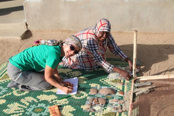
I collected already a nice sample of pottery from sites at the East Bank – dating from Neolithic times, Pre-Kerma, Kerma, New Kingdom (both 18th Dynasty and Ramesside), Pre-Napatan, Napatan, Post-Meroitic and Christian times. The rare Meroitic tombs in our concession are unfortunately all very much disturbed and yielded no finds for us as of yet.
Giulia and Huda busy with sorting pottery from the survey.
Next week work
will focus on the West Bank and on magnetometry of more Kerma and New Kingdom sites
on the East Bank – it will again be a very full, but definitely rewarding week!