
From the Nile back to the Isar, from sun and sand back to clouds and snow, from desert walking back to desk work, emails, meetings and teaching – although our travel back from Attab via Khartoum via Istanbul to Munich took more than 30 hours, it feels like a very sudden transposition.
Our first season of the MUAFS project was successfully closed and all of the principle goals were achieved thanks to the great support of NCAM and our inspector Huda Magzoub.
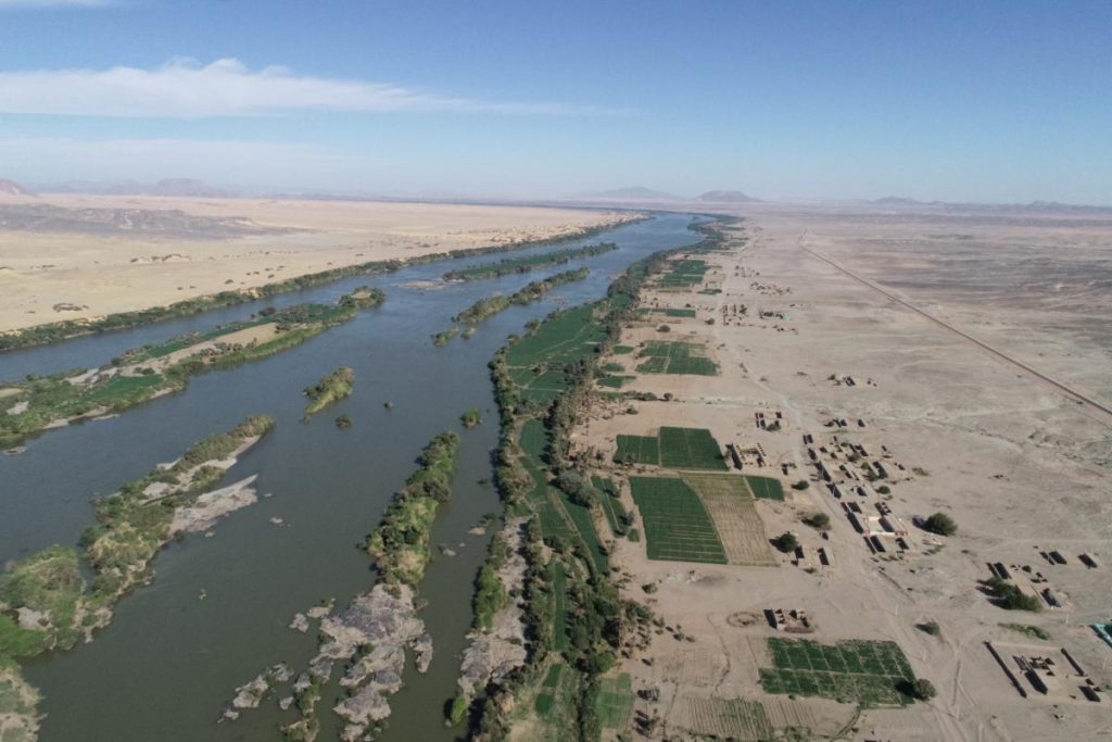
The principal goal of the first season was a new survey of the concession area, which was already recorded by Andrè Vila in the 1970s and published in his volumes 3-6. Altogether, 119 sites by Vila were re-identified and documented in the area between Attab East and Ferka East and Attab West and Mograkka West. For some of these sites, the dating can now be corrected, especially for Khartoum Variant and Abkan sites, Pre-Kerma sites, Kerma, New Kingdom and Napatan sites. Diagnostic stone tools and pottery fragments were collected from relevant sites. Other findspots of pottery and lithics that were previously not recorded by Vila, were documented as GPS waypoints and will be integrated in the new map of the area to be composed based on the results of our first season.
One particular focus was on the state of preservation of the sites nowadays – unfortunately, at almost all sites, we observed modern destruction and/or plundering. Especially drastic were destructions because of road building, the electricity posts and modern gold working areas (in particular at Mograkka West).
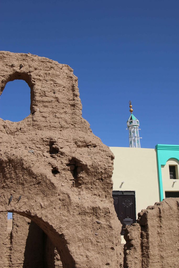
Major changes were observed compared to the state of preservation in times of Vila – one particularly illustrative example is Vila’s Kerma Period site 2-T-36B, partly overbuilt by modern houses and reduced because of the new electricity posts. Another example from the well-attested Christian period in our concession area is the church of Mograkka (2-L-2). While Vila documented it as single monument on a small hilltop, it is now embedded in newly built modern houses of the expanding village. The church new next-door neighbor is a modern mosque erected in the last years. Unfortunately, most of the Christian rock art, located by Vila in the immediate surroundings, are presently covered by modern debris from recent chanel works.
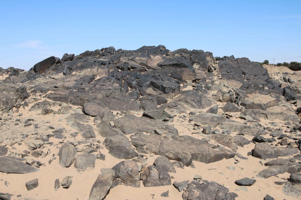
At other places, especially between Mograkka and Kosha, Neolithic and Post-Meroitic as well as Christian rock art was relocated by us. The most frequent motifs are cattle pictures and other animals like gazelles, hippos, ostriches and elephants.
The focus of our work in the first season was the east bank and here in particular the district of Ginis. We conducted aerial photography of large parts of the east bank, covering the area between Attab and Ginis by the drone kindly lent to us from the Department of Cultural and Ancient Studies of LMU Munich. These data will enable a digital elevation model and detailed orthophotos. A survey system with measuring points using the GPS Antenna was set up in this area as well, securing future work according to this coordination.
A geophysical survey of four sites from the Kerma period and the New Kingdom was realized by Marion Scheiblecker in Ginis East, using the Magnetometer of the type Ferex Foerster. New site labels were created for these find spots (GiE 001 for Vila 2-T-36B: Kerma and New Kingdom settlement, GiE 002 for Vila 2-T-13: New Kingdom cemetery, GiE 003 for Vila 2-T-39: Kerma cemetery and GiE 004 for Vila 2-T-5: Kerma settlement). The respective results are very promising and can serve as firm basis for a focused excavation of these important sites in the upcoming seasons.
In sum, the first season of the MUAFS project was very successful, providing new and partly unexpected results (like the strong presence of Napatan sites in the region), highlightening the rich potential of the concession area for detailed work from the Mesolithic period up to Christian times and allowing us to plan the next working steps. For now, we consider the Kerma and New Kingdom sites already investigated by magnetometry as of prime priority for further fieldwork.
We will be busy in the next week working on the collected data from our field season and setting up a strategy for the next years of work between Attab and Ferka. Of course we will keep you updated!