A while ago, I had the great pleasure of being interviewed for the ÖAW podcast “Hiccup: Through Time with a Hiccup”. This fantastic series invites academics to travel through different eras – from Ancient Egypt to the Byzantine Empire and on to the Early Modern Period. I myself chose the year 1454 BC on the Nile island of Sai in Upper Nubia – you can hear why in the podcast.
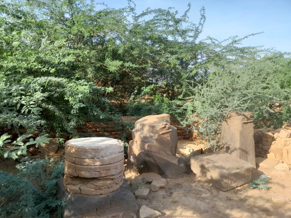
Today I had the wonderful opportunity to revisit the inscription of Nehi in Sai that was highlighted in the podcast. The whole experience was truly a lovely, nostalgic glimpse into the past – as I undertook the excursion with Sudanese friends and colleagues, particularly Huda Magzoub, who worked with me in Sai for many years.
Huda and I at the imposing stone block bearing Nehi’s inscription (photo: Mohammed Eltoum)
Especially in these difficult times in Sudan, where war still rages in parts of the country, this trip down memory lane is also, for me, a glimpse into the future – we will all work together again in Sudan and help to preserve the cultural world heritage.
There are many urgent tasks to be dealt with, and I am very grateful to be able to spend some time here in this beautiful country with its rich archaeology and wonderful people.
Greetings to all local and international colleagues working to protect Sudanese heritage and antiquities amidst the war in Sudan.
By Huda Magzoub Al-Bashir (Khartoum)
Protecting Archaeological Work and its Personnel in Times of War and Crisis
The Question of the Necessity of Archaeological Work in Times of War and Crisis
Archaeological work in times of war and crisis is not always necessary, but it can be important in some cases.
Importance of Archaeological Work in Times of War and Crisis:
1. Protecting Cultural Heritage: Archaeological teams can work to protect cultural heritage from destruction or looting.
2. Documenting Cultural Heritage: Archaeological teams can document cultural heritage before it is destroyed or looted.
3. Promoting Cultural Awareness: Archaeological teams can promote cultural awareness of the importance of cultural heritage.
Risks of Archaeological Work in Times of War and Crisis:
1. Risk of Injury or Death: Archaeological teams may face the risk of injury or death due to war and crisis.
2. Destruction of Archaeological Sites: Archaeological sites may be destroyed or looted due to war and crisis.
3. Difficulty Accessing Sites: It may be difficult to access archaeological sites due to war and crisis.
When should archaeological work be done in times of war and crisis?
1. When there is a risk to cultural heritage: If there is a risk to cultural heritage, archaeological teams should work to protect it.
2. When there is an opportunity to document cultural heritage: If there is an opportunity to document cultural heritage, archaeological teams should work on it.
3. When there is support from local authorities: If there is support from local authorities, archaeological teams should work to protect cultural heritage.
Ultimately, archaeological teams should assess the risks and benefits before deciding to work in times of war and crisis.
The security and academic role of archaeological work in Sudan in times of war and crisis is a vital and important topic. Sudan possesses a rich cultural heritage, but it faces significant challenges in protecting this heritage due to armed conflicts and the illicit trafficking of antiquities.
Security Role:
– Protecting archaeological sites from destruction and looting.
– Enhancing the security of museums and archaeological sites.
– Combating the trafficking of antiquities and cooperating with international organizations to recover looted artifacts.
Academic Role:
– Documenting archaeological sites and artifacts.
– Conducting archaeological research and studies to enhance understanding of Sudan’s cultural heritage.
– Promoting cultural awareness of the importance of archaeological heritage.
Challenges:
– Armed conflicts and illicit trafficking of antiquities.
– Lack of funding and technical expertise.
– Climate change and encroachment on archaeological sites.
Proposed Solutions:
– Enhancing international and regional cooperation to protect cultural heritage.
– Providing funding and technical expertise to enhance the security of archaeological sites.
– Launching awareness campaigns on the importance of cultural heritage.
It is essential that the Sudanese government, international organizations, and civil society work together to protect Sudan’s cultural heritage and promote awareness of its importance.
The collaboration between the Sudanese government, international organizations, academia, and civil society to protect Sudan’s cultural heritage in times of war and crisis has numerous benefits, including:
1. Enhancing cultural security: International and regional cooperation can help enhance the security of archaeological sites and museums, and prevent the trafficking of antiquities.
2. Providing funding and technical expertise: International organizations can provide the necessary funding and technical expertise to protect cultural heritage.
3. Promoting cultural awareness: Joint awareness campaigns can promote awareness of the importance of Sudan’s cultural heritage.
4. Protecting world heritage: Sudan possesses a rich cultural heritage, and international cooperation can help protect this heritage for the world.
5. Enhancing tourism: Cultural heritage can be an important source of tourism, and cooperation can help promote cultural tourism.
6. Enhancing regional cooperation: Cooperation in protecting cultural heritage can enhance regional cooperation between Sudan and neighboring countries.
7. Protecting cultural identity: Cultural heritage is an important part of Sudan’s identity, and cooperation can help protect this identity.
Overall, collaboration between the Sudanese government, international organizations, and civil society can play a significant role in protecting Sudan’s cultural heritage and promoting awareness of its importance.
The work of archaeological missions in Sudan in times of war and crisis has both benefits and risks:
Benefits:
1. Documenting cultural heritage: Archaeological missions can document archaeological sites and artifacts before they are destroyed or looted.
2. Protecting cultural heritage: Archaeological missions can help protect archaeological sites from destruction and looting.
3. Promoting cultural awareness: Archaeological missions can promote awareness of the importance of Sudan’s cultural heritage.
4. Training local staff: Archaeological missions can train local staff on methods of preserving cultural heritage.
5. Enhancing international cooperation: Archaeological missions can enhance international cooperation in the field of cultural heritage protection.
Risks:
1. Risk of destruction or looting: Archaeological sites may be vulnerable to destruction or looting due to war and crisis.
2. Risk of injury or death: Archaeological missions may face the risk of injury or death due to war and crisis.
3. Transfer of artifacts: War may lead to the transfer of artifacts abroad without the permission of the Sudanese authorities.
4. Deterioration of archaeological sites: War may cause deterioration of archaeological sites due to mishandling or lack of expertise.
Therefore, it is essential that archaeological missions in Sudan work in cooperation with the Sudanese authorities and international organizations, and follow necessary security and precautionary measures to protect Sudan’s cultural heritage.
The risk to archaeological mission personnel in Sudan in times of war is a vital and important topic. There are several risks facing archaeological mission personnel in Sudan, including:
1. Risk of injury or death: Archaeological missions may face the risk of injury or death due to war and crisis.
2. Kidnapping or detention: Archaeological mission personnel may be kidnapped or detained by armed groups.
3. Looting or theft of equipment: Equipment and tools used in archaeological missions may be looted or stolen.
4. Destruction of archaeological sites: Archaeological sites may be destroyed or looted due to war and crisis.
5. Difficulty accessing sites: It may be difficult to access archaeological sites due to war and crisis.
6. Lack of logistical support: There may be a lack of logistical support and resources necessary for archaeological missions.
7. Risk of disease: Archaeological mission personnel may be exposed to the risk of disease due to poor health conditions.
Therefore, it is essential that archaeological missions take precautionary and security measures to protect their personnel, such as:
1. Cooperating with local authorities: Working with local authorities and international organizations to ensure the safety of the mission.
2. Risk assessment: Assessing potential risks and taking necessary measures to mitigate them.
3. Providing logistical support: Providing logistical support and resources necessary for the mission.
4. Training personnel: Training personnel on security and precautionary procedures.
5. Continuous monitoring: Continuously monitoring the security situation and communicating with local authorities.
What are the responsible authorities for protecting global, international, and academic archaeological personnel in times of war and emergency?
There are several authorities responsible for protecting global, international, and academic archaeological personnel in times of war and emergency, including:
1. United Nations Educational, Scientific and Cultural Organization (UNESCO): UNESCO is the primary authority responsible for protecting world cultural heritage and provides support and assistance to archaeological personnel in times of war and emergency.
2. International Union of Academies: The International Union of Academies is an international organization that works to protect cultural heritage and promote international cooperation in the field of archaeology.
3. International Committee of the Red Cross and Red Crescent: The International Committee of the Red Cross and Red Crescent works to protect civilians, including archaeological personnel, in times of war and emergency.
4. International Atomic Energy Agency: The International Atomic Energy Agency works to protect cultural heritage from damage caused by nuclear radiation.
5. Non-Governmental Organizations: There are many non-governmental organizations that work to protect cultural heritage and archaeological personnel in times of war and emergency, such as BLAZ and Cultural Heritage in Danger.
6. Local Authorities: Local authorities in countries affected by war and emergency are responsible for protecting archaeological personnel and cultural heritage.
7. International Emergency Organizations: International emergency organizations such as Médecins Sans Frontières (MSF) and the International Committee of the Red Cross (ICRC) provide humanitarian assistance, including protection of archaeological personnel, in times of war and emergency.
These authorities work together to provide support and assistance to archaeological personnel in times of war and emergency, and to ensure the protection of cultural heritage.
Is it necessary for archaeological personnel to work in times of war and crisis?
Archaeological personnel working in times of war and crisis is not always necessary, but it can be important in some cases. Here are some points to consider:
Risks of archaeological work in times of war and crisis:
When should archaeological personnel work in times of war and crisis?
1. When there is a risk to cultural heritage: If there is a risk to cultural heritage, archaeological personnel should work to protect it.
2. When there is an opportunity to document cultural heritage: If there is an opportunity to document cultural heritage, archaeological personnel should work on it.
3. When there is support from local authorities: If there is support from local authorities, archaeological personnel should work to protect cultural heritage.
In conclusion, archaeological personnel should assess the risks and benefits before deciding to work in times of war and crisis.
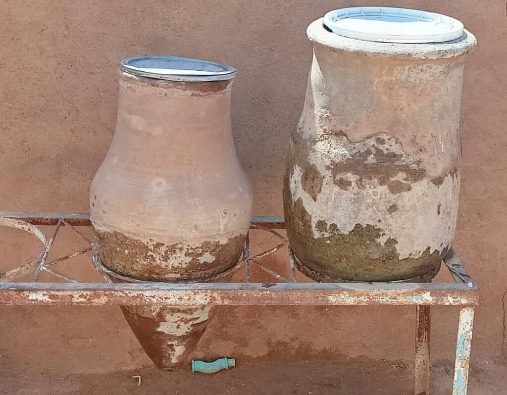
A so-called zir is a large pottery vessel for storing water and other materials. Local customs and traditions have developed in most parts, if not all, of Sudan, emphasizing the importance of having one or more zirs for storing drinking water. Additionally, the water that seeps out from the bottom of the zir is considered cleaner and is used for drinking by the sick or for making tea for those with a refined taste due to its higher purity.
The zir is well-known to most people, but some, especially the newer generation of Sudanese, particularly city dwellers, may not be familiar with it, as its use has decreased or become rare due to the availability of faster, easier, and more modern alternatives. However, the strongest survives!
The zir has been known in Sudan since ancient times, with evidence found in archaeological excavations – such as the MUAFS excavations between Attab and Ferka and many other missions. It is studied by scholars and is part of ethnographic and folklore studies, as its production is accompanied by stories and legends. It also has various uses in Sudanese customs and cultures, such as in weddings and circumcisions.
Today, we discuss its continuity. During the war in Khartoum, I noticed that the use of the zir had increased. Previously, it had been particularly important in villages, unlike in cities such as Khartoum, where alternative water containers and drinking vessels were available. Altogether, the zir remains the preferred choice in Sudan.
There is a focus on creating a special place for it, whether by building it with green bricks or red bricks, or creating a seat with an iron canopy, known locally as a „Mazira“.
Example of a modern zir.
By chance, I learned a special method for cleaning it, particularly from the green fungi that grow on its exterior due to exposure to air and water seepage, known as „dew“.
Zir vessels before cleaning – note the „dew“ in the lower part.
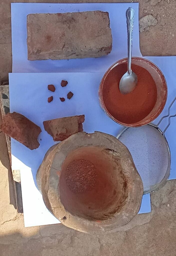
Firstly, the zir is made by men in the field, but its care and cleaning are the responsibility of women, especially older women.
Despite the various types of zir in terms of size, shape, and color, depending on the materials used, there are also different methods of cleaning and decorating them from one region to another. There is also a preference for using black or red zirs.
In Northern Sudan, both black and red zir are used, but there is a difference in decoration and polishing. The people of the Northern State and the River Nile State prefer to polish and clean the exterior using natural materials, often using red brick for red zir and black charcoal for black zir.
The red brick powder used for zir vessels.
In Dongola and some Nubian regions, people often use red zirs or those with a reddish color, known to specialists, which is determined by the materials used and the firing process. In these regions, the lower part of the zir, which is more prone to green fungi, is painted with a coating, often red or yellow, and has become a distinctive mark of the people of Dongola.
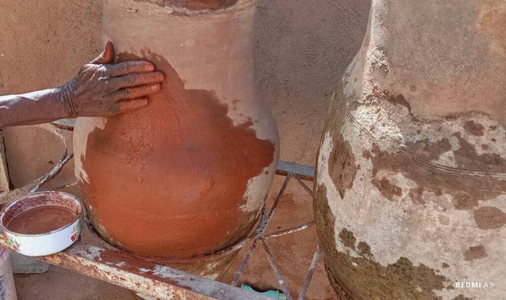
I was fortunate to witness a cleaning process, polishing, and applying a special coating to one of the zir, and I documented the process with photos. The tools and materials used are natural and part of the heritage.
The method of decoration, colouring, and polishing with red brick powder and water.
All of this is done to make the zir look clean and beautiful, and this method is usually used every month or more.
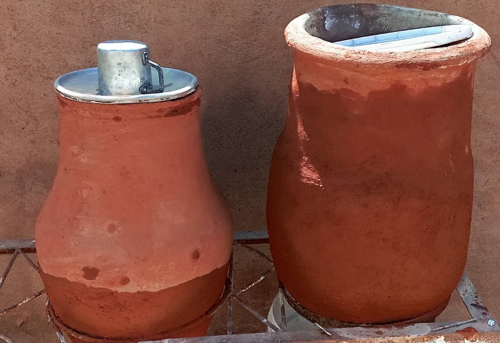
Zir vessels after cleaning.
These are customs, traditions, and tools that are part of the Sudanese heritage, and we hope they will continue for future generations.
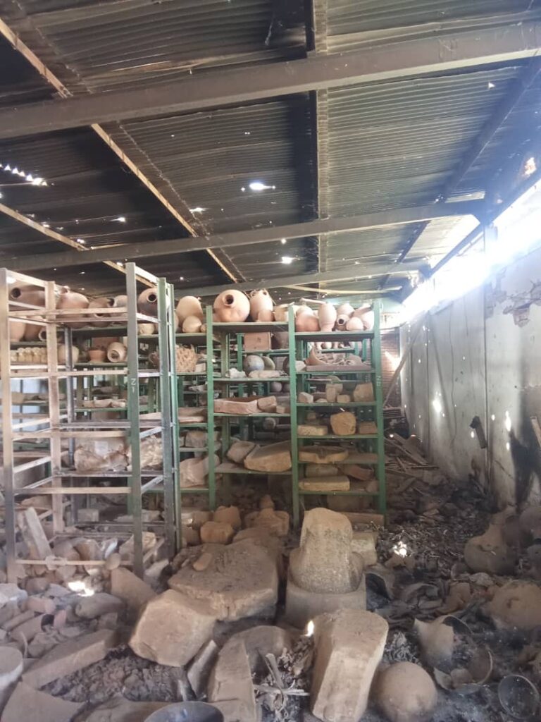
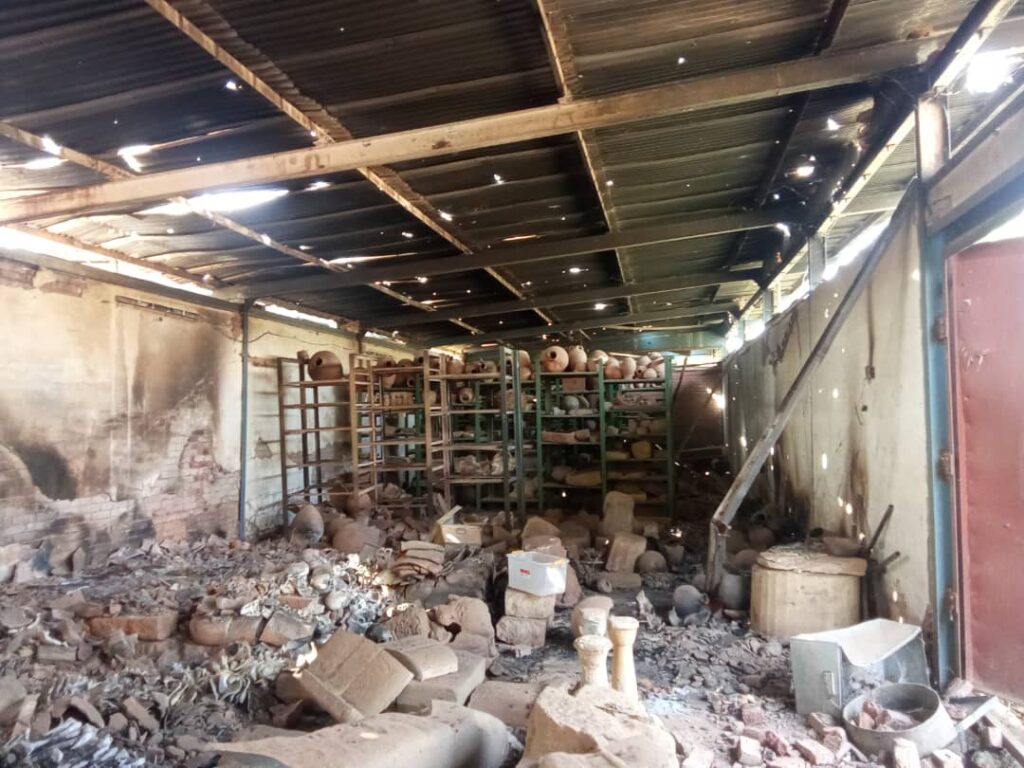
Opinion of Officials on the Attack, Theft, and Looting of the Sudan National Museum:
Dr. Ghalia Garinabi, Director General of the Sudanese National Corporation for Antiquities and Museums (NCAM), described the incident as a „humanitarian catastrophe“ that poses a significant threat to Sudan’s cultural heritage. She expressed her deep regret over the incident and condemned the looting of the museum.
Details of the Attack and Theft:
The museum was subjected to extensive looting and destruction, with over 100,000 artifacts stolen, including gold pieces, jewelry, and valuable historical artifacts.
Some of the stolen artifacts are believed to have been smuggled out of Sudan, with some spotted in neighboring countries like South Sudan.
The museum suffered significant damage to its infrastructure, including the destruction of laboratories and workshops.
Reactions and Efforts:
International Cooperation: Sudanese authorities are working with international organizations to recover the stolen artifacts and hold those responsible accountable.
Investigations: Authorities are conducting investigations to identify those responsible and bring them to justice.
Awareness: Efforts are being made to raise awareness about the importance of preserving Sudan’s cultural heritage and combating artifact smuggling.
Dr. Ikhlas Abdel Latif, Director of Museums Administration and Head of the Unit for Tracking and Recovering Stolen Artifacts, described the incident as a „great calamity“ and stated that it was a systematic theft by the Rapid Support Forces. She noted that the attackers targeted the most valuable and lightweight artifacts, and destroyed some that they couldn’t carry, reflecting their barbaric treatment of Sudan’s heritage.
Abdel Hai Al-Sawai, Director of the Archaeological Discovery Department at the Sudanese National Corporation for Antiquities and Museums (NCAM), believes that Sudan’s antiquities have been exposed to significant risks due to the war, especially in Khartoum. He emphasized that the National Museum in Khartoum was the most affected, looted, and stolen, as it contains many eras of Sudan’s ancient history, in addition to the warehouses that hold thousands of artifacts from various eras.
Impact of the War on Museums and Antiquities:
Destruction of Museums: Many museums and archaeological sites outside the capital were damaged, including the Sultan Ali Dinar Museum in Darfur.
Looting of Antiquities: Many priceless historical artifacts were looted from the National Museum in Khartoum, and many other archaeological sites were affected.
Assessment and Restoration Efforts: Efforts are underway to assess and evaluate the damage, with plans to restore damaged museums and recover stolen artifacts.
International Condemnation:
United Nations Human Rights Office: Condemned the gross human rights violations in Sudan, including attacks on museums and archaeological sites.
European Union: Strongly condemned the gross human rights violations in Sudan and called for the protection of cultural heritage and archaeological sites.
United States: Condemned the attack on civilians and cultural heritage.
Scorched Ruins and Remnants of the Sultan Ali Dinar Museum in El Fasher city was partially destroyed due to shelling in October 2025. This attack sparked widespread condemnation and was considered by authorities and international organizations as a serious violation of Sudan’s cultural heritage.
The museum housed valuable artifacts and important historical documents, and its destruction is a significant loss to Sudan’s heritage.
The African Center for Justice and Peace Studies expresses its deep concern over the systematic targeting of cultural and historical sites by warring parties in Sudan. The destruction of historical sites by warring parties is a deliberate act aimed at erasing the history of the Sudanese people, particularly in the Darfur region, and attempting to eliminate symbols that unite communities in the region.
Support from Global Museums:
Global museums can provide effective support to the Sudan National Museum through:
Technical and Expert Support: Providing experts in archaeology and restoration to assess damage and identify stolen artifacts.
Financial Support: Funding projects to restore the museum and recover stolen artifacts.
Diplomatic Support: Pressuring governments and international organizations to protect Sudan’s cultural heritage and recover stolen artifacts.
Media Support: Raising awareness about the importance of preserving Sudan’s cultural heritage and combating the importance of combating artifact smuggling.
Autumn Season and its Impact on Antiquities in Sudan
Sudan experiences a desert climate with minimal seasonal variation, but the autumn season can still have an impact on archaeological sites. The effects of climate change and environmental factors can exacerbate the deterioration of ancient structures and artifacts.
Impacts of the Autumn Season on Antiquities in Sudan:
Increased Rainfall: Heavy rainfall can cause erosion and damage to archaeological sites, especially those in fragile or unstable conditions.
Strong Winds: Strong winds can lead to the degradation of structures and the loss of artifacts.
Flooding: Flooding can damage archaeological sites, especially those located near rivers or in low-lying areas.
Conservation Efforts:
Site Monitoring: Regular monitoring of archaeological sites to assess the impact of environmental factors and take necessary conservation measures.
Risk Assessment: Conducting risk assessments to identify potential threats and develop strategies for mitigation.
Community Engagement: Engaging local communities in the conservation and protection of archaeological sites.
Importance of Protecting Sudan’s Cultural Heritage:
Sudan’s cultural heritage is invaluable, and it is essential to protect it from environmental degradation and human impact. Conservation efforts are necessary to preserve the country’s rich history and cultural identity for future generations.
Challenges and Opportunities:
Climate Change: Climate change poses a significant threat to Sudan’s cultural heritage, and it is essential to develop strategies to mitigate its impacts.
Sustainable Development: Balancing economic development with cultural heritage conservation is crucial to ensure the long-term preservation of Sudan’s archaeological sites.
International Cooperatio: International cooperation and support are necessary to support conservation efforts and protect Sudan’s cultural heritage.
Climate change poses a significant threat to cultural heritage in Sudan, as it can lead to the deterioration and erosion of archaeological sites, especially with harsh weather conditions such as heavy rainfall and strong winds. Rising sea levels can also lead to the submersion of coastal heritage sites and erosion of archaeological and architectural structures. Additionally, changes in the ecosystems surrounding heritage sites can affect their ecological balance and further complicate conservation efforts.
Main Impacts of Climate Change on Cultural Heritage in Sudan:
Erosion of archaeological sites: Heavy rainfall and strong winds can cause erosion and deterioration of archaeological sites.
Rising sea levels: Can lead to the submersion of coastal heritage sites and erosion of archaeological and architectural structures.
Changes in surrounding ecosystems: Can affect the ecological balance around heritage sites and complicate conservation efforts.
Efforts to Protect Cultural Heritage in Sudan:
Climate risk assessment: Climate risks are assessed for cultural sites to determine necessary protection measures.
Emergency plans: Emergency plans are developed to protect heritage sites from climate change impacts.
Use of technology: Remote sensing and 3D laser scanning techniques are used to assess the condition of heritage sites and monitor surroundings climate
Environmental changes, floods, and mining pose a greater threat to antiquities than wars!
There are archaeological sites in Sudan that are affected by the environment, especially in the northern regions of Dongola. Some of these sites include:
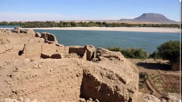
Sai Island Archaeological Site: An island containing tombs, Pharaonic sites, and graves dating back to thousands of years, with recent signs of severe mining activities on the island.
A view from Sai Island.
Old Dongola: A historical city containing archaeological sites consisting of palaces, remains of churches, tombs, and domes, considered one of the important cities during the Middle Ages, affected by rising groundwater levels or Nile floods.
Other Archaeological Sites in Sudan: Such as Kerma, suffering from the impacts of climate change, especially soil erosion, floods, and landslides.
Al-Bajrawiya: These archaeological sites are affected by strong winds and heavy rains, causing erosion to structures and antiquities.
Additional Archaeological Sites in the Nile River State and the Northern State: All are affected by climate change, desertification, and environmental degradation.
Meroe Archaeological Sites: Affected by climate change and desertification, leading to the deterioration of ancient structures and antiquities.
The Royal City of Meroe: All these are important archaeological sites affected by environmental changes, desertification, and environmental degradation.
Situation at the Royal City of Meroe.One of the temples at the Royal City of Meroe and glimpses of environmental change.
Some sites received attention and archaeological work during the Qataris project to protect Nubian antiquities, but environmental changes were stronger, requiring more serious and urgent attention to preserve them from deterioration and loss. Again, with recent environmental changes in Sudan, these sites, along with newly discovered ones, are affected by climate change, desertification, and environmental degradation, threatening their destruction and the loss of ancient cultural heritage in Sudan.
It’s crucial to note that these archaeological sites require special attention to protect them from deterioration and ensure their continuity for future generations.
After a long silence, the Sudanese antiquities and heritage, which have been ravaged by destruction, looting, and theft, are celebrating the Ministry of Culture and Information’s approval of international laws and conventions related to the protection of Sudanese heritage from looting, wars, and theft. This news is a beacon of hope that will push forward the protection of heritage in Sudan. The efforts of the state to protect the heritage in Sudan, represented by the antiquities stolen during the war in Khartoum between the Sudanese army and the Rapid Support Forces, are notable. There are several promising signs that this agreement will bring if the state is keen to swiftly implement it.
In this context, I will discuss some aspects related to these agreements, hoping that the international community will provide all possible support. I will review with you some aspects and questions related to the importance of these agreements for Sudan’s antiquities and heritage.
Firstly, what is the benefit of the Cultural Property Convention? And what is the 1995 UNIDROIT Convention on Stolen or Illegally Exported Cultural Objects? The 1995 UNIDROIT Convention aims to protect cultural heritage by establishing general legal rules for the return of stolen or illegally exported cultural objects. The importance of this convention lies in:
– Protecting cultural heritage: It contributes to protecting cultural property from theft and smuggling and promotes international cooperation for its recovery.
– Facilitating the return of cultural property: It provides a legal mechanism for the return of stolen or illegally exported cultural objects, making it easier for countries to recover their cultural heritage.
– Enhancing international cooperation: It encourages cooperation between countries to strengthen the protection of cultural heritage and combat illicit trafficking in cultural property.
– Protecting cultural identity: It contributes to protecting the cultural identity of countries and communities and promoting a sense of belonging and pride in cultural heritage.
– Combating illicit trafficking: It contributes to combating illicit trafficking in cultural property and promoting transparency and accountability in the trade of antiquities and cultural objects.
In general, the 1995 UNIDROIT Convention aims to strengthen the protection of cultural heritage and the return of stolen or illegally exported cultural objects, and to promote international cooperation in this field.
Secondly, what are the consequences of delaying the implementation of these conventions, especially for the collections of the National Museum? Delaying the implementation of international conventions for the protection of antiquities and heritage in Sudan and the National Museum can lead to several negative consequences, including:
– Increased looting and theft: Delaying the necessary measures to protect antiquities and heritage can increase the chances of looting and theft of museums and archaeological sites, as happened in the National Museum in Khartoum, where many rare artifacts were looted and stolen.
– Destruction of cultural heritage: Delaying the protection of antiquities and heritage can lead to their complete destruction, especially in the context of armed conflicts and wars, where archaeological sites and museums are subjected to bombardment and destruction.
– Loss of cultural identity: Cultural heritage plays a significant role in defining the identity of peoples, and losing it can lead to a national identity crisis.
– Difficulty in recovering stolen artifacts: The longer the delay between the theft of artifacts and the necessary measures to recover them, the more difficult it becomes to recover them, especially if they are sold on the global market or smuggled out of the country.
– Impact on scientific research: Losing cultural heritage and antiquities can make it difficult to conduct scientific research and archaeological studies, affecting our understanding of Sudanese history and culture.
– Negative impact on tourism: Cultural heritage and antiquities play a significant role in attracting tourists, and losing or destroying them can negatively impact the tourism sector in Sudan.
Examples of destruction include:
– The National Museum in Khartoum: It was looted and raided, and trucks loaded with artifacts left the museum, resulting in the loss of important artifacts.
– Nyala Museum: All the properties and museum collections were looted.
– The Khalifa Abdallah Museum: It was looted and parts of the building were destroyed.
– The Naga’a and Musawwarat area: It was attacked by the Rapid Support Forces, and videos were filmed inside the archaeological sites.
– Jebel Barkal: A World Heritage site that faces significant challenges due to urban and agricultural expansion, which could lead to its removal from the list.
Efforts to protect heritage include:
– The National Corporation for Antiquities and Museums: It works to recover stolen artifacts and track them through Interpol and international security institutions.
– UNESCO: It tries to coordinate efforts to protect Sudanese heritage by enhancing cooperation with local and international organizations.
– Civil society organizations: They play a significant role in highlighting the importance of antiquities and heritage and advocating for their return.
Thirdly, how can international laws and conventions be applied to protect Sudanese heritage, such as what was looted from the National Museum in Khartoum? To protect heritage in Sudan, international laws are applied through several mechanisms:
– UNESCO’s role: UNESCO works to promote the protection of cultural heritage in Sudan, especially after reports of looting and destruction of museums and archaeological sites. The organization has sounded the alarm and expressed deep concern about these actions.
– International cooperation: UNESCO encourages the international community to make joint efforts to protect Sudanese cultural heritage, including preventing the illicit trafficking of antiquities and cultural objects.
– Training and awareness: UNESCO provides training courses to enhance the capabilities of local authorities in the field of cultural heritage protection, in addition to raising public awareness about the importance of preserving heritage.
– Damage assessment: UNESCO works to assess the damage to archaeological sites and heritage in Sudan, including using satellite images to identify affected sites.
– Support for artists and local communities: UNESCO provides support to artists and local communities in Sudan through the establishment of art centers and cultural programs that help pre serve cultural heritage.
Regarding the National Museum in Khartoum as an example, several measures can be taken to protect the looted heritage, including:
– Recovery of stolen artifacts: Working to recover stolen artifacts from the National Museum and other museums in Sudan.
– Preventing illicit trafficking: Working to prevent the illicit trafficking of Sudanese antiquities and cultural objects through cooperation with local and international authorities.
– Documenting damage: Documenting the damage to the National Museum and other archaeological sites in Sudan to present it to the relevant authorities to take necessary measures.
The Ministry of Culture’s approval of international conventions related to the protection of Sudanese heritage is a positive step towards protecting heritage in Sudan, especially in the face of challenges posed by wars and conflicts.
By Mrs. Huda Magzoub Al-Bashir, Senior Curator of the Sudan National Museum, Khartoum (status: 14th Oct. 2025)
Mechanisms for protecting museums and antiquities in Sudan
The mechanisms for protecting museums and antiquities in Sudan are divided into two parts:
Firstly: The mechanism for protecting the building with its contents. This is further divided into two parts in terms of importance:
1. Archaeological, historical, and heritage buildings, where preservation is more important and requires greater care and caution. This also includes museums and field museums.
2. Museum collections, archaeological, historical, and heritage collections, whose preservation depends on the preservation of the building in which they are displayed, after careful selection of the site, method, and materials of construction, and the importance and concern of the state in doing so.
Secondly: The state’s mechanism for paying attention to museums, antiquities, and heritage, as a symbol of national sovereignty and identity, and any negative interference with it requires swift and necessary response.
Prior planning:
Establishing a museum under state sponsorship requires prior planning to protect it from internal and external threats and to adopt a sound and effective method for preserving it.
Mechanism based on supporting national security awareness to protect antiquities and museums and the right to swift intervention through those in charge of managing museums, antiquities, and heritage in Sudan, by following pre-planned methods to protect archaeological collections in museums and rescue them to safe areas or routes.
Mechanism for preserving museum collections:
This mechanism is the primary work mechanism in this field and is represented by:
– Museum collections themselves, in terms of collecting, restoring, documenting, displaying, publishing, preserving, and making copies of them.
– In this context, when feeling insecure, relying on the experiences of some countries that have previously preserved the originals of collections, antiquities, and artifacts in safe places and displayed copies of them to avoid theft or attacks, even if it requires returning them to the ground or to secret storage until safety is ensured.
Insurance mechanism through security agencies recognized and approved by the state to protect museums, antiquities, and heritage in Sudan.
These security agencies must receive adequate training to qualify them to preserve and protect collections and their locations, including museums.
Armed defense mechanism:
This mechanism is only allowed to be used in case of an attack on museums or their contents. It requires a deadly defense by specialized agencies to do this work and make the security of museum facilities part of national security.
Avoiding exposure of archaeological museums and their heritage to looting:
To avoid exposure of museums with rare archaeological collections to looting, especially in cases of armed threat, requires prior efforts based on:
– The state’s interest in its heritage and collections, whose loss would affect the state’s dignity, strength, and prestige.
– Several aspects and methods can be followed to avoid exposure of museums, antiquities, and museum collections to looting, theft, and aggression:
1. Increasing and developing insurance and its methods, according to modern techniques of theft, and benefiting from the experiences of other countries.
2. Addressing and cutting off corruption in all aspects related to the management of museums, antiquities, and heritage in Sudan.
3. Financial preparedness can play an important role in avoiding exposure of museums to looting, by providing the necessary resources for protection and security.
4. Working continuously to raise cultural awareness of the importance of museums, especially among security agencies, and instilling a sense of national duty to defend this heritage.
5. Seeking international cooperation and assistance from organizations concerned with protecting museums, antiquities, and heritage worldwide.
6. Establishing laws and deterrent penalties that must be put in place in agreement with the state and adopted internationally in case of exposure of museums, antiquities, and national heritage to looting, especially by armed parties.
On Tuesday, October 14, 2025, the Council of Ministers approved a number of international agreements for the Ministry of Culture, Information, and Tourism. This was considered a historic event due to the long wait for these agreements to be reviewed by the Council. The approved agreements include:
1. Convention on the Means of Prohibiting and Preventing the Illicit Import, Export and Transfer of Ownership of Cultural Property (1970).
2. Convention on the Protection of the Underwater Cultural Heritage (2001).
3. UNIDROIT „Institut international pour l’unification du droit privé“. Convention on Stolen or Illegally Exported Cultural Objects (1995).
Additionally, the Council approved several memoranda of understanding between the Ministry of Culture, Information, and Tourism and its counterparts in China and Russia, including:
1. Memorandum of Understanding between the Ministry of Culture, Information, and Tourism of Sudan and the Ministry of Culture of the Russian Federation on cooperation in the field of culture.
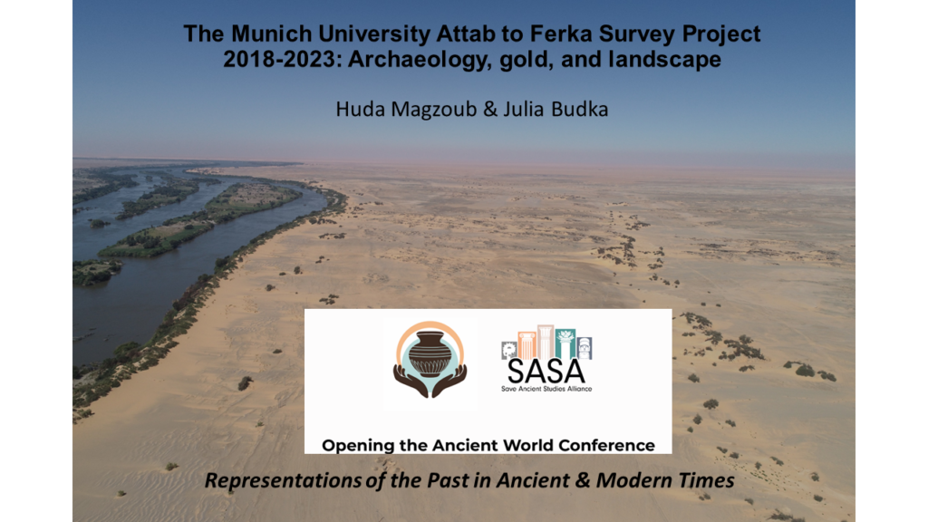
I am delighted that today there will be a joint presentation by my dear friend and colleague Huda Magzoub and me at the SASA conference. Under the title “The Munich University Attab to Ferka Survey Project 2018-2023: Archaeology, gold, and landscape” we will summarize some aspects of our work in Sudan.
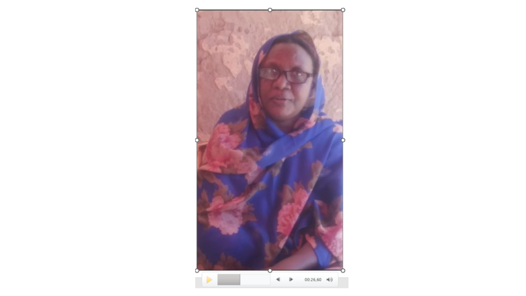
Since Huda is currently having very restricted internet, being displaced with her family in Sudan because of the current war, she sent me a video which I incorporated in the presentation. As much as it hurts not to be able to see her online or in person, it’s a wonderful feeling to present some outcome of our common work and to focus for a change on archaeology & scientific research despite of all the tragedies connected with the war in Sudan.
In our paper today, we will give an overview of the activities and results of the MUAFS project from its start in 2018 until 2023, with a special focus on new findings regarding ancient gold working in the region. In addition, modern gold working and the challenging of preserving cultural heritage in a remote area in times of war will be addressed. Thus, the presentation will follow a comparative approach to analyze gold working throughout the ages. This is especially relevant for Sudan as gold mining has been already in ancient times not just an economic activity but a testament to technological and cultural advancements. Gold has served as a catalyst for cultural evolution, economic prosperity, and sometimes conflict. We will address these aspects and thus highlight some features of the multifaceted story of gold in Sudan, tracing its influence from the dawn of civilization to the contemporary era. Finally, modern concepts of ancient gold working can be critically revisited thanks to the new evidence in the MUAFS concession, making the paper highly relevant for the general theme of the conference.
I am very grateful to the conference organizers for accepting our paper and for giving Huda as a displaced Sudanese archaeologists a forum to share her research in times of war.
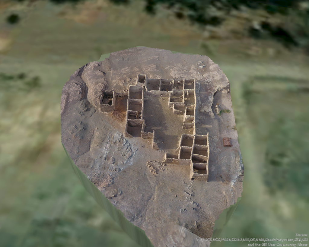
This past season in Sudan, our drone program took flight (pun-intended) in more ways than one. We dedicated most of our efforts to flying programmed missions over large areas of the landscape mainly in Attab West, to collect data for the generation of Digital Elevation Models (DEMs) and orthophotos. In addition, we found time to make targeted flights of standing architecture for 3D modeling and visualization purposes. Digital recording of archaeological sites using the methods and principles of photogrammetry has immense implications for cultural heritage preservation.
I was able to spend an entire day in Attab East documenting an extremely interesting, and remarkably well-preserved Islamic house, located just south of the Nile. The structure was identified and recorded by André Vila as site 2-S-57, a fortified Islamic house. It was built on a small raised rocky plateau, east of a small drainage channel.
Image of the Islamic house 3D model in Drone2Map, facing north.
The house is especially interesting in that many of its walls are still very well preserved, along with evidence of a second story, multiple small staircases, and a larger staircase in the northwestern corner of the house, leading to a tower-like structure. Several walls have also collapsed in recent years, and the collapsed building material remains in situ in the southeastern corner of the structure.
The house itself is designed with a large central courtyard surrounded by relatively small interior rooms. These rooms are all roughly rectangular in shape, seem to be similar sizes, and are mostly oriented east to west. Some rooms contain interior sub-divisions, as well as windows and doorways preserved along the northern exterior wall. The rooms form a cellular pattern around the central courtyard, a common architectural pattern in Islamic houses (Abu-Lughod 1987; Petruccioli 2008; Zolfagharkhani and Ostwald 2021). It would certainly be interesting to consider the use of domestic space in this house, as activity areas and movement patterns are surely present.
Current challenges exist to the house’s preservation, including erosion, flooding, and modern use of the house’s rooms as animal pens. It is interesting that there is continuity in the use of this structure for subsistence activities. However, it is extremely important to have the opportunity to digitally document well-preserved, at-risk sites such as this one. I collected approximately 700 images using our Phantom 4 drone of the site and processed a 3D model in Drone2Map.
Given the high-quality model, the site can be virtually “visited” on open-access sites like Sketchfab. This gives diverse publics the opportunity to engage with and experience the site. Furthermore, systematic analyses such as space syntax can be conducted to further understand the use of the site with the data from the model. Digital representations of archaeological sites are especially valuable during periods of political turmoil when cultural heritage may come under threat. Given the on-going conflict and humanitarian crisis in Sudan, and the enduring impact of the Covid 19 pandemic on research disciplines in general, archaeologists must continue to develop innovative solutions to critical problems of cultural heritage management and preservation.
Check out the model of the Islamic house for yourself on MUAFS’s Sketchfab profile:
Here you can play with the model, manipulate the view, zoom in on rooms and features, and experiment with the size of the model. Sketchfab is a completely free educational platform for all users. Be on the lookout for more models from the project in the future!
References:
Abu-Lughod, J.L. (1987). “The Islamic City–Historic Myth, Islamic essence, and Contemporary Relevance”, International Journal of Middle East Studies, 19(2), pp. 155-176.
Petruccioli, A. (2008). “House and Fabric in the Islamic Mediterranean City” in S.K. Jayyusi, R. Holod, A. Petruccioli, and A. Raymond (eds.), The City in the Islamic World: Volume 1. Leiden: Brill: pp. 851-876.
Zolfagharkhani, M. and Ostwald, M.J. (2021). “The Spatial Structure of Yazd Courtyard Houses: A Space Syntax Analysis of the Topological Characteristics of the Courtyard”, Buildings, 11(262), pp. 1-22.


