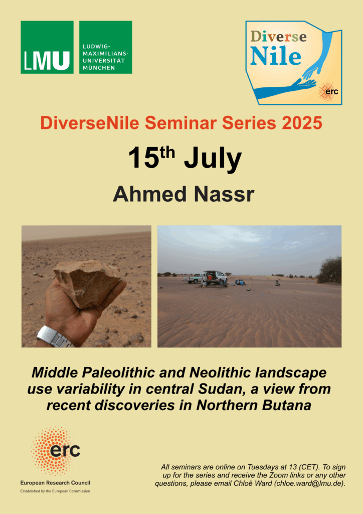
I am delighted to announce the next DiverseNile seminar, which will take place before the summer break.
Ahmed Nassr will be speaking on the topic of: „Middle Paleolithic and Neolithic landscape use variabilities in central Sudan, view from recent discoveries in Northern Butana“. Ahmed is an Associate Professor in the Department of Tourism and Archaeology at the College of Arts at the University of Ha’il in Saudi Arabia.
He specialises in Palaeolithic and Neolithic Sudan and has conducted a wide range of surveys and excavations in various regions of Sudan.
Ahmed kindly wrote an abstract highlighting the content of his upcoming lecture, which I am happy to share here:
“During July 2022 we carried out an archaeological survey in northern Butana (NB) in the area so called Dihaira in the Atbara/Nile triangle. The survey covered the area south of Edamr about 40 km into the fringes of the Butana 80 km in the south, and 20 km east of the Nile to the western margin of Atbara paleo-lake about 60 km. Multiple methods applied including desktop archaeological exploration, landscape ground survey, systematic survey, and test excavations.
The concession is adjacent to two major prehistoric sites (Atbara and Butana), which are of significant importance for understanding human adaptation, cultural evolution and mobility within the central Sudan region. Building on the results of our previous fieldwork in Atbara and the Middle Nile, the NB project was established to understand the range of landscape units exploited by Middle Stone Age (MSA) groups and subsequent prehistoric inhabitants, and to explore the relationship between the hinterland of Butana and the riverine zone.
This lecture tries to present the outcomes of the inaugural survey of the first season, which recorded ninety new archaeological sites. These sites found in variable landscapes, and encompass high-density concentrations of stone artifacts, burial sites, and stratified contexts spanning various periods from Middle Paleolithic, Early and late Neolithic, and Meroitic. The data collected from site surfaces, surface cleaning of MSA sites, excavation of terminal Neolithic sites supported by comprehensive classification and C14 dating.”
Don’t miss this opportunity to find out about a very promising field project in Sudan!
Happy to announce that my new article on the DiverseNile project’s use data from a 1970s survey of the research area by André Vila and colleagues has just been published with Journal of Global Archaeology. In the paper, I discuss the (re)-use and integration of historical data into the DiverseNile project. This includes the geo-referencing of published plans and making effective use of the bespoke typology of sites used by Vila and his team. The use of historical data is widespread in archaeological research but it is not always problematised effectively from a methodological perspective, as I showcase in the paper.
The scope of the 1970s survey make it in an invaluable starting point for much of the research conducted by the DiverseNile team. However, integrating historical data which has to be re-assessed and sometimes altered to reach its full potential is not always straightforward. It is also crucial to consider such work within its historical context in order to fully integrate the results, as I discuss in the article. Unfortunately, the remoteness of some of the sites, as well as the ongoing war in Sudan, means that we must increasingly rely on existing archaeological data to study this particular region.
Reference:
Ward, C. (2024) “Between Legacy and Innovation: Archaeological Data Re-use and Integration, a Case Study from Northern Sudan”, Journal of Global Archaeology, 2024(05), pp. 214–235. doi:10.34780/3zczgz54.
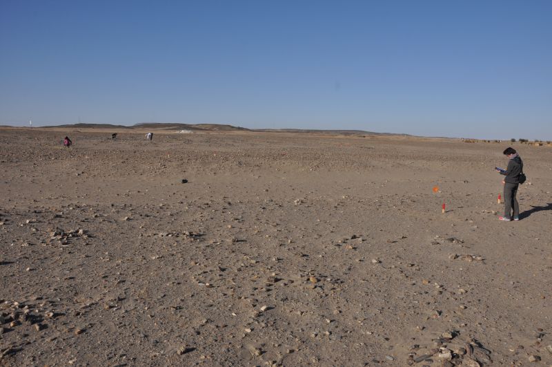
The excavation season of the fourth MUAFS campaign lasted from January 23 to March 18 2023, and focused on aims of the ERC Project DiverseNile, investigating Bronze Age sites (Kerma and New Kingdom) and cultural diversity in the region. The team was supported by Huda Magzoub Elbashir as Antiquities Inspector from NCAM. Our major activities in the 2023 season are summarised in the following.
Excavations
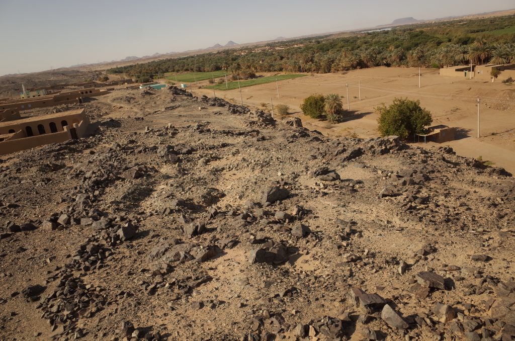
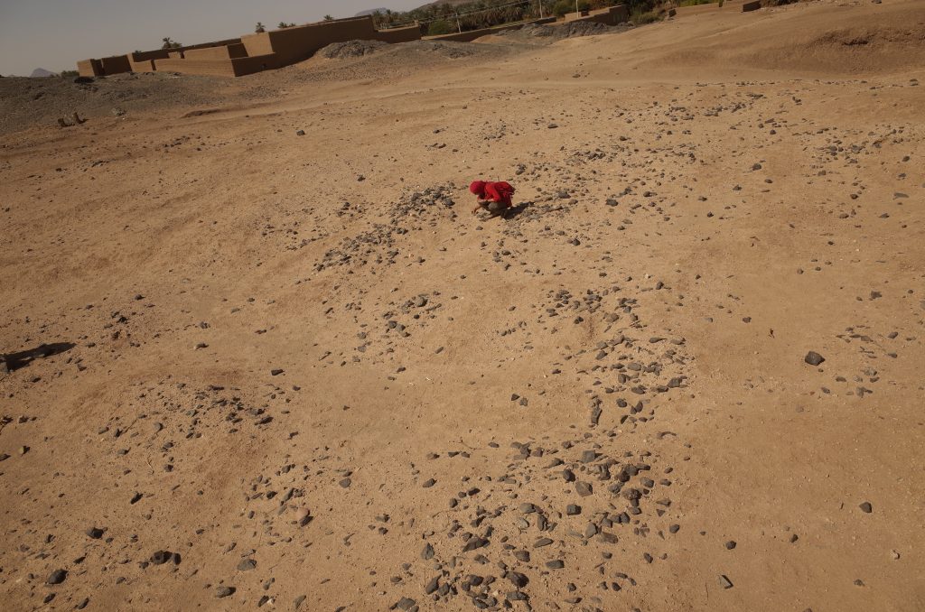
We focused on Bronze Age sites in the area of Ginis and Attab. Our selection included two settlement sites, AtW 001 and site 2-S-54, and one cemetery, GiE 003. Work was carried out with the support of a team of 12 local workmen from Ernietta, Ginis and Attab.
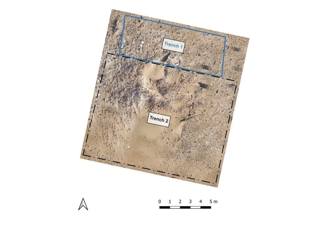
AtW 001
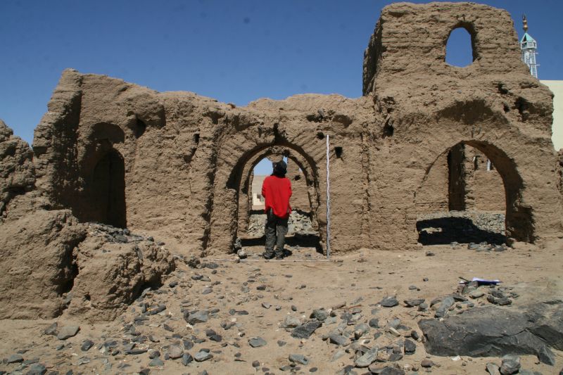
In 2023, the complete mound of this site in Attab West was excavated (Trench 2). Substantial layers of mud brick collapse were found as well as several phases of poorly preserved mud brick structures.
Location of Trench 2, situation before the excavation in 2023.
The domestic character of the site is also obvious from many ashy spots, rubbish deposits including much animal bones and charcoal as well as loads of broken pottery and a surprisingly large number of intact and almost intact vessels. In addition, several round and oval-shaped storage pits were documented, some of them with traces of firing/ash and possibly also connected with heating/cooking.
Most importantly, the same ashy layer on the alluvial surface like in 2022 was reached in the northern part of Trench 2. It is now clear that apart from a slight natural slope, most of the mound-like appearance of site AtW 001 was composed of settlement debris and especially mud brick debris in several layers, all dating to the 18th Dynasty.
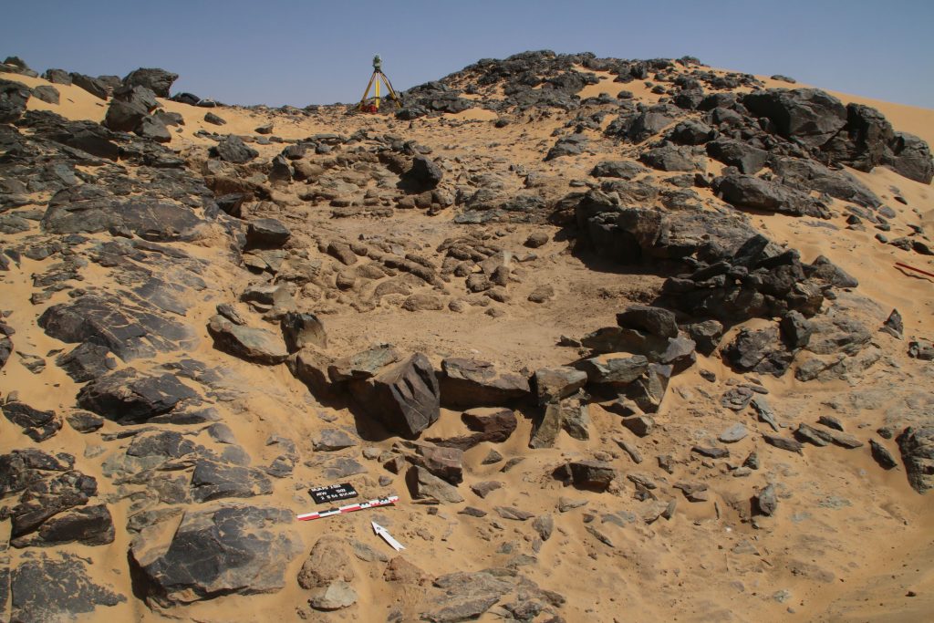
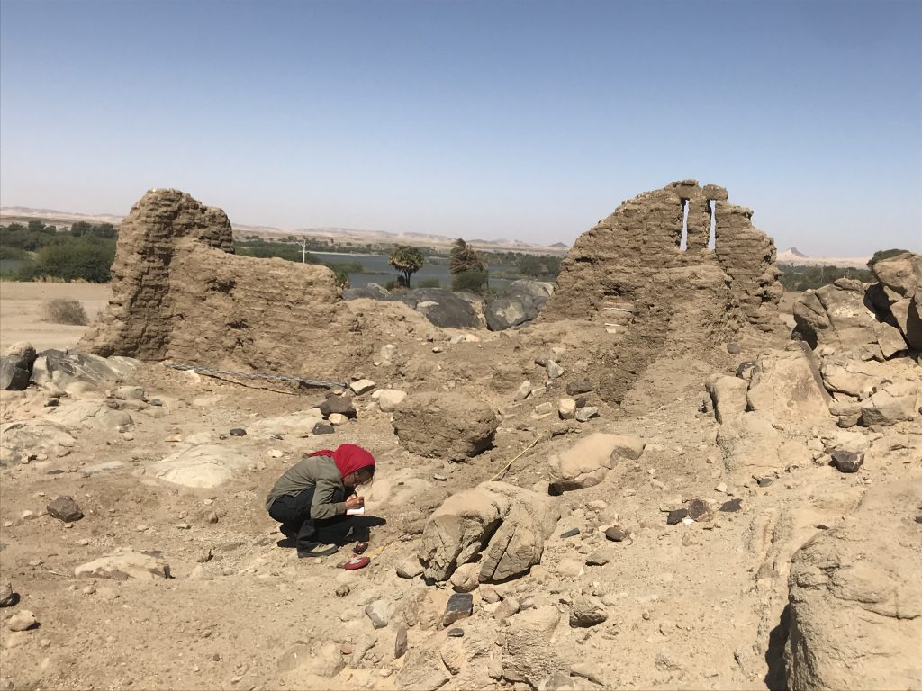
Vila site 2-S-54
Structure 1 at site 2-S-54 is a domestic building measuring 6.5 x 3.5m on the interior and preserved to more than 80cm in height, datable to the 18th Dynasty. We cleaned it from windblown sand and exposed a substantial layer of mud brick debris as well as internal mud brick structures. The feature seems to have been divided in at least three parts, presumably with an open courtyard in the centre. It is still unclear where the main entrance of the structure was originally located (one side entrance seems to have been on the east side in the centre, leading into the open courtyard). Ceramics and collapsed mud bricks were also found on the slope towards the south and this area still needs to be fully cleaned and documented.
Structure 1 at 2-S-54 shows an intriguing mix of stone and mud bricks as building material.
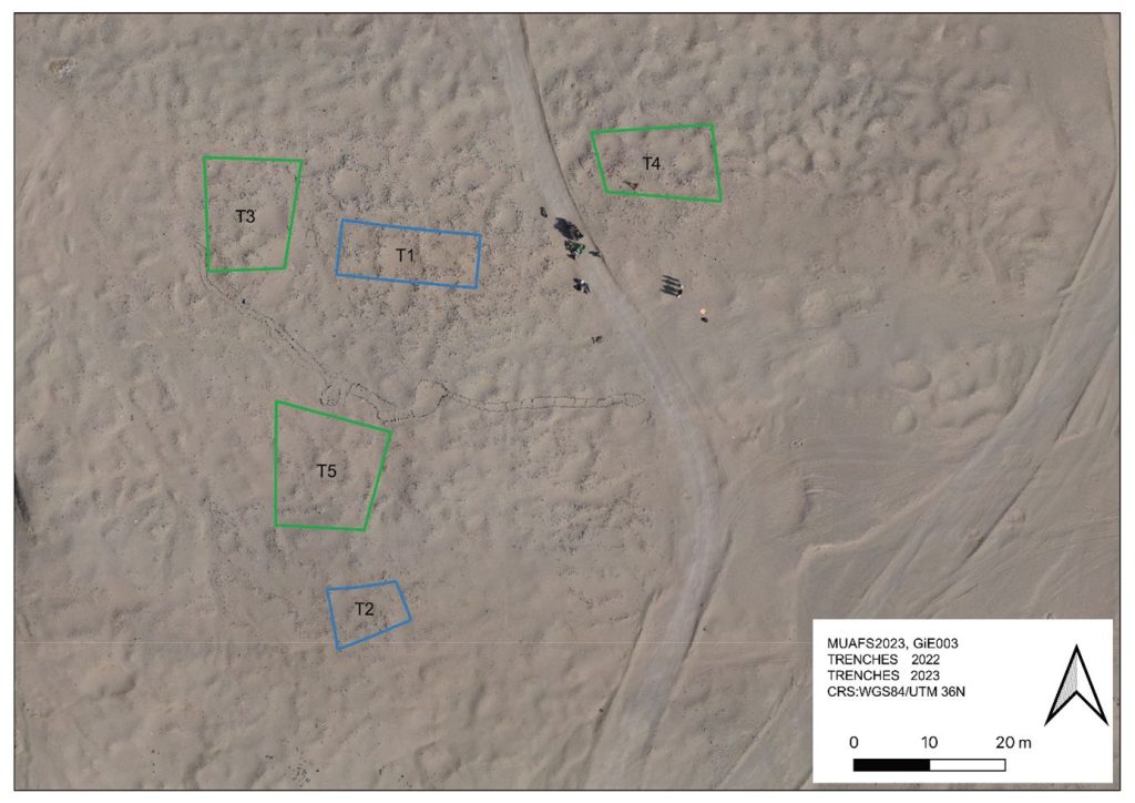
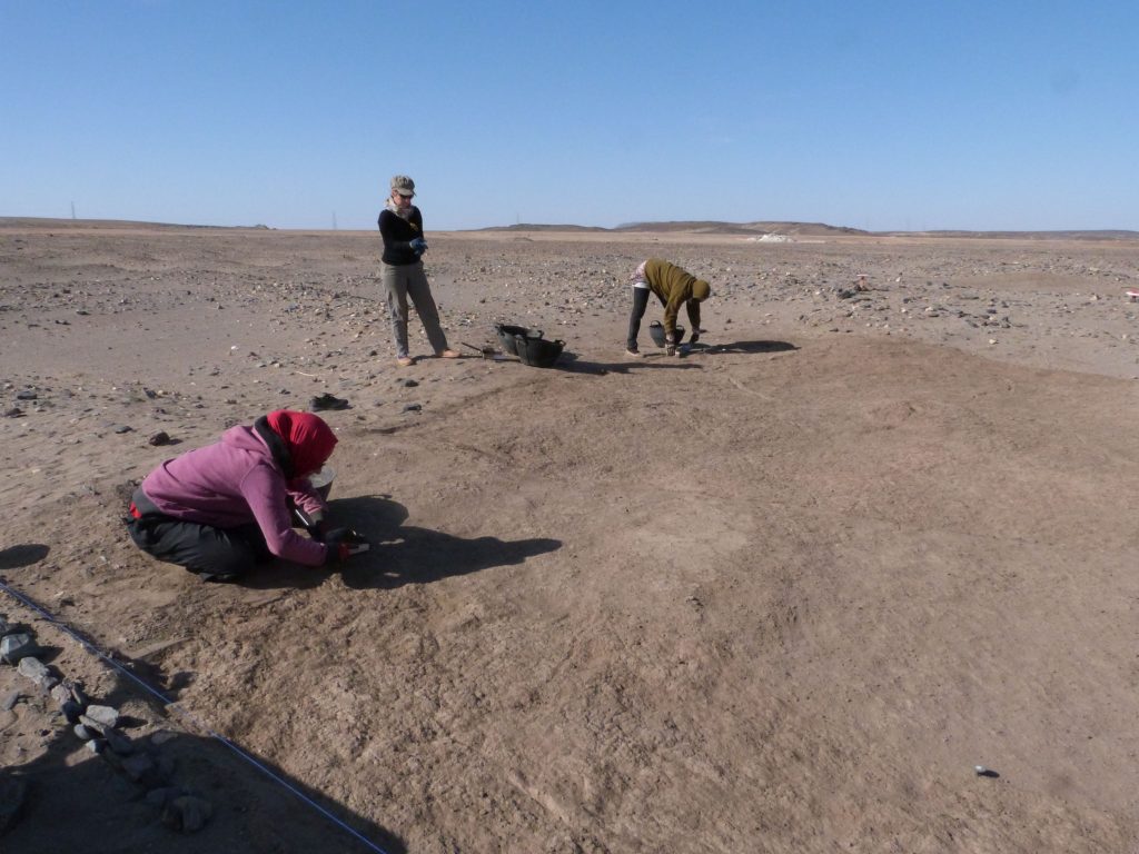
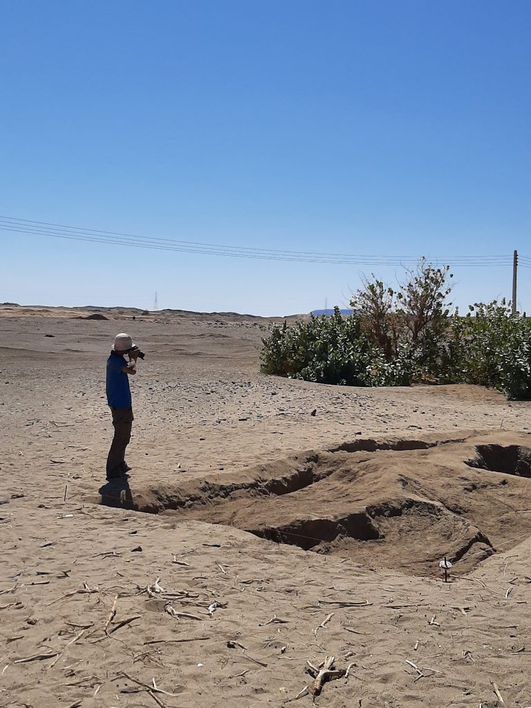
GiE 003
We excavated three new trenches (Trenches 3, 4 and 5) to check the extension of this Kerma cemetery, the distribution of burial types and chronological aspects.
Location of the trenches excavated in GiE 003 in 2023 (including the 2022 trenches in blue).
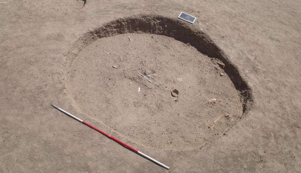
The oldest material was exposed in Trench 5, just north of the Middle Kerma burials in Trench 2. One Middle Kerma circular pit (Feature 53) and a total of four pits associated with Pan-grave style material were discovered.
The largest pit, Feature 50, contained the remains of a wooden bed frame, the remains of a human contracted burial, several goat offerings and a considerable number of intact pottery vessels, comprising Black-topped fine wares as well as incised and impressed decorated vessels.
Feature 50, the Pan-Grave burial pit (second situation with goat offerings and complete pots).
Trench 3 yielded a total of 14, Trench 4 ten new Classic Kerma burial pits, closely resembling our results from 2022 in Trench 1. These burials are rectangular east-west oriented burial pits with rounded corners, vertical walls, and two depressions in the east and west for the funerary bed of which wooden remains were found in some of the features. Two niche burials in Trench 4 also seem to date to the Classic Kerma time.
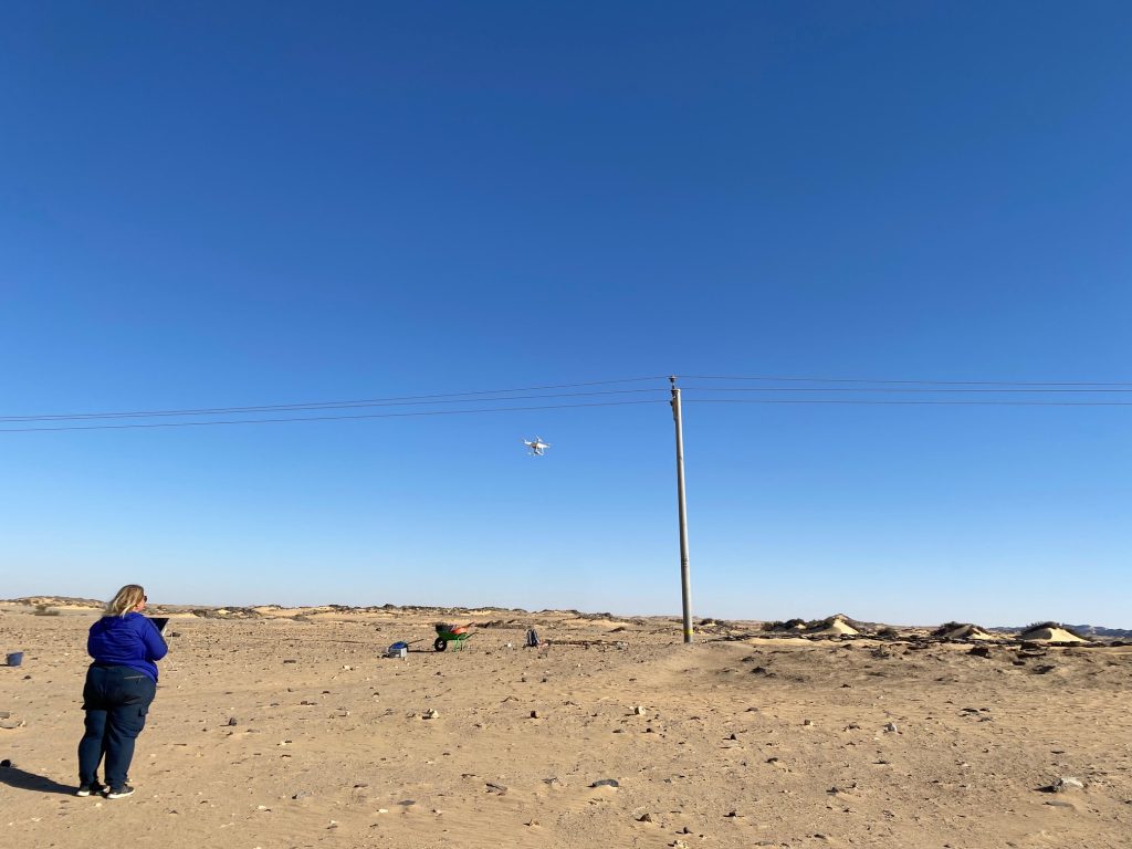
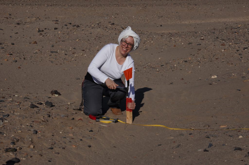
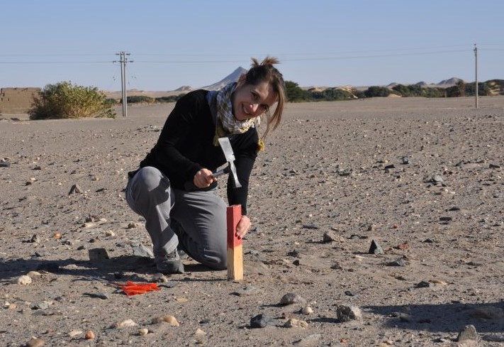
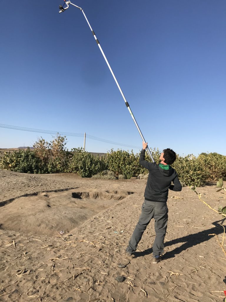
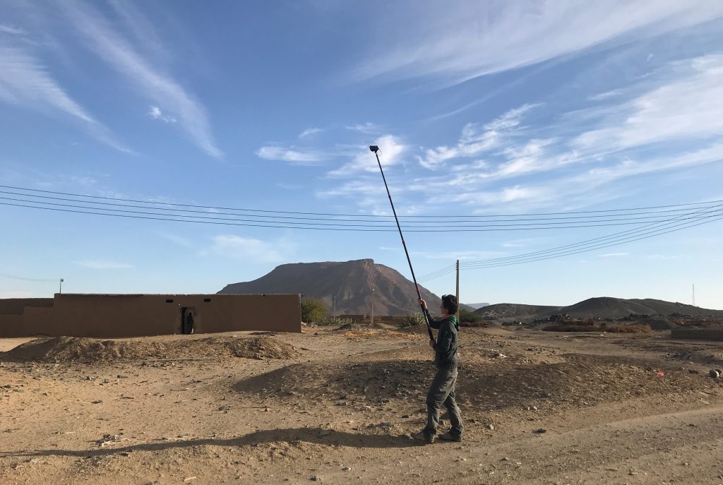
Drone Aerial Photography
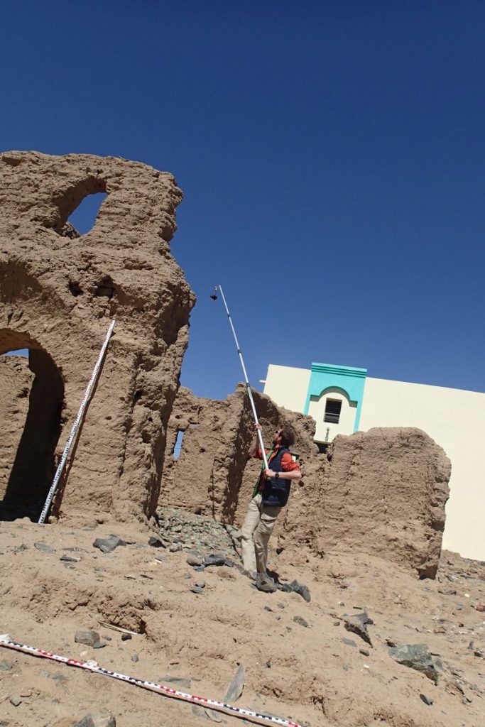
Kate Rose was busy conducting Drone aerial photography (DAP) at the excavated sites and on a larger scale at Attab West, Attab East, Ginis East and Ferka East. Many precise measurements were taken with our new Trimble Catalyst GNSS Antenna and extensive mapping of drystone walls in Attab and Ginis West was carried out as well.
Kate documenting the final state of AtW 001 with our drone.
Find documentation
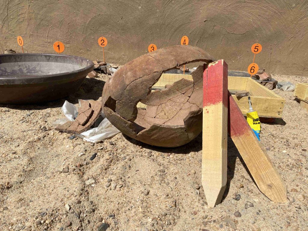
We used a total of 566 find bag numbers in the 2023 spring season. 229 finds were registered, photographed and recorded in detail in the Filemaker Database.
One of the highlights of the ceramic processing 2023: a complete cooking pot from AtW 001 reconstructed from many fragments.
Simultaneously to the excavations, I carried out the recording of the pottery. The numerous settlement material from AtW 001, accounting to more than 10.000 sherds, was very time consuming to process, especially since a large number of pottery vessels could be reconstructed from fragments to complete vessels like an amazing hybrid cooking pot. A total of 43 vessels was documented by drawing in 2023.
The 2023 season survey
Two Vila sites in Attab West and one in Kosha East were newly identified and documented as well as seven new MUAFS site in Attab East, Attab West and Kosha East. A number of these sites is difficult to date and might be sub-recent.
In sum, our 2023 season was very successful, achieving all planned work tasks despite of the looting events and the destruction of site 2-S-54. Especially cemetery GiE 003 with its mixed material culture of Middle Kerma, Pan-Grave and Classic Kerma illustrates cultural encounters between various Nubian groups in the region. The living aspect of these cultural encounters seems to be traceable at sites like 2-S-54 where both Egyptian and Nubian ceramics were found, rectangular and circular buildings appear side by side and mud bricks were used jointly with dry-stone architecture.
Plenty of post-excavation work is now waiting for us and updates will follow soon.
Four years have passed since the last International Conference of Nubian Studies in Paris and on Sunday, the 2022 edition of the 15th congress will start in Warsaw.
Rennan, Chloë and I will be attending, and I will present the MUAFS project and its main results of the last years. My paper will give an overview of our activities from 2018 until 2022, with a special focus on the ongoing subproject ERC DiverseNile focusing on the Bronze Age remains. I will introduce our landscape biography approach in the Attab to Ferka region as the investigation of encounters of humans and landscapes in a peripheral borderscape with a longue-durée perspective, considering all attested finds from Palaeolithic times until the Islamic age.
For the presentation, I updated our list of sites and processed some of the quantitative data. At present, a total of 266 sites was documented. This comprises 186 of the 219 Vila sites as well as 80 newly identified sites. This number of sites is still preliminary because parts of Kosha, Mograkka and Ferka on the West bank have not yet been surveyed.
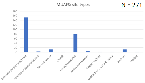
Regarding the types of sites, the most common sites are settlements and burial grounds. However, it is also remarkable that the MUAFS concession includes one granite quarry, one gold extraction site and several rock art sites.
Main types of sites in the MUAFS concession (status 2022).
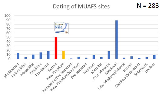
As far as the dating of the sites in concerned, the majority belongs to the Medieval time. However, Bronze Age sites, here labelled as Kerma and New Kingdom sites, which are relevant to the DiverseNile project are also well represented. There are also several multi-period sites and others were re-used in later periods (e.g. Kerma sites in Medieval times).
Dating of the MUAFS sites. Note that the total number of sites for this table is 283 since several sites were used in more than one period. The Kerma and New Kingdom sites are currently being investigated by the DiverseNile project.
I will also present some general patterns of the distribution of sites throughout the ages. This allows to highlight the importance of environmental parameters and changing landscapes in the region.
Although my last visit to Warsaw was just in May this year, I cannot wait to be back in this beautiful town. I am very much looking forward to the Nubian conference and meeting all the international colleagues working in Sudan.
Since joining the project in June, I have been busy catching up on the research that has been conducted to date. A considerable amount of this goes back much further than the start of the DiverseNile project to an archaeological survey which took place between 1969 and 1973 directed by André Vila (Budka 2020). As much as we archaeologists enjoy excavation, we also spend a huge amount of time using and building on the work of our predecessors (see also the earlier blog posts by Rennan Lemos and Veronica Hinterhuber). This is particularly important when considering large concession areas such as the one held by the DiverseNile project and the questions the project poses.
Published plan of the area surveyed between 1969 and 1973 (Vila 1979)
Past work such as Vila’s survey can help inform current (and future!) projects in myriad ways. At the most basic level, we can use the results to help locate potential sites of interest for the project and then identify and re-explore them in the field in Sudan. This can also be significant in noting changes in archaeological sites since Vila’s survey, which is crucial for their preservation (Budka 2019; 2020). We can also integrate past data into our current research, increasing the data we have available at our disposal to answer our present research questions. Finally, we can use this survey data to explore research and archaeological practices both today and in the past. Understanding these practices is crucial as they directly influence the way that archaeological knowledge is constructed (Ward 2022). Therefore, a key consideration when using Vila’s data is to understand how it was collected and presented at the time, this means we can make use of it much more effectively. To this end, considering Vila’s results as ‘legacy data’ is a useful way of integrating this past research into our current project.
Normally, the term legacy data in archaeology is used to define ‘obsolete’ archaeological data but, given the vast importance of digital data for any kind of analysis, manipulation, or mapping, this can broadly be applied to any data which is not digital (Allison 2008). As such, any work involving the re-contextualisation, application of modern techniques, or modelling of past data can be considered working with legacy data (Wylie 2016). Thinking of this evidence as legacy data rather than simply data is crucial when using it in any new or future research as it demands a more complex engagement with the material then simply extracting quantitative data. It would be redundant to simply apply new methods to old data, without engaging with more fundamental questions which consider how the data was originally collected and how it fits into the broader historical and methodological contexts of previous studies.
Fortunately for us, Vila’s survey is comprehensively published across 11 volumes, all of which are available on the website of the SFDAS (Section française de la direction des antiquités du Soudan). The volumes are nicely bookended by an introductory volume — which provides crucial information on how the survey and recording was conducted by the team, as well as the classification system used — and a concluding volume — which provides some quantitative analyses of the results of the survey.
Classification of sites used by Vila during the survey (after Vila 1975)
This is a fantastic resource for the project to draw upon as a key consideration when making effective use of legacy data is not only to understand the methodological processes used, but also to ensure the replication of past results (Corti and Thompson 2004; Corti 2007; Corti 2011). As in any science, the reproducibility of results is fundamental in ensuring the accuracy — and therefore usability — of past research, which is crucial when incorporating it into contemporary research. Furthermore, advances in the archaeology of Sudan means that some of Vila’s results — for example, in terms of phasing — may well need to be re-examined and ‘updated’ to take into account the half-century of subsequent research.
Of course, all of this leads to additional questions on the future of the research and data created by the DiverseNile project. This includes thinking about the best ways to collect, store, and share our data and ‘futureproof’ our work.
Keep reading the blog for future updates on Vila’s work and its integration into the DiverseNile project!
References
Allison, P. 2008. Dealing with Legacy Data ‒ an introduction. Internet Archaeology 24. DOI:10.11141/ia.24.8
Budka, J. 2019 (with contributions by Giulia D’Ercole, Cajetan Geiger, Veronica Hinterhuber & Marion Scheiblecker). Towards Middle Nile Biographies: The Munich University Attab to Ferka Survey Project 2018/2019, Sudan & Nubia 23:13‒26
Budka, J. 2020. Kerma presence at Ginis East: the 2020 season of the Munich University Attab to Ferka Survey Project, Sudan & Nubia 24: 57‒71
Corti, L. 2007. Re-using archived qualitative data ‒ where, how, why? Archival Science: 37‒54
Corti, L. 2011. The European Landscape of Qualitative Social Research Archives: Methodological and Practical Issues. Forum: Qualitative Soical Research 12(3)
Corti, L. and Thompson, P. 2004. Secondary Analysis of Archive Data. In: Seale, Gobo, Gubrium, et al. (eds) Qualitative Research Practice. London: Sage: 327‒343
Vila, A. 1975. La prospection archéologique de la Vallée du Nil, au Sud de la Cataracte de Dal (Nubie Soudanaise).Fascicule 1: General introduction. Paris: CNRS
Vila, A. 1979. La prospection archéologique de la Vallée du Nil, au Sud de la Cataracte de Dal (Nubie Soudanaise).Fascicule 11: Récapitulations et conclusions. Paris: CNRS
Ward, C. 2022. Excavating the Archive/Archiving the Excavation: Archival Processes and Contexts in Archaeology. Advances in Archaeological Practice 10(2). DOI:10.1017/aap.2022.1
Wylie, A. 2016. How Archaeological Evidence Bites Back: Strategies for Putting Old Data to Work in New Ways. Science, Technology, & Human Values 42(2): 203‒225
We have returned safely from Sudan and our short preparation season of the Munich University Attab to Ferka Survey Project (MUAFS) in its research concession between Attab and Ferka from Dec. 29 to January 9 was very successful.
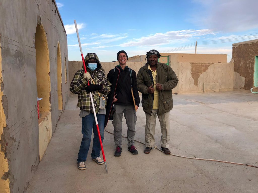
Huda, our driver Saif and I getting ready to leave for another day of surveying the area (photo: C. Geiger).
Huda and I conducted a foot survey in areas of Attab East, Attab West, Ginis East, Ginis West and Ferka West. The focus was on the identification of sites already recorded by Vila. We were able to document a total of 79 sites, comprising 21 new MUAFS sites. The sites range in date from Palaeolithic times to the Medieval and Ottoman eras. The types of sites are mostly camp sites, habitations, and tombs/cemeteries, but also include rock art and stone wadi walls.
Surveyed area of the 2021/2022 season (map: C. Geiger).
Whenever possible, we collected diagnostic pottery and lithics from the sites for dating purposes. I was able to document most of them by photography and also managed to draw 35 Kerma and New Kingdom sherds. Most interesting are some newly documented New Kingdom sites, attesting to both a use in the 18th Dynasty and a Ramesside presence in the periphery of Amara West.
One example of a newly documented site, unfortunatly recently plundered (photo: J. Budka).
One particularly striking site, a cluster of cleft tombs at Ginis East, has never been documented before but was unfortunately lately plundered. And this is not an isolated example! Recent plundering, modern gold working, new electricity lines and damaged caused by car tracks, roads and new buildings are unfortunately very frequent, have increased since 2020 and stress how urgently we need to document this rich area in the Middle Nile.
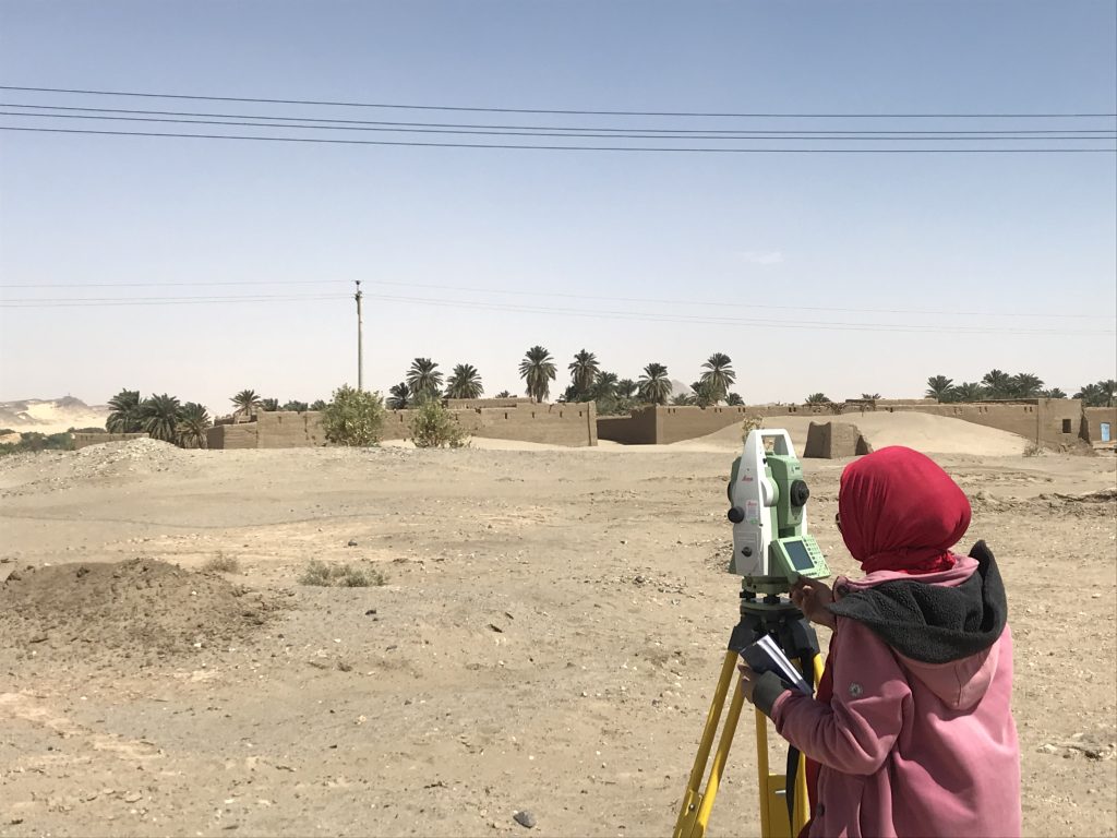
The surveying campaign carried out by Cajetan resulted in the setup of new benchmarks using a GPS Antenna and a totalstation in Attab East, Ginis East and Ginis West. We will use these benchmarks as basis for future measurements during our planned excavations. Drone aerial photography was successfully conducted in Ginis East, Ginis West and Ferka West.
All in all, I am very grateful to the support of our Sudanese friends and colleagues – without them our work at site would not have been possible in these very difficult times of political changes. We collected a large amount of new data and will now be very busy processing these here in Munich – and of course we will keep you updated.
The magnetic data collected at our first campaign in the Attab to Ferka region in 2018/2019 was first processed and interpreted directly after the field season. After the first excavation campaign in 2020, focusing on two of the four geophysically investigated sites, a reconsideration of the data took place. It is based on the excavation results, the photogrammetric data and new kite images.
But before looking at the data, you have to know where exactly on earth the data was generated! The Earth’s magnetic field is a complex system, which is protecting us against ultraviolet radiation, as it is deflecting most of the solar wind, which is stripping away the ozone layer. The earth’s magnetic field can be visualized as a three-dimensional vector: Declination (angle in ° to geographic north, X), Inclination (horizontal angle in ° or magnetic dip, Y) and Intensity (measured in T “Tesla” resp. nT “Nanotesla”, Z). In archaeomagnetism, all components are measured to be compared to the single curves of the region. For magnetometry and interpreting these data, the Inclination is the most important value besides the Declination, which helps for example to detect in situ burnt features. The Inclination describes the angle in which the Earth’s Magnetic Field meets the surface of the Earth itself. Therefore, the angle is changing depending on your position e. g. if you are closer to the magnetic poles or to the magnetic equator.
The geomagnetic field changes all the time, every second, every day, and every year! For Munich resp. Fürstenfeldbruck you can follow the alterations simultaneously here. The geomagnetic observatory there is part of the Ludwig-Maximilians-Universität and the Department of Earth and Environmental Studies. As you may know, the magnetic poles are wandering as well. The magnetic north pole did it that fast in the last years that the navigation map had to be changed before the standard interval of five years in 2019. This world magnetic model (WMM) is available online.
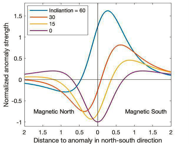
But why do we have to know especially the Inclination of the area we are working in and doing magnetometry? The shape and intensity of every single anomaly is depending especially on the Inclination! The shallower the Inclination the wider the anomaly is visible in the magnetogram. Additionally, the dipole (positive/black – negative/white) components are changing. The closer we are measuring to the geomagnetic equator (not the geographic equator), the larger gets the negative part of the anomaly and the lower are the amplitudes of the magnetic signal. Figure 1 illustrates the differences in Inclination for a single anomaly.
Figure 1: Anomaly strength of the total field intensity as north-south traverse through the anomaly’s centre for different Inclinations (Ostner et al. 2019, 181 Fig. 2).
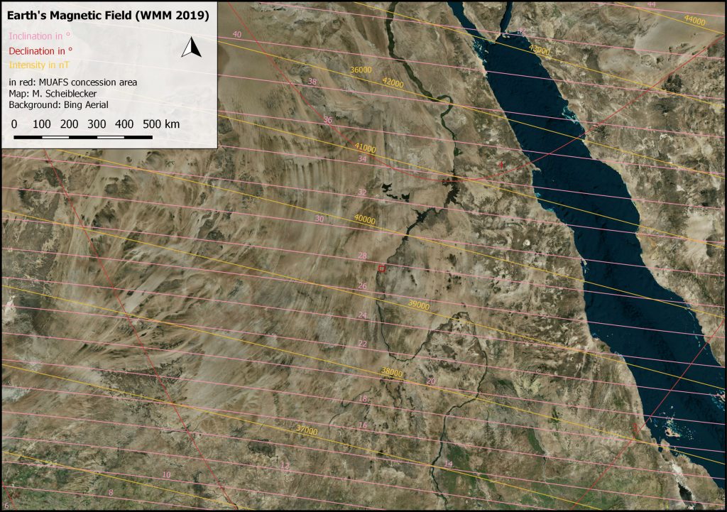
While the Inclination in Munich is around 64°, the Inclination in the MUAFS concession area is 27-28° and shallower. The components of the Earth’s Magnetic Field at the MUAFS concession area are illustrated in Figure 2, showing a Declination of almost 4° and a total field intensity of around 39.000 nT (Munich: 48.585 nT). The measured archaeological and geological features, visible in the magnetogram, are showing contrasts of sometimes less than 1 nT. Due to different Inclinations, the same archaeological feature would result in a different anomaly in Sudan compared to Munich. While the anomaly in Sudan would be wider (see the red curve, Fig. 1) than in Munich (ca. the blue curve, Fig. 1), it would cause lower intensities as well as showing more negative parts than the Munich one. This means while in Bavaria the negative part of an anomaly is regarded more as a small “white shadow”, in Sudan it would be almost equal to the positive part of the anomaly. Furthermore, depending on the depth of the buried feature, the shift in locating the feature could be larger with shallower inclination.
Figure 2: The Earth’s Magnetic Field in Sudan after World Magnetic Model (WMM) 2019, with the MUAFS concession area in red (M. Scheiblecker).
Regarding the used magnetometer – a gradiometer, the intensities are additionally lower than for example with a total field magnetometer, which makes it more difficult to interpret the data and why sometimes low value-features like pisé walls are not detectable with gradiometers. Furthermore, with wider anomalies closer to the geomagnetic equator like in Sudan, it is more possible that anomalies are overlapping so that it is not easy to distinguish features lying next to each other or from different periods.
Usually, magnetograms are shown in greyscale to avoid confusion and “pseudo-limitations” of different values and colors. For interpreting the data, one can play around with the minimum and maximum values as well as inverting of the greyscale version. On magnetograms of measurements with the total field magnetometer usually a high-pass filter is applied, which can be overlayed with the total field data as well.
In rare cases it is helpful to use color scales for the magnetograms additionally to show special features better or to highlight some very high or low values. If the magnetogram is disturbed by high magnetic anomalies like metal fences, iron rubbish on the site etc., color scales are not useful anymore, because they are showing especially the disturbances due to their high amplitudes and less of the archaeological features itself. Nevertheless, it is possible to adjust the color scale as needed for every site separately.
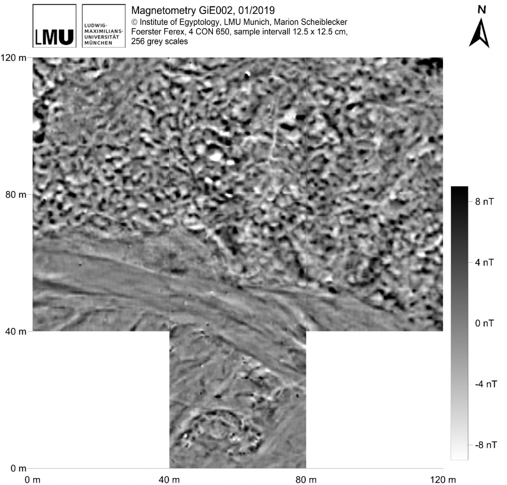
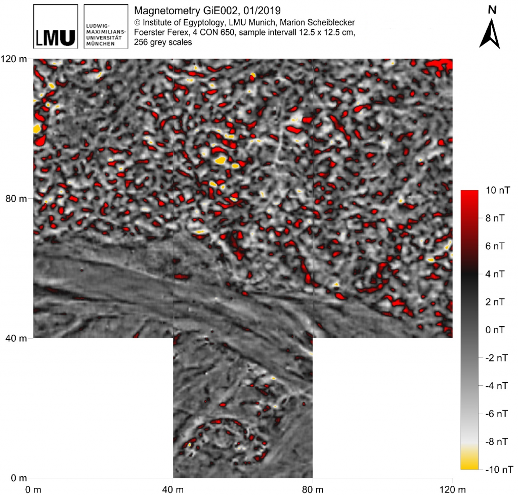
Illustrating the mentioned methods, I would like to show the magnetogram of GiE 002, where a cemetery is located.
Figure 3: Magnetogram of GiE 002 in greyscale (M. Scheiblecker).
The usual greyscale (Fig. 3) shows clearly the traces of the recent and former wadi/khor, tumuli-like features in the very south as well as lots of features of different shape in the northern part of the magnetogram, interpreted as graves. They are resulting in positive anomalies, accompanied by negative anomalies of different amplitudes.
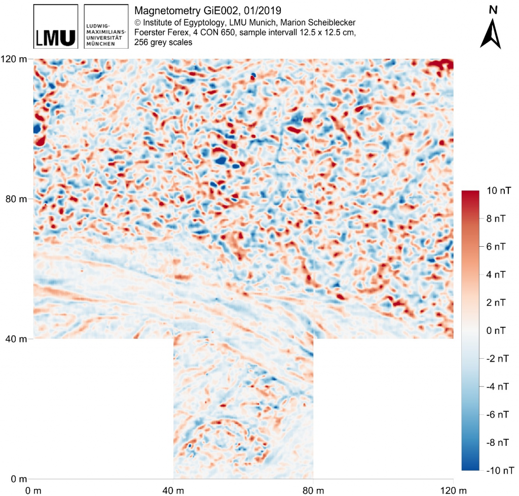
Figure 4: Magnetogram of GiE 002 in blue to red color scale (M. Scheiblecker).
To understand more of the single burials it is helpful to change to a blue-red color scale (Fig. 4). In this way, it is easier to differentiate the single anomalies consisting of the positive (red) and negative (blue) part.
Figure 5: Magnetogram of GiE 002 in highlighted grey scale, showing maximum values in red as well as minimum values in yellow (M. Scheiblecker).
Highlighting the minimum and maximum values – in yellow resp. red – helps e. g. focusing on the probably best-preserved archaeological features located in the center of the measured area, visible in Figure 5.
The magnetograms of GiE 002 show clearly that it is worth playing around with different color scales and that there is more than one magnetogram important for interpreting the data for archaeological and geological purposes.
References
Fassbinder, J. W. E. (2017): Magnetometry for Archaeology. In: Allan S. Gilbert, Paul Goldberg, Vance T. Holliday, Rolfe D. Mandel and Robert Siegmund Sternberg (eds.): Encyclopedia of Geoarchaeology. Dordrecht: Springer Reference (Encyclopedia of Earth Sciences Series), 499-514.
Livermore, P.W.; Finlay, C.C.; Bayliff, M. (2020): Recent north magnetic pole acceleration towards Siberia caused by flux lobe elongation. Nature Geoscience 13, 387–391.
Ostner, S.; Fassbinder, J. W. E.; Parsi, M.; Gerlach, I.; Japp, S. (2019): Magnetic prospection close to the magnetic equator: Case studies in the Tigray plateau of Aksum and Yeha, Ethiopia. In: James Bonsall (ed.): New Global Perspectives on Archaeological Prospection. 13th International Conference on Archaeological Prospection. 28 August – 1 September 2019. Sligo – Ireland. Oxford: Archaeopress, 180-183.
Every archaeologist knows that what we write about the past is mediated by present-day questions, expectations and challenges, but also state-of-the-art documentation techniques. Archaeologists don’t simply reconstruct what happened back in the day. Instead, archaeological and historical narratives are essentially modern constructions that can either be repaired or demolished as scholarship moves forward. Archaeological research is also mediated by complex site and object biographies that span thousands of years; e.g., in our case, from the Neolithic to monumental surveys carried out in northern Sudan in the mid-20th century.
To understand tombs, burials and mortuary objects in the region from Attab to Ferka we need to understand the impact of André Vila’s work in the region, the epistemological framework from which he was reporting and his methodology. How Vila’s work materialise in the landscape directly affect the questions we ask and the methodologies we apply today. Not surprisingly, archaeologists in Sudan usually deal with traces left by earlier archaeologists at various sites, and retracing their steps becomes a fundamental aspect of accessing the past through remaining material culture (e.g., Howley 2018: 86-87).
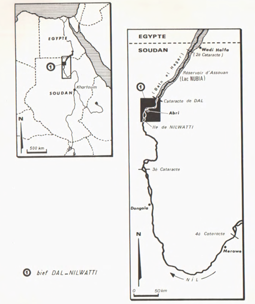
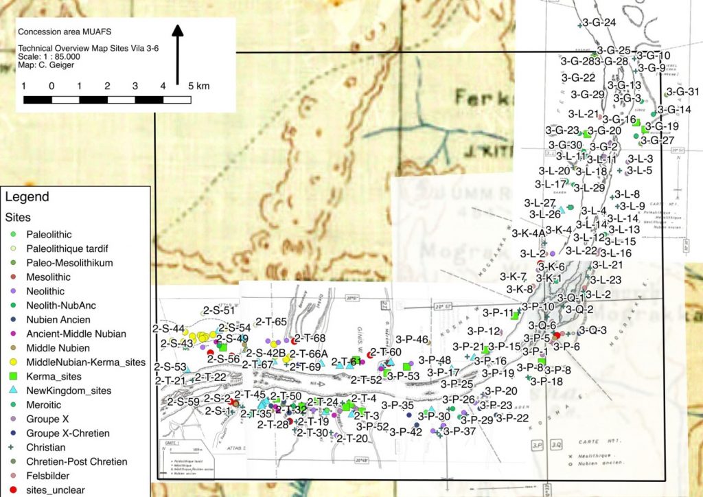
Vila’s survey can be seen as part of a long tradition of large-scale surveys going back to the first Archaeological Survey of Nubia (see Adams 2007). From Dal (the southern limit of Lake Nubia) to Nilwatti Island, Vila identified 462 sites of which 219 sites are within the MUAFS concession (figure 1). These sites were attributed to cultural units, e.g., Kerma, Christian etc. Even though Vila noted that various sites belonged to one or more cultural units, today archaeologists approach those ‘units’ more fluidly, especially in situations of cultural exchanges, which is especially true for Kerma and New Kingdom sites. On the one hand, revisiting sites surveyed and reported in the 1960s and ’70s requires us to contextualise archaeology to ‘deconstruct’ theoretical biases and ask different questions. On the other hand, Vila’s methodology determines the extent to which sites can be explored.
Figure 1: distribution of sites in the MUAFS/DiverseNile concession area (map: C. Geiger)
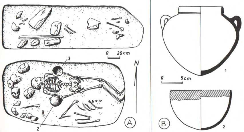
In terms of method, Vila’s survey aimed to keep disturbance to sites to a minimum. Test excavations and sampling followed rigid guidelines and excavations were only carried out when cultural affiliations couldn’t be distinguished otherwise, e.g., based on surface finds. Cemeteries were approached in a slightly different way. Cemeteries were usually cleared to determine their extent and number of graves at each site. A few graves were fully excavated and recorded, as well as ‘peculiar’ collective burials (figure 2).
Figure 2: Bagagin Farki, Ginis East. “Egyptian” New Kingdom pit burial containing an individual deposited in extended position together with sherds from two pots and the remains of other six individuals (Vila 1977, Vol. 5: 47)
In Work Package 2, I am responsible, among other things, for reassessing the material from such graves. For example, comparison of items from graves in our concession area with objects from other sites allows us to shed new light onto different roles performed by the same types of objects in different contexts (Lemos 2020). Scientific analysis of pottery also allows us to explore the (potentially) alternative role of objects in rituals (stay tune to Giulia D’Ercole’s blog!). I am currently collaborating with Kate Fulcher from the British Museum on the topic of mortuary rituals in New Kingdom Nubia based on scientific analysis of artefacts (see Fulcher and Budka 2020 for examples of such approaches).
Working with previously excavated material culture poses several theoretical and methodological challenges, mostly related to the lack of information provided by earlier excavation reports and the problematical categories used to classify things. However, revisiting the burials excavated by Vila holds an immense potential for us to ask different questions within larger-scale perspectives on burial communities, the role of (foreign) objects in the constitution of (local) social relations and identity formation strategies. Comparative approaches to sites and material culture allow us to understand different social realities within Nubia, challenging previous homogenising perspectives on cultural interactions focusing on elite centres. Revisiting sites also holds great potential to unveil things under new theoretical perspectives and using state-of-the-art documentation techniques. This is especially the case because disturbance to sites was limited during Vila’s survey, although looting poses an additional challenge to new fieldwork in our concession area.
Ultimately, researching burials and other sites in our concession area and excavating sites firstly worked by Vila presupposes a deep knowledge of the data sets produced by him, what was ignored/discarded, what was considered worth investigating etc. Previous ways of excavating, identifying and reporting sites also determine the extent to which we can revisit them through excavation and comparative analysis.
References
Adams, W. Y. 2007. A Century of Archaeological Salvage, 1907-2007. Sudan and & Nubia 11: 48-56.
Fulcher, K. and J. Budka. 2020. Pigments, incense, and bitumen from the New Kingdom town and cemetery on SaiIsland in Nubia. Journal of Archaeological Sciencehttps://doi.org/10.1016/j.jasrep.2020.102550.
Howley, K. 2018. Return to Taharqo’s Temple at Sanam: the inaugural field season of the Sanam Temple Project. Sudan & Nubia 22: 81-88.
Lemos, R. 2020. Material Culture and Colonization in Ancient Nubia: Evidence from the New Kingdom Cemeteries. Encyclopedia of Global Archaeology, ed. C. Smith. https://doi.org/10.1007/978-3-319-51726-1.
Vila, A. 1977. La prospection archéologique de la Vallée du Nil, au Sud de la Cataracte de Dal (Nubie Sudanaise). Fascicule 5: Le district de Ginis, Est et Ouest. Paris: CNRS.
As a team member of the first MUAFS season 2018/2019 responsible for magnetic investigations I would like to introduce the geophysical methods used for archaeological purposes. These methods will also be highly relevant for the DiverseNile project.
In the last decades, geophysics became a substantial part of archaeological projects. Depending on several factors, the most suitable geophysical method is chosen: the environment (desert, steppe, swampland etc.), the archaeological period and the used archaeological materials (stone, mudbrick etc.), but also the questioning (settlement layout and extension, cemetery detection etc.). Additionally, the decision is influenced by available time, financial means and sometimes the season.
Still the fastest and most effective geophysical method in archaeology is magnetometry. It provides getting an overview of a site as well as its environment, extension and layout. Magnetic prospecting enables us to distinguish between settlement and burial sites, their structure, special buildings, open areas, as well as fortifications. Depending on the chosen sensors, we can learn more about the geology and environment and their changes over time. Accompanying measurements of magnetic susceptibility deliver information about magnetic properties of scattered objects and building materials as well as archaeological sediments and can be used in archaeological excavations as well.
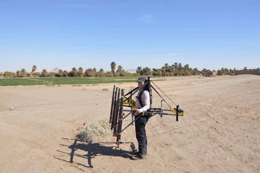
Magnetic gradient investigations in Ginis 2019, site GiE 001 (Photo: Giulia D’Ercole).
But how does it work? Magnetometers are recording the intensity of the earth magnetic field with high-resolution. Nowadays, the earth magnetic field in the Attab to Ferka region has an intensity of around 39.400 Nanotesla (nT). With sensitive total field magnetometers, magnetic anomalies of less than 1 nT can be detected during archaeo-geophysical surveys, displaying even archaeological features like mudbrick walls or palisades.
Magnetic investigations benefit from varying magnetic properties of archaeological soils and sediments as well as materials. Every human activity regarding the surface is detectable because of different magnetic response. For example, digging a ditch, building a wall or using a kiln is changing or disturbing the actual earth magnetic field. What else can be detected? Architecture, streets, canals and riverbeds, ditches, pits and graves can be revealed just as palisades, posts and fire installations. Additionally, more information about geological and environmental conditions can be collected using magnetometry, e. g. paleo channels or former wadis.
For detecting stone architecture and for example voids, resistivity (areal or profile) and Ground Penetrating Radar (GPR) methods are applied, partly in addition to magnetic investigations. While magnetometry gives an overview about buried features beneath the surface in a ‘timeless picture’, GPR and ERT (Electrical Resistivity Tomography) provide more information about the depth and preserved height of the features. Of course, more than one geophysical method can be applied to get a comprehensive dataset for more complete interpretation of the results. Combined with archaeological work – survey and excavation – we can increase our knowledge and understanding of physical properties of archaeological and geological features as well as improve our interpretation.
Geophysical prospecting was originally developed for military purposes to detect submarine boats, aircrafts or gun emplacements. Furthermore, natural and especially mineral resources can be located. Geophysical methods and first of all magnetometry are used in archaeology since the late 1950s, when Martin Aitken detected Roman kilns in the UK. In Sudan, magnetometry is used since the late 1960s when Albert Hesse started investigations at Mirgissa in Lower Nubia. Since then, instruments as well as software programs for data collecting, processing and imaging have been developed and improved and offer detailed mapping of sites. First, geophysical prospecting can be applied fast, nondestructive and comprehensive. For magnetic prospection there is a variety of configurations to use, from handheld one/two-sensor instruments to motorized and multisensory systems but also different types of sensors. Through geographic information systems (GIS) geophysical investigations are benefiting from integrating high-resolution satellite images, drone images and models, survey and excavation data for a comprehensive interpretation of results.
After collecting magnetic data in the field, the files are downloaded and processed to get an idea of the first results. With that the field measurement proceeding can be adjusted as well as excavation trenches can be chosen. The detailed processing and analyzing of the collected field data are conducted back home on the desk.
References
Campana, Stefano; Piro, Salvatore (eds.) (2009): Seeing the Unseen. Geophysics and Landscape Archaeology. London: Taylor & Francis.
Dalan, R. (2017): Susceptiblity. In: Allan S. Gilbert, Paul Goldberg, Vance T. Holliday, Rolfe D. Mandel and Robert Siegmund Sternberg (eds.): Encyclopedia of Geoarchaeology. Dordrecht: Springer Reference (Encyclopedia of Earth Sciences Series), 939–944.
Fassbinder, Jörg W. E. (2017): Magnetometry for Archaeology. In: Allan S. Gilbert, Paul Goldberg, Vance T. Holliday, Rolfe D. Mandel and Robert Siegmund Sternberg (eds.): Encyclopedia of Geoarchaeology. Dordrecht: Springer Reference (Encyclopedia of Earth Sciences Series), 499–514.
Herbich, Tomasz (2019): Efficiency of the magnetic method in surveying desert sites in Egypt and Sudan: Case studies. In: Raffaele Persico, Salvatore Piro and Neil Linford (eds.): Innovation in Near-Surface Geophysics. Instrumentation, Application, and Data Processing Methods. First edition. Amsterdam, Oxford, Cambridge: Elsevier, 195–251.
Schmidt, Armin; Linford, Paul; Linford, Neil; David, Andrew; Gaffney, Chris; Sarris, Apostolos; Fassbinder, Jörg (2015): EAC Guidelines for the Use of Geophysics in Archaeology. Questions to Ask and Points to Consider. Namur: Europae Archaeologia Consilium (EAC Guidelines, 2).
We should just have landed in Munich these minutes… but since a sandstorm in Khartoum prevented the airplanes to land yesterday, our flight was cancelled and Jessica and me are now stuck in a hotel close to the airport…
Well, we are still waiting for information when we will have the next try and thus I thought I use the time to go through some of the pictures we took this season.
The 4.5 weeks of work at Ginis East and sourroundings were intense and varied, in terms of tasks, weather, nimiti and other things. Here are some impressions with a huge load of thanks to my great 2020 team! Looking much forward to the next season!
First day in the field, setting up the trenches (photo: C. Geiger)Veronica setting on of the posts for our trench (photo: C. Geiger).
Giulia at work (photo: C. Geiger).Surface cleaning at GiE 001, Jessica and Huda (photo: J. Budka).Jessica documenting the church of Mograkka (photo: C. Geiger).Cajetan at work – image based documentation of the church of Mograkka (photo: J. Distefano).Giulia, Veronica and Huda at GiE 006 (photo: J. Budka).The 2020 Team at Ginis East.The Nile and riverbank at Ginis (photo: J. Budka).Me busy with surface documentation at GiE 001 (photo: J. Distefano).Photographing Trench 2 at GIE 001 (photo: J. Distefano).Jessica taking survey points with the total station (photo: J. Budka).The landscape at Mograkka East (photo: J. Budka).Jessica looking for diagnostic pottery sherds at one of the Christian cemeteries in Mograkka (photo: J. Budka).Jessica taking measurements at the curch of Ferka East (photo: J. Budka).Me photographing Post-Meroitic tumuli at Ferka (photo: J. Distefano).Huda, Jessica and me after we finished the survey in Mograkka.
