Post-flooding irrigation at Attab West in the Bronze or Iron Age – some new data from our drone survey

Back from the very successful International Conference for Meroitic Studies last week in Münster, I would like to elaborate on one interesting site I mentioned there in the broader context of Napatan sites in Ginis West. As outlined in a previous post, presenting these “stone villages”, I took another look at all our drone images and, above all, the georeferenced orthophotos and digital elevation models, especially from Attab West and Ginis West.
This enabled me to correctly locate a site in Attab West, on the border to Ginis West, which I had never found in the field in Sudan. This map of Ginis West was created by Kate Rose in 2023 after our last field season and shows all the Vila sites that we were unable to relocate in the field. There are various reasons for this – some of them are damaged, for some we have problems because of the georeferencing of Vila’s maps and because of unclear terrain on the ground.
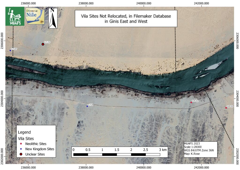
Map with the status of 2023 showing sites documented by Vila, but not yet relocated by us in Ginis. 2-T-67 is on the top left, at the border between Attab and Ginis.

The latter holds true for Vila’s site 2-T-67 (Vila 1977, 93-96). I tried twice to relocate it on the ground, but could not find what Vila referred to as channels. I only saw sandy dunes, modern tracks, some depressions, but no clear traces of what Vila described. Since Vila dated these three openings with underground connections to channels to the New Kingdom, based on a single pottery vessel, the site was of greatest interest to DiverseNile. It was correspondingly annoying that I simply couldn’t find the site.
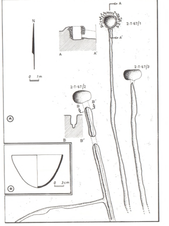
Sketch of the site by Vila 1977: fig. 49 incl. the pottery vessel he used as dating evidence.

However, the dating of Vila is anything but certain. Looking at this pottery bowl, for example, it is more likely to date already from the Pre-Napatan period. The site is nevertheless truly intriguing – the basins and channels have recently been linked to post-flood irrigation by Mathew Dalton and colleagues (2023). They suggest very convincingly that the site, and in particular the circular features, one of which was surrounded by a stone setting, actually served as wellheads for shadufs. Now it was great when I discovered the channels and round depressions on the orthophoto based on our drone images from 2022!
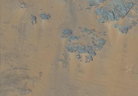
Detail from our orthophoto showing features corrsponding to Vila’s description to the left.

Importantly, our drone photographs show more features than those documented by Vila. Now that we have relocated this site, it will be possible to verify it in the field once we can go back to Sudan and try to obtain more certain dating evidence. This is particularly relevant to understand the dry stone walls in the area, the presumed irrigation systems (see Dalton et al. 2023) and the changing land- and riverscapes in Attab and Ginis.
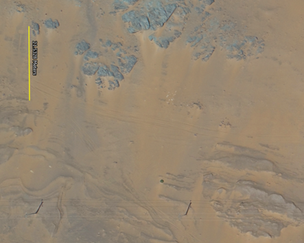
Zoomed out area of 2-T-67, with a measuring line along one of Vila’s channel, showing more depressions and circular pits towards the east.

References

Dalton et al. 2023 = Dalton, M., Spencer, N., Macklin, M. G., Woodward, J. C., & P. Ryan. “Three thousand years of river channel engineering in the Nile Valley.” Geoarchaeology, 2023, https://doi.org/10.1002/gea.21965.

Vila 1977 = Vila, A. La prospection archéologique de la Vallée du Nil, au Sud de la Cataracte de Dal (Nubie Soudanaise). Fascicule 6: District de Attab (Est et Ouest). Paris 1977.

Successful survey in Attab West – from my desk in Munich

These days, it is anything but easy to think of our friends and colleagues in Sudan. After all, our working area in northern Sudan has seen the worst rainfall in decades and there is still no end to the war in sight. Nevertheless – inspired by the EAA last week in Rome and fully motivated by meetings there with colleagues who also work in Sudan – I was able to achieve great results regarding our survey in Attab West in the last few days. It was a kind of by-product of my preparation for the International Conference for Meroitic Studies next week in Münster.

Among other things, I will be talking about dry-stone walls in Münster – and that’s why I took another look at all our drone images and, above all, the georeferenced orthophotos and digital elevation models, especially from Attab West and Ginis West.

The level of detail in these photos and models is simply marvellous! And so I was finally able to correctly localise a site in Attab West that I had never actually found on site in Sudan! But that will be a topic for another time.

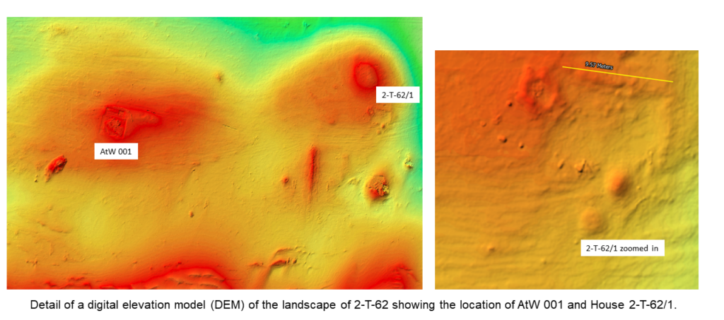
Today we want to focus on a detail about the New Kingdom settlement site 2-T-62. Vila describes it as a habitation site whose structures are spread over a series of small mounds that extend from east to west over 200 metres and a width of 50 metres, 175 metres from the Nile. The site also contains several dry-stone walls, although their dating is not certain.

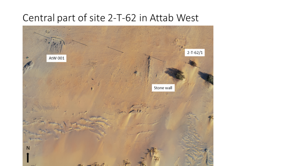
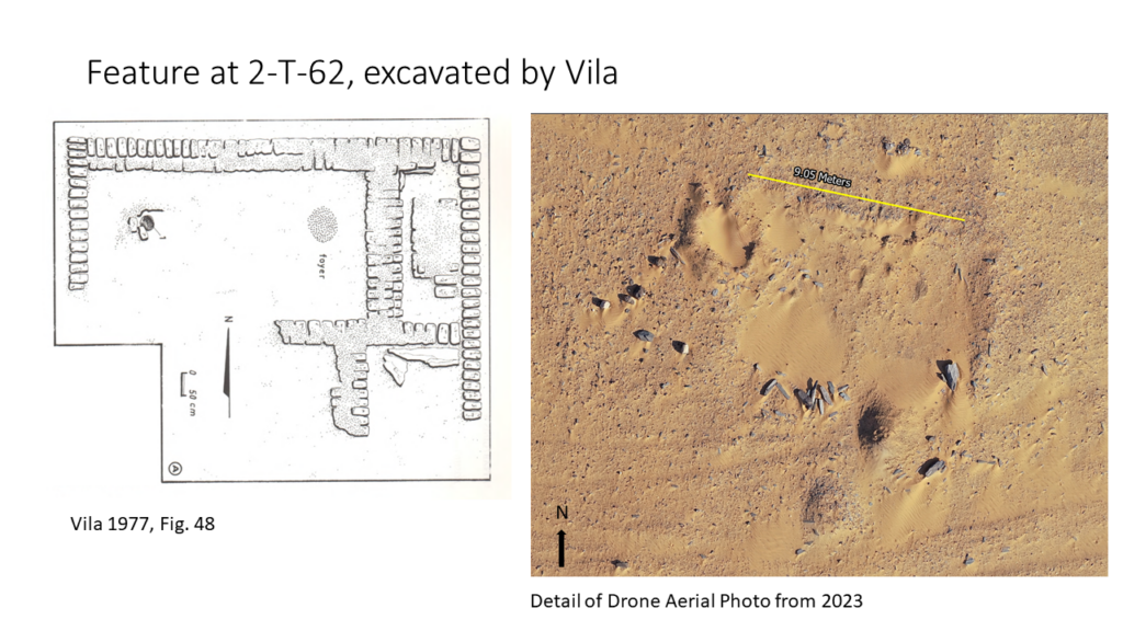
For a long time, we weren’t sure whether the site we excavated in 2022 and 2023, AtW 001, really belonged to the larger site 2-T-62 or not – but the answer is now a resounding yes. The special discovery this week, however, is that from my desk here in Munich, I have finally found the mudbrick building 2-T-62/1 that Vila excavated in the 1970s!

It was simply not recognisable on site – there were no more pottery sherds, other artefacts or mudbricks lying around. However, the dimensions can be easily checked on the orthophoto – they fit perfectly. Vila described 2-T-62/1 as a rectangular structure measuring 9 m x 7 m, orientated from east to west, of which only one layer of the foundation walls survives (Vila 1977, 88-89). Inside, a courtyard with a fireplace was identified in the north-west corner, bordered by rooms to the east and south. The room in the south-east corner contained the remains of a schist floor/pavement – something we know very well from the urban sites of Sai Island and Amara West. Some of the schist slabs can still be recognised on the orthophoto.

The digital elevation model also clearly shows the excavated building and the surrounding landscape. AtW 001 is located on a small mound to the west, the building 2-T-62/1 on another mound further to the east. A possible palaeochannel runs north of the two mounds from east to west (see Budka et al. 2023).

This successful remote sensing and the new results of 2-T-62 are comforting in several ways – on the one hand they clarify open questions and on the other hand they offer a very good opportunity to analyse our data even when we cannot be on site in Sudan.

References

Budka et al. 2023 = Budka, J., Rose, K. and C. Ward. Cultural diversity in the Bronze Age in the Attab to Ferka region: new results based on excavations in 2023. MittSAG – Der Antike Sudan 34, 2023: 19−35.

Vila 1977 = Vila, A. La prospection archéologique de la Vallée du Nil, au Sud de la Cataracte de Dal (Nubie Soudanaise). Fascicule 6: District de Attab (Est et Ouest). Paris 1977.
Presentation of DiverseNile at the EAA in Rome

All roads lead to Rome – this was especially true last week for 5000 archaeologists who all came to the 30th annual meeting of the EAA.

Chloe Ward and I were among this impressive number of participants to present the DiverseNile project. Fortunately, both sessions in which we presented also included a number of other presentations on Egypt and Sudan, which shows that our field is also increasingly represented at the EAA.

My talk was on the very first day in a session organised by Maria Gatto and colleagues entitled “The Archaeology of ancient Borderscapes: Multiple approaches, new paradigms.” This session was related to Maria’s The Borderscape Project. The lectures covered a great depth of time and geographical range – and yet we had a very solid thematic basis for discussion, regardless of whether it was about the Nile Valley, the Middle East, the Levant or various parts of Europe.

In my own presentation, I focused on the Dal cataract area as a kind of buffer zone between Lower and Upper Nubia and explored what we can learn about it from the finds in the MUAFS concession. My case studies included results from surveys, rock art and excavations at the sites GiE 003 and AtW 001. I also argued that our contact space biography approach is well suited to understanding the complexity of cultural dynamics often found in borderscapes.

Chloe found the perfect session for her expertise in the construction and production of knowledge in excavation archives. She attended the session “Old excavations and finds, new data and interpretations: The use of archices in current archaeological research projects”, which was organised by Kerstin Hofmann and colleagues on Saturday. This session also included a wide range of very exciting presentations. Chloe emphasised in her talk „Knowledge construction in and with the archaeological archive“ the methodological challenges we need to consider when working in the MUAFS concession and with the data published by André Vila in the 1970s.

As with every conference, however, the EAA in Rome was primarily about the discussions outside of the presentations, meeting old friends again and getting to know new colleagues. And of course, there was also Rome – a beautiful city that had far too much to offer. The social events of the conference were real highlights here – starting with the great location of the welcome party directly at the Palatine in the Vigna Barberini – what a luxury to be able to enjoy this place in the evening as an archaeological community!

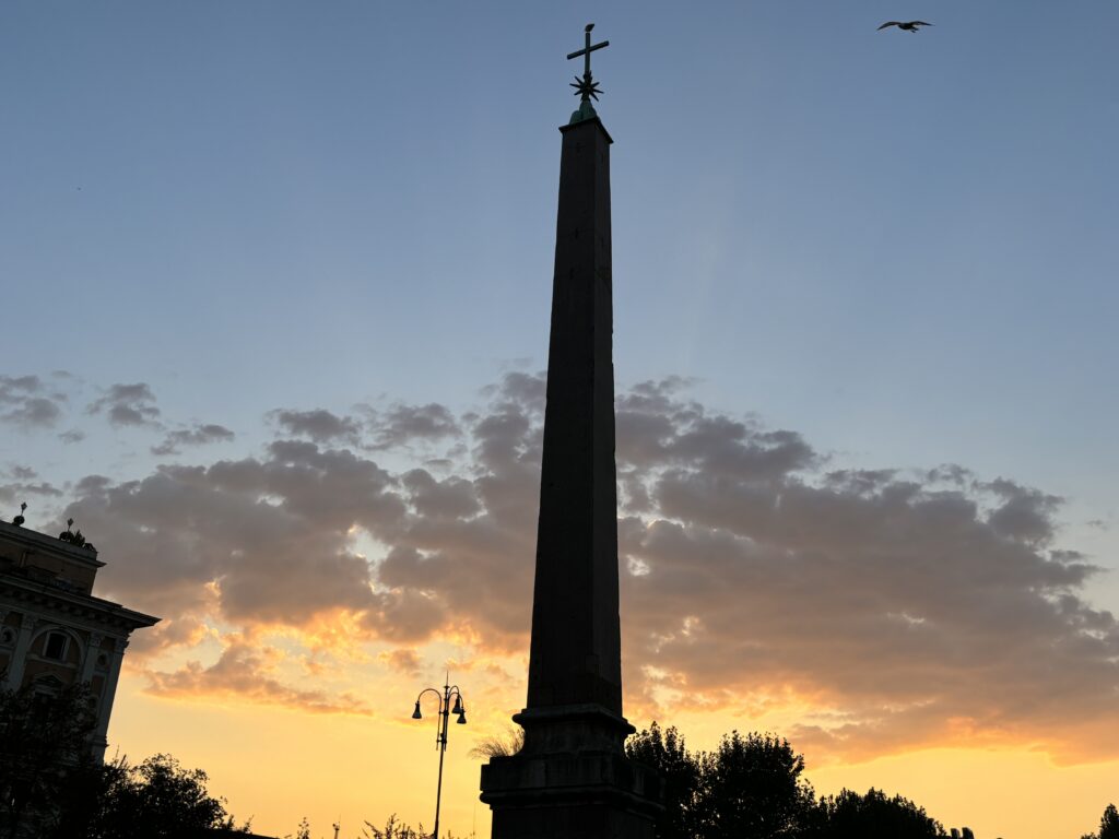
One of the stunning sunsets last week in Rome – here with the obelisk on the Esquilin.

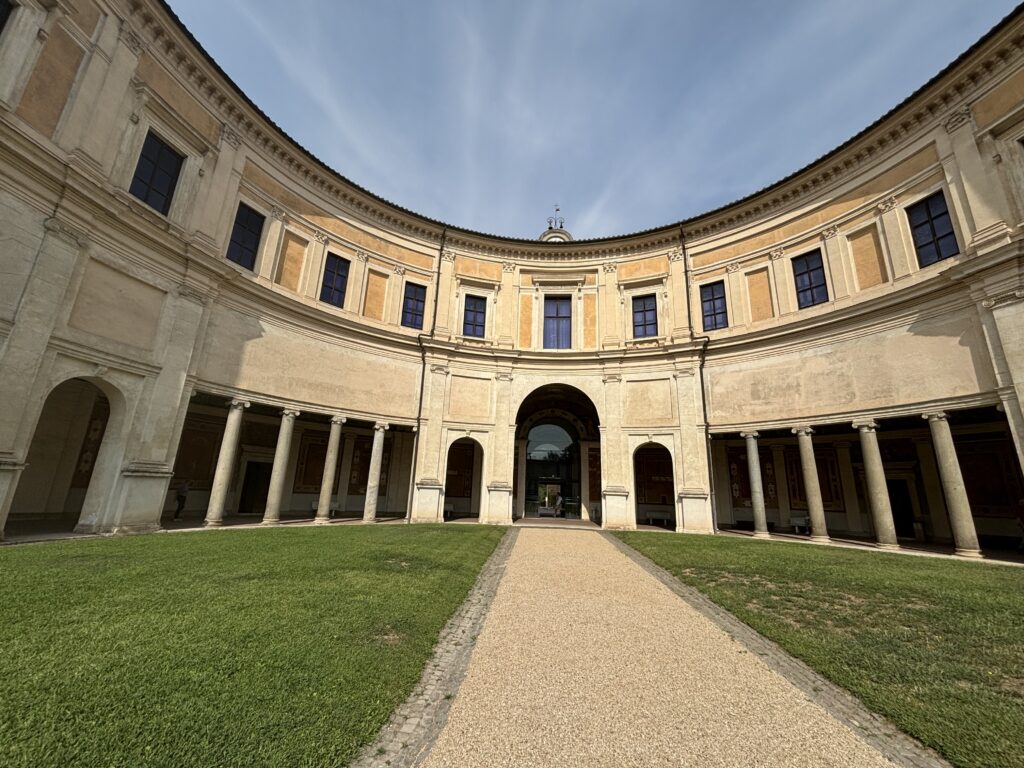
Of course, there was also time for some city tours – in my case, of course, tours to the various obelisks. Museums were also freely accessible to all participants – I was particularly impressed by the Villa Giulia and the National Etruscan Museum housed there.

Both the architecture of Villa Giulia, but also the contents of the museum are breathtaking and simply beautiful!

In any case, we are already looking forward to the next EAA, which will take place in Belgrade in 2025.