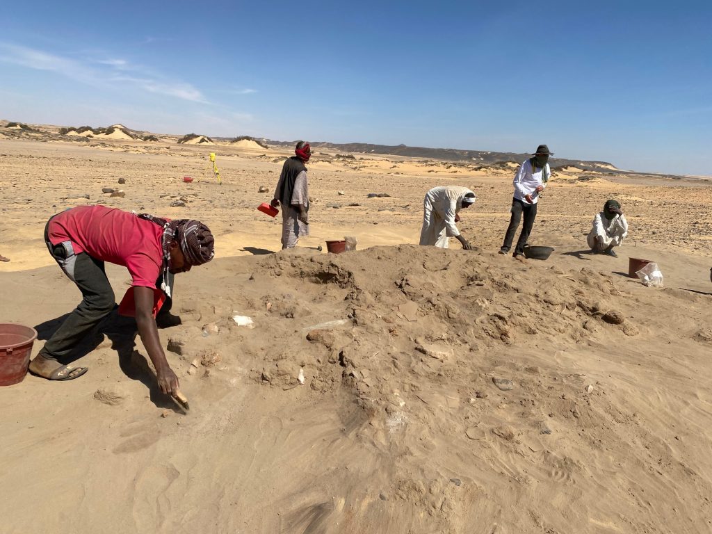
Our first week with workmen excavating at Attab West in site AtW 001 was very productive, despite of some windy days when we had to stop early.
Fig. 1: Work in progress earlier this week.
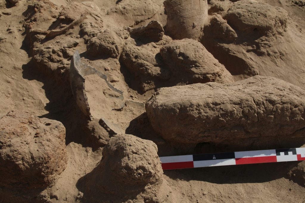
The mound of AtW 001 which was covered by schist stones and pottery sherds on the surface yielded substantial mud brick debris layers. These layers contained much pottery – a total of more than 6300 sherds was processed already – including many complete vessels. The most common shapes are Egyptian-style zir vessels, bowls and dishes, beer jars and Nubian-style cooking pots with basketry impressions. One almost complete Nubian cooking pot was still found in place, partly below a very large mud brick.
Fig. 2: Large fragment of Nubian cooking pot in its finding place.
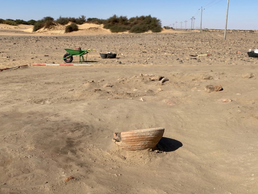
A large Nile clay bowl was found in a sandy filling south of the mound with mud bricks (Fig. 3). All in all, the pottery corpus very closely resembles the ceramics from the New Kingdom town of Sai Island, especially of the Levels 4 and 3 in SAV1 North, suggesting a date from the early 18th Dynasty to the mid-18th Dynasty. Interestingly, some of the vessels seems to belong to the Second Intermediate Period tradition – whether these are old pieces or imply a use of AtW 001 already during Classic Kerma times needs to be checked.
Fig. 3: Vessels like this Egyptian-style bowl illustrate the splendid state of preservation of ceramics at our site.
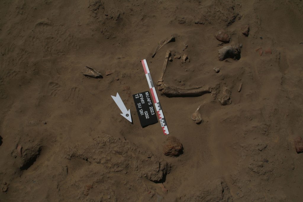
Similar to our findings from last year, we had plenty of charcoal, ashy spots and some burnt doum nuts as well as date seeds. Doubtlessly, people were eating and cooking here during the 18th Dynasty. This is further supported by many animal bones – seemingly mostly cattle but also some caprids. The details remain to be checked by our zooarchaeologist.
Fig. 4: Overview of some of the deposits of animal bones.
Finally, there is much evidence for quartz working at the site and many stone tools (especially pounders, whetstones, grindstones, and hand mills) – Sofia is documenting these and we will double-check if my previous interpretation of the site as being connected to gold working can be supported (or modified) by our new findings.
All in all, I am very happy with both the progress of work in week 1 and the great team of this season – together with our wonderful local workmen, Huda, Chloe, Matei, Sofia and I will continue on Saturday and an update will follow shortly.
It’s hard to believe – but tomorrow the last DiverseNile seminar of this year will take place. Chloë works already on the programme for next year, so we will continue with this successful online format discussing important aspects of the archaeology of the Middle Nile.
Tomorrow, Elizabeth Minor (Wellesley College), will be speaking about „Social Complexity and Community Resilience Strategies under a Changing Climate on the Middle Nile: Life at Es-Selim R4“.
The site of Es-Selim R4 (Minor et al. 2020) is an intriguing Kerma Period settlement located in the Northern Dongola Reach. Preliminary results suggest that Es-Selim R4 represents an opportunity to determine a cultural sequence for rural Kerma settlement sites, being inhabited from at least the Kerma Ancien period through to the Kerma Moyen period. Most interestingly, the site also allows to shift perspectives and to investigate the nature of socio-economic interactions between Kermans and Egyptians on a regional level.
Elizabeth is a Visiting Assistant Professor in Anthropology at Wellesley College. She received her Ph.D. in Near Eastern Studies from UC Berkeley, and her research focuses on the Kingdom of Kerma and cultural connections between ancient Egypt and Sudan. She has a special interest in understanding interregional and local social relationships – and we will hear more about this in her lecture.
For those interested in Kerma art, I highly recommend Elizabeth’s most recent article on key elements of Classic Kerma religious imagery (Minor 2022). In this though-provoking analysis she traces possible echoes of Kerman animal representations in later Kushite religion.
I am delighted that Elizabeth is joining us tomorrow! In case you cannot attend, be sure to check out the recording of her lecture – it will be available soon on LMU Cast.
References
Minor 2022 = Minor, Elizabeth 2022. Afterlives of Kerma religion: rams, lions, and fantastical winged animals (hippopotami and giraffes) in Classic Kerma and later Kush contexts. Journal of Ancient Egyptian Interconnections 35, 141-154.
Minor et al. 2020 = Minor, Elizabeth, Sarah M. Schellinger, Christopher Severa, Ahmed el-Ameen Ahmed el-Hassan, and Sajda Adam Omer Ahmed 2020. Laying the groundwork: the 2020 survey season and community outreach programme at the Kerma Period settlement site es-Selim R4 in the Northern Dongola Reach. Sudan & Nubia 24, 100-111.
While the first weeks of our 2022 season focused on mortuary remains and excavations in cemeteries, first of all the Kerma cemetery GiE 003, we switched focus and location in our week 4.
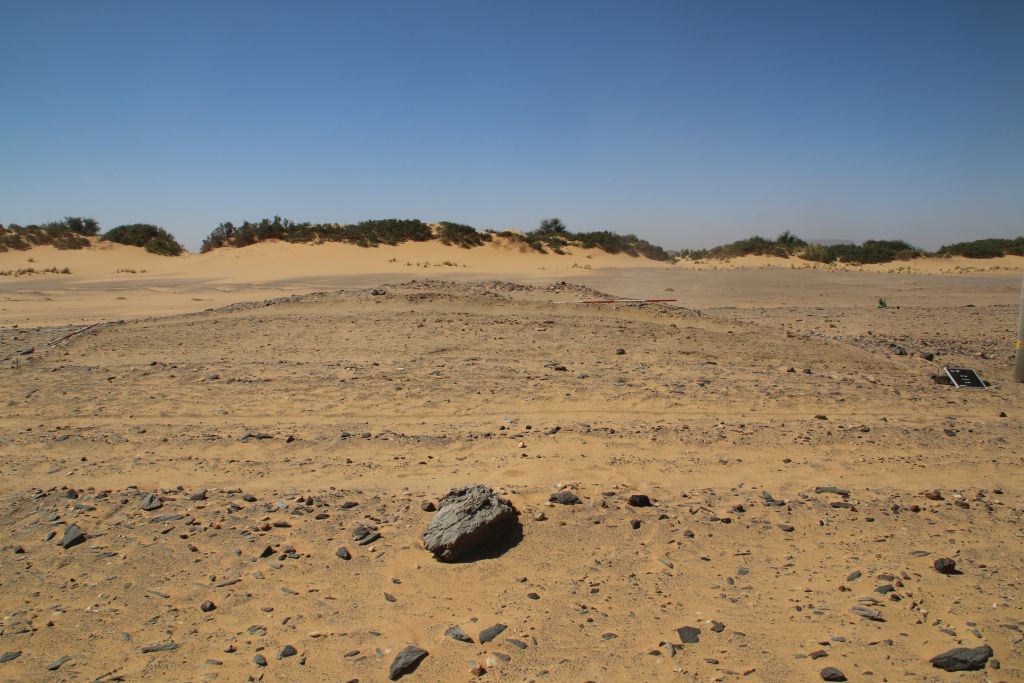
Earlier this year during our MUAFS survey, I noted an extremely interesting site at Attab West, with loads of early 18th Dynasty potsherds as well as scatters of local schist pieces on the surface. This site, AtW 001, is a small almost circular mound (Fig. 1). Unfortunately, the new line of electricity runs right through the site and seems to have destroyed part of it. This week, we went back there and excavated one trench as a first check of whether stratigraphy is preserved and any structures are traceable.
Fig. 1: Work in Week 4 focused on site AtW 001 at Attab West. View of Trench 1 to the south, with the loose surface removed. The mound covered with potsherds and schist pieces on the surface is still visible in the back.
It was our first excavation on the west bank, which differs considerably from the east bank in terms of landscape and general conditions. Logistics are a bit more complicated as well, bringing the team and the equipment to the site by boat and through large sandy dunes with picturesque tamarisks.
In sum, the test excavation at AtW 001 was a challenge but also very rewarding – we found what can be classified as domestic rubbish, loads of ashy deposits, plant remains, animal bones and lots of pottery sherds as well as debris from fires and other everyday activities. The ceramics are nicely datable to the early 18th Dynasty to Thutmoside times. Interestingly, the amount of Nubian wares in the various horizons of fill was really high, accounting to ca. 30% of the ceramics. The lower fills only had very little ceramics inside and here the Nubian wares were more common than Egyptian style wheelmade pots – this is just a first impression and I will follow up on this with a more detailed assessment soon!
We seem to have at least two phases of activity in the New Kingdom period preserved, possibly an early phase and a slightly later one which can be dated to Thutmose III. Remains of collapsed mud bricks and overfired sherds indicate the former existence of buildings and possible also ovens or kilns, but no standing remains of architecture was identified up to now. There were several homogenous deposits of silt, partly showing some ash. The ashy spots of the earliest phase are directly on top of the natural alluvium, suggesting that we either have an open courtyard or maybe part of the periphery of a domestic site. Apart from ceramics, the finds included some grindstones and stone tools like pounders, testifying to some grinding and crushing activities. However, many questions about this site are still open and AtW 001 needs to be excavated on larger scale in the near future.
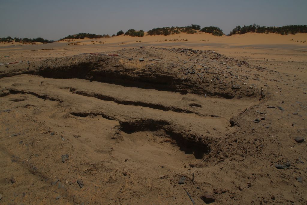
Fig. 2: Final status of Trench 1 at AtW 001 in 2022 – there is still much work waiting for us at this domestic site!
Overall, our site finds a perfect parallel in the nearby site 2-R-18 in the desert hinterland of Amara West (Stevens and Garnett 2017, previously documented by Vila in the 1970s). As highlighted by Anna Stevens and Anna Garnett, there were also rubbish deposits above homogenous deposits of silt and ash, which seem to have accumulated directly on top of the natural surface. Similar to our site, no traces of architecture were preserved at 2-R-18. The material culture, especially of the pottery and the stone tools, is extremely well comparable to our finds. The dating to the early 18th Dynasty is also almost identical.
Thus, the results of our trench are clearly promising and work at AtW 001 will continue in the near future. Especially the function and duration of use of this site will make a considerable impact to our aims of addressing seasonal sites as well as sites connected with gold working (as suggested by Stevens and Garnett 2017 for 2-R-18 and other desert hinterland sites) and other activities in the 18th Dynasty periphery of Sai Island.
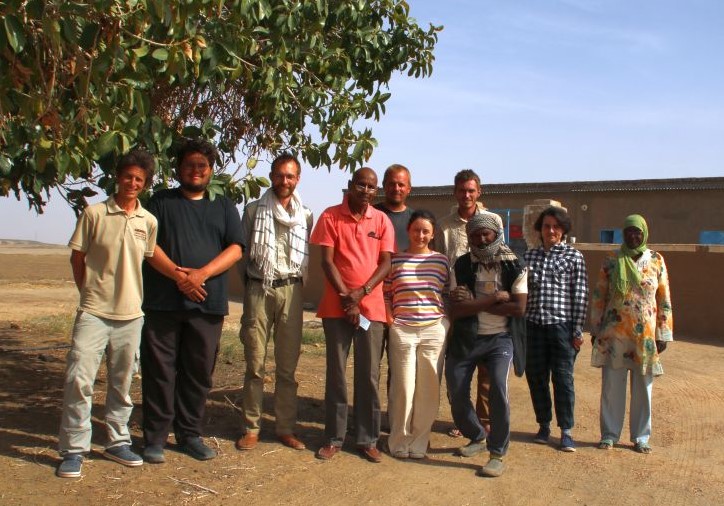
With the final day of work at AtW 001 yesterday, our fieldwork with workmen and excavation has come to an end – just in time before Ramadan starts tomorrow. Part of the team – all of them fully recovered from the corona infection by now – has already left and is heading back to Vienna and Munich. A small team will continue with processing finds here at Ginis and documenting the rich material culture from our very successful excavations in 2022.
Fig. 3: Group picture of the DiverseNile 2022 fieldwork team.
Many thanks go to all team members of 2022 – it has been a challenging season with so much wind, cold weather, covid-19 and a dense excavation programme at four different sites. The results are clearly remarkable and I am very grateful to all! For now, I am really keen to process the new material in more detail in the upcoming week.
Reference
Stevens and Garnett 2017 = Stevens, A. and Garnett, A. 2017. Surveying the pharaonic desert hinterland of Amara West, 287‒306, in: N. Spencer, A. Stevens and M. Binder (eds.), Nubia in the New Kingdom. Lived Experience, Pharaonic Control and Indigenous Traditions. British Museum Publications on Egypt and Sudan 3. Leuven.
After some really busy and intense weeks, I finally made it back to Sudan. Iulia and I arrived yesterday night. Everything is sorted and we are ready to leave Khartoum to the north tomorrow morning with our friend and colleague Huda as our NCAM inspector – to start our first proper excavation season for the ERC DiverseNile project.
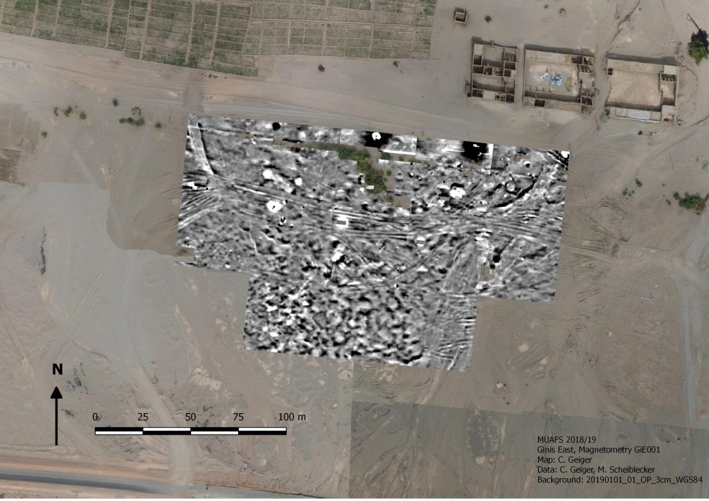
This spring season is super exciting: we will excavate several New Kingdom sites at Ginis East, hopefully also on the West bank. Other than in our test excavations in 2020, we will open large areas and conduct our excavation work with the help of local workmen. Starting on Saturday with site GiE 001, we will test once more the results of the magnetometry from 2018/2019.
Fig. 1: results of magnetometry of GiE 001 2018/2019 and its sourroundings (M. Scheiblecker).
This season is also exciting because we will live for the first time in the new digging house in Ginis East. Construction work started in January and has been finished just in time, allowing us to settle down in our new home away from home during these weeks in northern Sudan. I am very much looking forward to this!
Excavations are scheduled for 4 weeks, with an extra week for processing and/or survey, depending on our results. Of course I will keep you updated – hoping that internet connection will allow to do so.
Studying Kerma remains in the MUAFS concession area will provide fresh and urgently needed input for manifold, still open questions about a region far north of the Kerma capital, as our PI Julia Budka stated lately in her article about the Kerma presence in Ginis East (Budka 2020).
Today, I would like to give a short outlook over the settlements of the Kerma horizon in the Attab to Ferka region and exemplarily introducing you to an intriguing site, which seems to hold the potential for further thought (for Kerma tombs in Attab to Ferka see the blog entry of my colleague Rennan Lemos with his presentation of a fascinating Kerma burial).
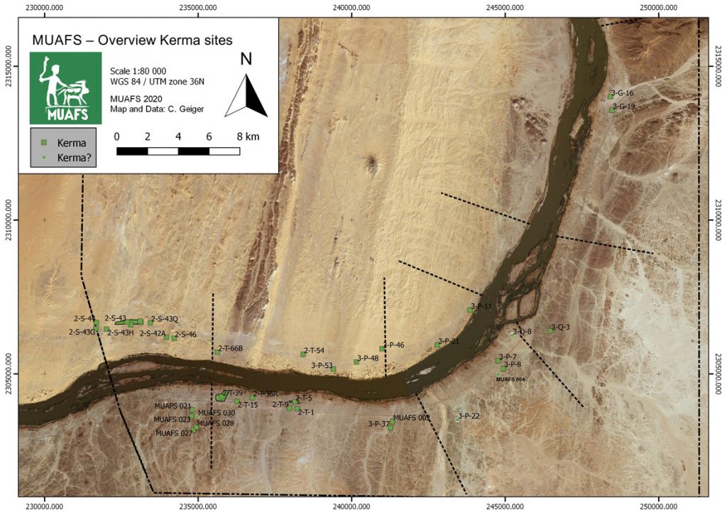
Currently, 30 settlements classified as Kerma are included in our database – whereby Egyptian New Kingdom presence at some of them and vice versa clearly illustrates the need to move away from the previous used interpretation of sites as rigid ‘Egyptian and ‘Nubian’ cultural units, addressing them as more closer interconnected cultures in this region (Budka 2020: 63).
Concerning their location, the settlements with Kerma presence are consistently distributed between both river banks with a certain dominance (18) on the right bank. Kerma sites on the left bank (12) were often situated in an impressive distance from the modern Nile, thus following the ancient course of the river. Besides a striking number of Kerma remains in the districts Attab and Ginis, Kerma sites can also be traced much further north (see Fig. 1).
Figure 1: Kerma sites in the region from Attab to Ferka (status 2020). Budka 2020: fig. 13 (modified).
These observations will not only shed further light on Sai during the Kerma period and its periphery, or the northern borders of the Kerma kingdom. Particularly important will be the insight how people lived there in the period of the New Kingdom occupation of Nubia – how the diverse social and cultural groups interacted with each other away from the major urban centres, collectively shaping, exploiting and making the landscape their home (Budka 2020: 63, Budka 2019: 24).
In a contact space like Attab to Ferka, it is the physical manifestations of the living that can shed light on how a cultural exchange could have happened, not only through the adoption or modification of ‘Egyptian’ patterns by the Nubians, but clearly vice versa – visible in the choice of design or used building material. Concerning the latter, with the fascinating site we will have a closer look now, I will focus today on dry-stone as building technique – a method Liszka states that “appears to have been passed down through generations of Nubians for many millennia” (Liszka 2017: 41).
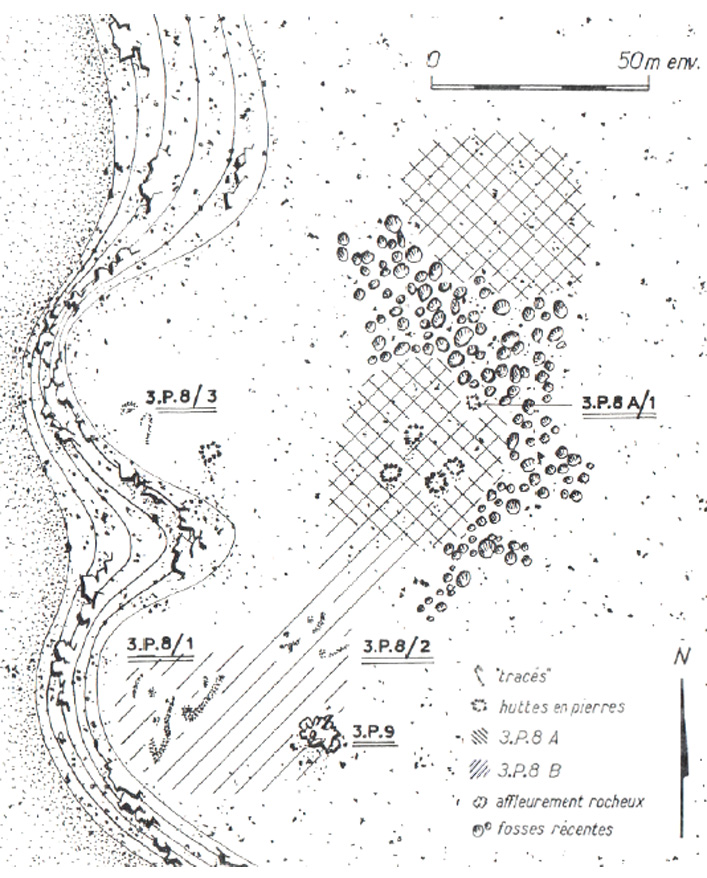
Besides the material the second characteristic of this site, detected by Vila and his team at Mindiq and numbered as NF-36-M/3-P-8 is its location further in the north of the MUAFS concession (Vila 1976: 90–96). More precisely the archaeological remains were found in the north-eastern part of Kosha East, situated in an impressive distance of 750 m to the modern Nile on the first hills rising 10 to 12m above the Kosha plain. The site occupied an overall surface of 200 x 60m (NE-SW), with intermediate sterile zones.Within this area, the areal NF-36-M/3-P-8A/B is from special interest (Fig. 2), being categorised by Vila as habitation site – a term he specifically used for remains of organised structures, perhaps being once a permanent settlement.
Whereas Vila still proposed a Neolithic or Nubien Ancien/Moyen context of the site, his attribution could be revised by our PI during our last campaign, giving, besides the Neolithic, a presumptive Old or Middle Kerma date, based on a large number of Kerma pottery.
Looking closer at Vila’s description of the character and the nature of the site, the division in 3-P-8A and 3-P-8B is explained by the existence of stone structures together with sherds and stone tools in part 3-P-8A at the centre and in the northern part of the site, whereas 3-P-8B consisted of a massive amount of stone tools scattered all over the site, with a certain concentration in the southern part, where no sherds were found.
Figure 2: Mindiq, General sketch plan of site NF-36-M/3-P-8A/B (Kosha E). Vila 1976: fig. 41 (modified).
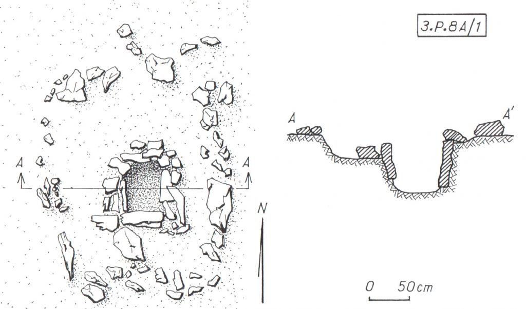
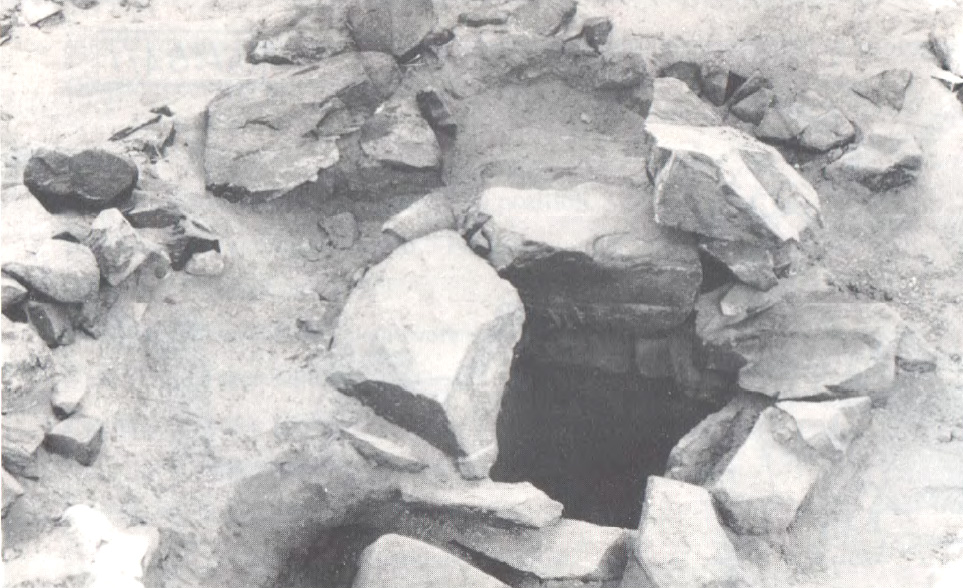
Concerning the questions of used material and building techniques the design of the stone remains in 3-P-8A are highly interesting – for a tentative interpretation of the site’s purpose also the nature of 3-P-8B can add some hints. In 3-P-8A Vila noted the remains of five dry stone huts – and in close proximity to them (originally connected?) – a feature from special interest (3-P-8A/1) (only) for which he gave a more detailed sketch plan and description: Its visible remains consisted of a quite circular structure made of stone blocks (possibly continuing with similar adjoining structures further north) with a diameter of approx. 4m. Within this stone structure the most interesting detail is a square stone-lined bin measuring approx. 60 cm x 60cm, with a depth of around 50/60cm, whose vertical walls were reinforced with raised slabs (Figs. 3a, b).
Figure 3a: Sketch plan and section of circular structure with stone-lined bin (NF-36-M/3-P-8A/1). (Vila 1976: fig. 42).Figure 3b: Detail of stone-lined bin in NF-36-M/3-P-8A/1, view towards S. (Vila 1976: fig. 44.1).
When visiting the place in the 1970ies, Vila and his team noted a heavily disturbed area in the northern part of the site, dividing 3-P-8A in two zones (Fig. 2), and consisting of pits of modern stone extractions. A similar picture emerged during our visit in the last campaign, when we found the site badly damaged by modern gold mining. These endangering activities not only clearly illustrate the urgent need of our research in the MUAFS concession, but also the richness of resources of this region, especially in this area, still being extracted today.
Thus, together with the abundance of stone tools indicated by Vila in 3-P-8A/B – further attested by the numerous quartz flakes we found on site – may point to an original purpose of the site associated with gold processing activities. In this context, one may wonder what role the above mentioned stone-lined bin might have played and if the architectural nature of the site 3-P-8/A with its dry-stone constructions could strengthen this assumption? Looking outside the box – thus beyond the MUAFS research area to other comparable frontier and contact spaces of similar time periods within Nubia may help to gain more thought-provoking hints.
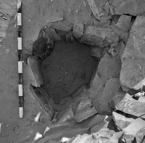
Here I will just refer to the evidence in the Batn el-Hagar, recently published by Edwards who introduced the occurrence of a fascinating category of Pharaonic sites, that clearly outnumbered other types of settlements in this region. Besides their number, their peculiarity consists especially of their dry-stone architecture and their often curvilinear layout – representing as Edwards stated “a still unfamiliar form of an ‘Egyptian’ presence” in Nubia (Edwards 2020: 378). These sites were apparently linked to gold mining activities within the region, which is why Edwards refers to them as ‘workshop sites’. Mostly situated in larger distances to the Nile their architecture consists of a number or dry-stone walls forming complexes of subcircular or curvilinear rooms. The different equipment found in these rooms points to different working units and working steps, as illustrated by large granite mortars and grinding installations of diverse types – but it is especially indicated by numerous stone-lined bins or tanks (Fig. 4) comparable to “our” example from Mindiq. Some of the latter seemed to be originally associated withworking processes using water and still contained accumulations of fine water-laid crushed gold bearing quartz (Edwards 2020: 404).
Figure 4: Example of a stone-lined bin (diam: 55 cm, depth: 45 cm, workshop site 11-Q-61, Saras E). Edwards 2020: fig. 3.3.31.
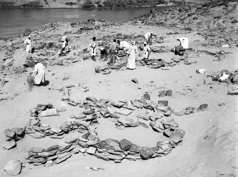
Concerning the rather unusual ‘Egyptian’ architectural appearance of those workshop sites, Edwards suggested a possible more complex history of Egyptian gold mining in this region – and a very plausible stronger role of Nubians in this context. His assumption was not only based on often found Nubian or Kerma style pottery within these workshops (f. ex. Duweishat area, workshop 16-O-12, Attiri – Sorki, with even a predominance of Nubian style ceramics, Edwards 2020: 226–234), but also on the existence of at least one similar site clearly dating in the Middle Kerma period (Duweishat area, workshop 16-S-16, also addressed as ‘Kerma/C-Group’ workshop site). The layout, finds and crushed quartz debris of his clearly Nubian site hold striking similarities to those qualified as Pharaonic workshop sites in this region (Edwards 2020: 406–407).
Figure 5: ‘Kerma/C-Group’ workshop site (16-S-16, Duweishat), 1967. Several large grindstones are visible at floor level of the nearest structure. Edwards 2020: Fig. 7.32.
Returning to our site in Kosha E, 3-P-8A/B, it would be tempting not only to assume a similar functional purpose, but – indicated by the today still visible remains – an original possibly related architectural layout. With clearly still needed further research in the coming years, this site with its presumed Old and Middle Kerma context already is from special interest due to its possible earlier date than the aforementioned site 16-S-16 in the Duweishat region. Thus site 3-P-8A/B, holds not only important hints about the gold-working activities in the Attab to Ferka area but also may help to shed further light on early Nubian gold exploitation.
Not least this early site has the potential to deeper explore the still pending ‘chicken or the egg-problem’ – so the question (is it) ‘Egyptian or Nubian?’ that Liszka chose concisely as title of her important article (Liszka 2017) on the matter of dry-stone architecture in Nubia in ‘Egyptian’ contexts. It is precisely such sites, that not only allow us to find answers concerning the activities of ancient people living there and the reasons for the choice of diverse building techniques, for different materials or locations (f. ex. being possible rather pragmatic choices depending on the better availability of stone or are they rather hinting to an internal cultural variability? Or point they to a rather seasonal occupation resp. are explained by the sites purpose?). But most importantly, architectural remains, such as these dry-stone buildings used by ‘Nubians’ or ‘Egyptians’ can also contribute to reconstruct the dynamics of such an ancient ‘contact space’ as the Attab and Ferka region – does it point, f. ex. to knowledge transfer throughout the times and cultures or to the inclusion of craftsmanship of well-trained people, thus not only resulting in acceptance or appropriation of various cultural influences, but also in possible fusions creating together something new.
In this regard – stay tuned for further insights in the fascinating topic of exploring the settlement-scape and the nature of living in the Attab to Ferka region!
References
Budka, J. 2019 (with contributions by G. D’Ercole, C. Geiger, V. Hinterhuber and M. Scheiblecker). Towards Middle Nile Biographies: the Munich University Attab to Ferka Survey Project 2018/2019, in: Sudan & Nubia 23, 13–26.
Budka, J. 2020. Kerma presence at Ginis East: The 2020 season of the Munich University Attab to Ferka Survey Project, in: Sudan & Nubia 24, 57–71.
Edwards, D.N (ed.). 2020. The Archaeological Survey of Sudanese Nubia, 1963–69. The Pharaonic Sites. Oxford.
Liszka, K. 2017. Egyptian or Nubian? Dry-Stone Architecture at Wadi el-Hudi, Wadi es-Sebua, and the Eastern Desert’, in: Journal of Egyptian Archaeology 103(1), 35–51.
Vila. A. 1976. La prospection archéologique de la vallée du Nil au sud de la Cataracte de Dal. Fascicule 4. District de Mograkka (Est et Ouest). District de Kosha (Est et Ouest).Paris.
As my colleague and ‘scientific counterpart’ Rennan Lemos, responsible together with our PI for Work Package 2 (The Variability of Funerary Monuments), pointed out so perfectly in his blog entry On the footsteps of Vila and the archaeology of monumental surveys in northern Sudan, a number of different factors determine how we have to approach our engagement with the past today. Not only do we archaeologists have to keep in mind our own social or cultural conditioning, our own socialisation, which is always an on-going process, but we also have to take into account the zeitgeist of our predecessors, and thus the working methods influenced by it, when we include their previous results.
In this regard, the method that Vila and his team applied for their Archaeological Survey in the 1970ies, which also covered the MUAFS concession area from Attab to Ferka, is equally relevant for settlement sites and thus for Work Package 1 (The Variability of Domestic Architecture).
Although Vila and his team also followed up on earlier surveys in Sudan, they deliberately chose an approach that was kind of new for their time. Their main aim was to give an idea and thus evidence of the cultural legacy, to raise awareness of the archaeological value of the explored regions. Linked to that was the explicit wish to pave the way for further fieldwork in the future.
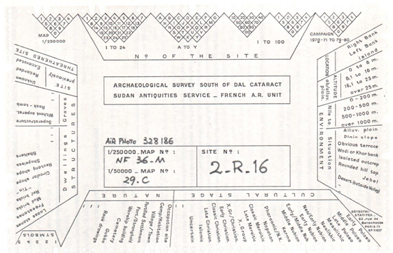
Concerning the settlements, in slight contrast to the cemeteries, where clearing or minor excavations were carried out more frequently, the major rule was that survey work must avoid disturbing the original condition of the archaeological sites. Instead of using invasive methods that would have resulted in significant destruction, (in most cases) work was limited to indicating the existence of the sites, documenting their visible remains and giving a current status report on them. The documentation system chosen by Vila and his team was based on a strict, predetermined catalogue of guidelines (Vila 1975, Volume I). Exemplarily mentioned shall be the given information about the localisation, the extent of the sites or the geographical features, and – in this point naturally somewhat more subjective – the classification of the respective archaeological value. The latter dictated quite decisively, f. ex. the extent of sampling, which was also subjected to strict rules. Another positive aspect to be highlighted is a topic usually rather neglected: The consistent application of the terms chosen for their survey (f. ex. vestiges for removable witnesses, like sherds or stone implements; remains for any kind of fixed structure) as well as the explanation of chosen terms like settlement, camp site, occupation site etc., and not least the description of the problems they were confronted with when creating their system.
Although Vila and his team likeable (and very well understandable for any field archaeologist) admitted their own hardships in this approach, having to leave to other people what they discovered, it is especially this transparency that makes it particularly helpful for us subsequent scholars to comprehend the information they gained, documented and what they understood by it.
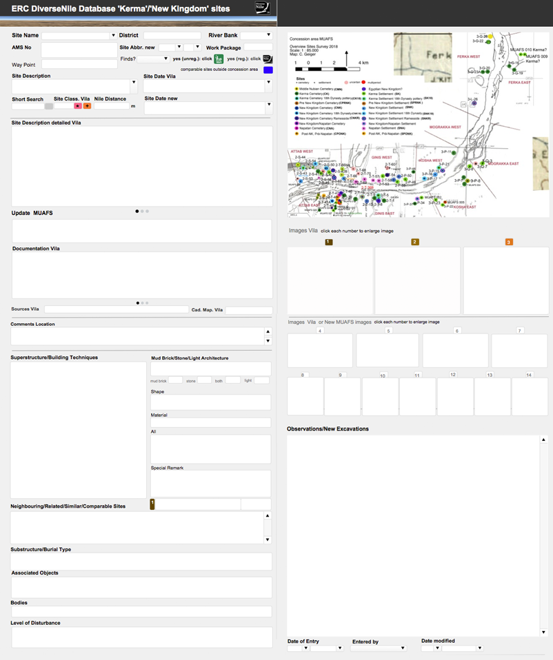
This systematics, which at that time was still applied in the field via punched cards created according to the guidelines and not unlike an analogue database (Fig. 1), enables the old survey results to be easily transferred to a now digital Database (FileMaker Pro), the ERC DiverseNile Database for ‘Kerma’ and ‘New Kingdom’ sites, I designed for Work Package 1 (see also the Petrographic Database my colleague Giulia D’Ercole designed for Work Package 3).
Figure 1. Selective card used for documentation in the 1970ies (Vila 1975: 19, Fig. 2).
This new database contains on one hand all the available documentation published by Vila concerning the settlement sites, whereas the then state of research is contrasted in a clear and critical separation with the new data gained from our own studies, which includes f. ex. not only new sites, new maps, new photographs but also a revised dating for several dates given by Vila. As strongly intertwined topics it also includes basic information on cemeteries.
This easy to handle database, which I will give you here a short overview of, can be flexibly modified and adapted to the on-going work process (Fig. 2): Structured in three parts, the database first provides a short general information about the site, f. ex. its Name and location, the AMS-No (alphanumeric classification regarding the 1, 250 000 map sheets of the Sudan Survey Department, a method firstly implemented by W.Y. Adams 1961, further elaborated by F.W. Hinkel and used by Vila), or new Way Points (taken by the MUAFS team). Important entries are of course the site’s Dating given by Vila, which has been updated if necessary (Site Date new). The second, more detailed part includes the elaborated Site description by Vila together with already published photos, drawings or sketches, again updated and compared with new results collected in our last seasons (f. ex. Observation/New Excavations). The third section serves to cover specific data relevant for the settlements within Work Package 1, such as f. ex. Superstructure or Building Techniques, as well as entries like Shape or Material.
Figure 2. Layout of the ERC DiverseNile Database for ‘Kerma’ and ‘New Kingdom’ sites (detail).
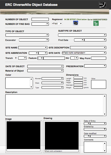
An equally beneficial option within FileMaker is the integration of other databases I made, the ERC DiverseNile Object Database (Fig. 3) and the MUAFS All Finds Database, which contain the data of all the new finds we so far recorded and are accessible through an easy command.
Figure 3. Layout of the ERC DiverseNile Object Database.
Altogether these databases are an extremely helpful and time-saving working tool to sort and select relevant data at a glance (or a click), revealing not only the wide variability of sites in our concession area but also the cultural diversity of the archaeological remains in the Attab to Ferka region, including at the moment 53 recorded sites relevant for Work Package 1.
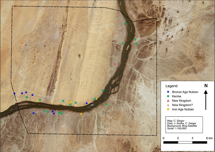
Being able to expand and optimise these databases during the work process, they also reflect at one glance the development of past and present research: This holds f. ex. true for the attribution of sites indicated by Vila as either ‘Kerma’ or ‘Egyptian New Kingdom’, defining them then still as more rigid cultural units, than we do today. Numerous data from revisited sites and newly added ones show a much closer interconnection of cultures in this region – thus supporting our new approach to move away from these strict categories and going a step further, with our PI introducing the preliminary term Bronze Age Nubia as a starting point (Fig. 4). Provided with newer methods in archaeology and fresh promising data we are looking forward to further shedding light on this flourishing and dynamic region in the periphery of Sai and Amara West.
Figure 4. New distribution of ‘Bronze Age’ sites according to the results of the MUAFS 2018/2019 season (Budka 2019: Map 7).
References
Adams, W. Y. and Verwers C. J. 1961. ‘Archaeological Survey of Sudanese Nubia’. Kush 9, 7–43.
Budka, J. 2019 (with contributions by G. D’Ercole, C. Geiger, V. Hinterhuber and M. Scheiblecker). Towards Middle Nile Biographies: the Munich University Attab to Ferka Survey Project 2018/2019. Sudan & Nubia 23, 13–26.
Hinkel, F.W. 1977. The Archaeological Map of the Sudan. A Guide to its Use and Explanation of its Principles. Berlin.
Vila. A. 1975. La prospection archéologique de la vallée du Nil au sud de la Cataracte de Dal. Vol. 1. Paris.
After the recent blog posts by my colleagues Rennan Lemos and Giulia D’Ercole presenting their tasks within Work Package 2 and Work Package 3 I am not only happy to introduce Work Package 1: The variability of domestic architecturein the Attab to Ferka region I am – together with our PI Julia Budka – responsible for, but also to write my first blog entry as a member of the ERC Consolidator Grant project DiverseNile. This especially, since I already could join the previous ERC Starting Grant project AcrossBorders of Julia Budka for its last year at the end of 2017, leaving Berlin and moving to Munich, which – as a Tyrolean – felt a bit like coming home.
My first contact with Sudan, which I immediately fell in love with, while working in Hamadab/Meroe and Musawwarat es-Sufra, was very long ago in 2003. But also my first visit to the region between the Second and Third Cataract – and here specifically to Sai Island with its impressive New Kingdom town – dates some years back to 2012.
At Sai Island, especially by the AcrossBorders project or at the neighbouring town Amara West (Spencer et al. 2017), the research of the recent years concerning the manifold relations between the Egyptians and the Nubians in the Middle Nile already moved towards a more differentiated approach with implementing the concept of ‘cultural entanglement’ (see van Pelt 2013 with references). The focus of work at sites like Sai and Amara being administrative centres in New Kingdom Nubia was necessarily set on the official and elite sphere.
The DiverseNile project investigating the Attab to Ferka region now goes a step further aiming to throw light on the peripheries still very much standing in the shadows of the powerful urban sites. Shifting the focus towards the hinterland not only broadens our horizon filling the still significant voids of research in this region of the Nile valley but very much promises to give a new and deeper insight in the cultural diversity of people living in the hinterland of towns, their interactions and possible more autonomous living situations – as these aspects become archaeologically more visible aside official power throughout the rich cultural history of Nubia.
In this regard WP 1 aims to contribute to a better understanding of the occupants of the Attab to Ferka region, their cultural identities and interactions, their social structures or complexity through investigating the diverse settlement sites, their variability and development and thus their spatial and temporal frame. Concerning the latter our focus lies on Bronze Age Nubia, a term introduced by our PI reflecting the need to have a more differentiated look at the so far used categories ‘Nubian’ or ‘Egyptian’ during the Kerma and the Egyptian Second Intermediate and New Kingdom Periods in Nubia and thus an era with multiple upheavals. This need became also clear studying the previously classifications attributed to the diverse archaeological remains in this part of the Middle Nile valley.
In this respect the region of our interest was previously and firstly surveyed by the Sudan Antiquities Service together with the French Archaeological Research Unit in the 1970ies directed by A. Vila and resulting in several Volumes. These works serve as very important input for our research, as Vila and his team impressively discovered and documented 219 sites from Palaeolithic to Medieval times. Among these, sites qualified by Vila as Kerma and New Kingdom remains were represented both at around 7% on the right and with a larger number at 12.4% resp. 16.9% on the left riverbanks, the latter consisting predominantly of settlement sites.
Kerma sites in the Attab to Ferka region identified by the MUAFS project (status: 2020)
Among all of the sites listed by Vila a total of 138 sites could be successfully re-identified during our two MUAFS seasons in 2018/2019 and at the beginning of this year, shortly before Covid-19 became the new reality (for further details see the online reports as well as Budka 2019). As an fascinating example for an Egyptian New Kingdom domestic site comprising evidence for Kerma presence too, GiE 001 (Vila’s site NF-36-M/2-T-36B), can be emphasized here, where a test excavation was started in 2020, which we will hopefully further pursue next year.
Distribution of New Kingdom, Pre-Napatan and Napatan sites in the MUAFS concession (status: 2020)
Although Covid-19 has restricted us to office work, it has not limited us to carry out our research or staying in contact with our Sudanese colleagues and friends. Re-planning rather is giving us the possibility not only to evaluate the already gained data and information but also to engage with the topic in depth. In this regard I am currently not only further screening sites of our interest indicated by Vila, analysing his approach and state of documentation, but also their distribution within our concession area. Concerning the latter the examination of similar situations of periphery within frontier zones like for example the Third Cataract (Edwards 2012) and a deeper study of other rural Kerma villages like Gism el-Arba (Gratien 2003) yields a very fruitful input for our questionings in many ways. As I dealt a lot with Kushite sacral architecture in the last years doing my PhD, I am especially happy to explore architectural remains aside of the official sphere telling a lot of different and lesser known stories. In this regard – as my next blog entry will address Kerma types of domestic architecture and building techniques – keep reading here in our space!
References
Budka, J. 2019 (with contributions by G. D’Ercole, C. Geiger, V. Hinterhuber and M. Scheiblecker). Towards Middle Nile Biographies: the Munich University Attab to Ferka Survey Project 2018/2019. Sudan & Nubia 23, 13–26.
Edwards, D. N. 2012. ‘The Third-Second Millennia BC. Kerma and New Kingdom Settlements’, in A. Osman and D. N. Edwards (eds), Archaeology of a Nubian frontier. Survey on the Nile Third Cataract, Sudan. Leicester, 59–87.
Gratien, B., S. Marchi, O. Thuriot, and J.-M. Willot 2003. ‘Gism el- Arba, habitat 2. Rapport préliminaire sur un centre de stockage Kerma au bord du Nil’. Cahiers de Recherches de l’Institut de Papyrologie et d’Égyptologie de Lille 23, 29–43.
Spencer, N., Stevens, A. and Binder, M. 2017. Introduction: History and historiography of a colonial entanglement, and the shaping of new archaeologies for Nubia in the New Kingdom, 1‒61, in: N. Spencer, A. Stevens and M. Binder (eds.), Nubia in the New Kingdom. Lived Experience, Pharaonic Control and Indigenous Traditions. British Museum Publications on Egypt and Sudan 3. Leuven.
Van Pelt, W.P. 2013. Revising Egypto-Nubian Relations in New Kingdom Lower Nubia: From Egyptianization to Cultural Entanglement. Cambridge Archaeological Journal 23.3, 523‒550.
My personal favorite landscape in the MUAFS concession area is the left riverbank of the districts Ginis and Kosha which is also rich in archaeology. Beautiful sand dunes and tamarisks dominate the strip along the Nile; desert and rocky outcrops shape the hinterland.
Despite of Covid-19 and the unclear situation regarding our next field season in Sudan, we are of course planning for the ERC DiverseNile project. One of the main tasks for the next season will be test excavations at habitation sites at Kosha West.
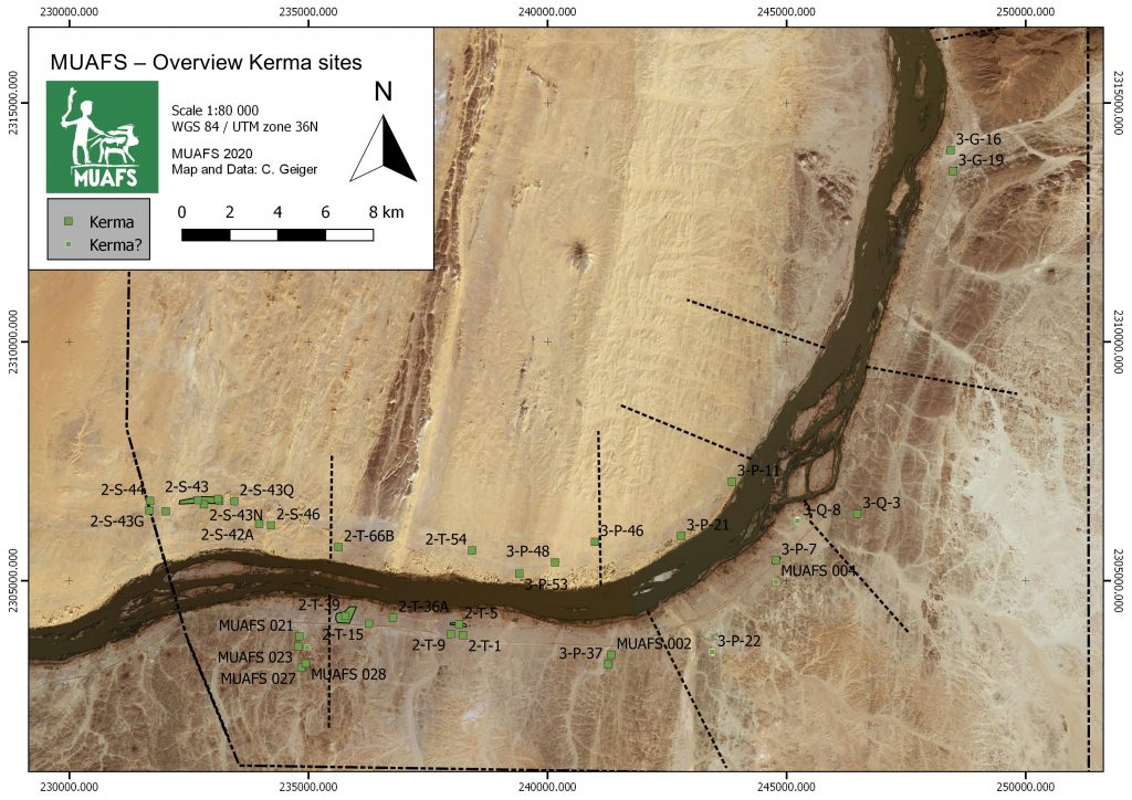
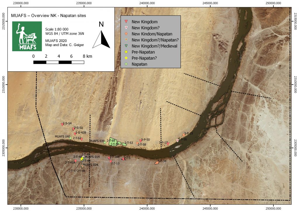
If one looks at our new distribution map of sites dating to the New Kingdom, Pre-Napatan and Napatan times, it is striking that the most downstream ones are three sites in the district Kosha West.
Distribution of New Kingdom, Pre-Napatan and Napatan sites in the MUAFS concession.
These are remains of structures/dwellings, situated on three isolated mounds on the dune area with tamarisks. The distance to the Nile is 100-150m. This group of habitation site was already noted by André Vila in the 1970s and he attributed all of them to the Egyptian New Kingdom. This is, however, not the case.
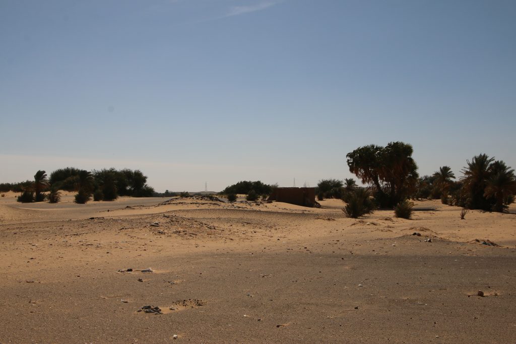
Overview of site 3-P-17.
3-P-17 is traceable with some mud bricks and scattered stones on a mound, the total extension of the site is at present a bit unclear. According to the surface pottery we recorded last year, this site can be attributed to the early 18th Dynasty.
The remains of 3-P-16 are located on a circular mound with a diameter of c. 50m. In the south-eastern part of the mound large amount of mud bricks seem to have once formed a fortification. The dating of this structure must remain unclear for now; the surface material suggests indeed a New Kingdom date, but there were also some Medieval sherds.
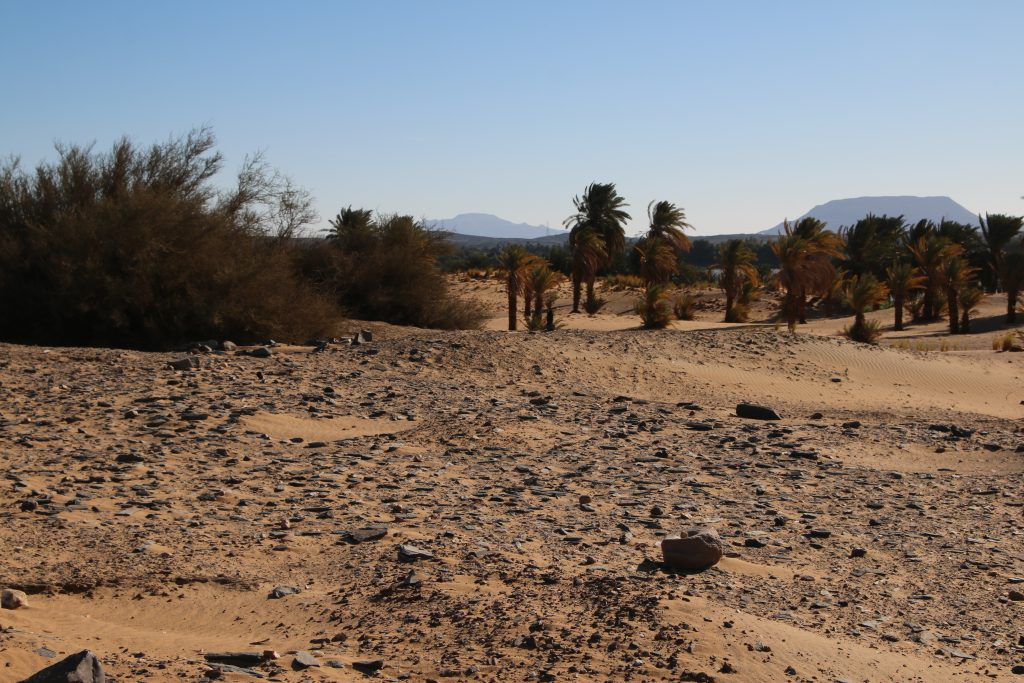
Surface at site 3-P-15.
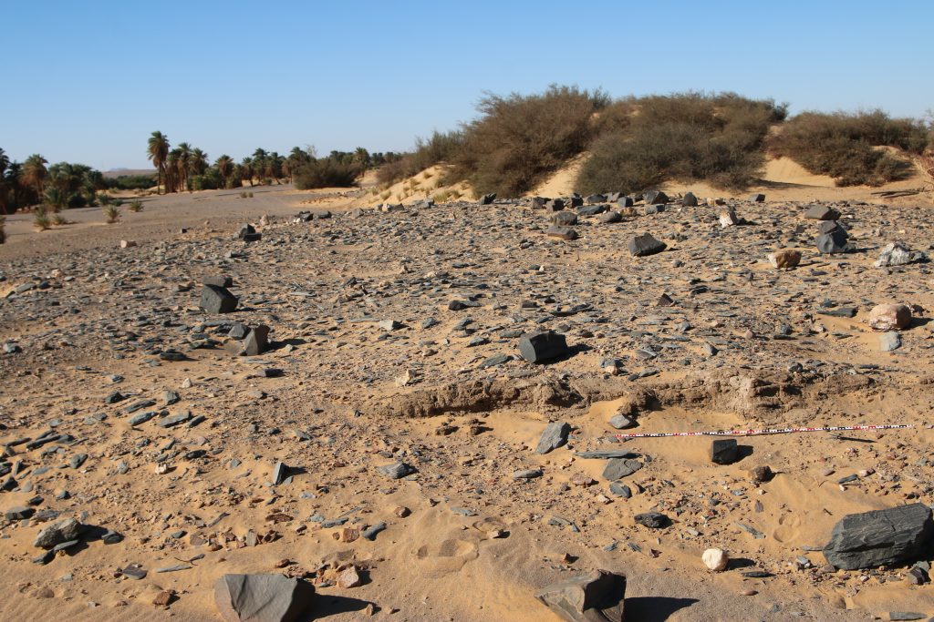
The third habitation site, 3-P-15, comprises a mound of c. 55-100m, the surface is covered by schist blocks and sherds. The appearance of the site is very similar to 3-P-16. In the northeastern part, remains of mud bricks are visible. 3-P-15 is especially intriguing because it shows a continuation from late Ramesside times well into the ninth and maybe even the eight century BC according to the surface ceramics we documented. A more precise dating and a concise characterisation will require excavations – but a New Kingdom only date as suggested by Vila seems were unlikely.
Mud brick remains at site 3-P-15.
For now, we keep our fingers crossed that the Covid-19 situation in Sudan – and of course everywhere else! – will soon improve and everybody stays healthy. Insha’allah our planned fieldwork will be possible somewhen in the near future – there are definitly plenty of things to be checked and discovered between Attab and Ferka!