This MUAFS/DiverseNile season is divided in two fronts: there will be simultaneous work on site and in Khartoum. I’m working in the storeroom at the Sudan National Museum together with Shadia Abdu and the assistance of various colleagues from NCAM with the aim to document objects previously excavated by Vila in the region from Attab to Ferka. This is a crucial step for us to better understand the sites located in the project’s concession area and to design future excavation and research strategies, especially concerning the cemeteries I’m investigating for DiverseNile’s work package 2.
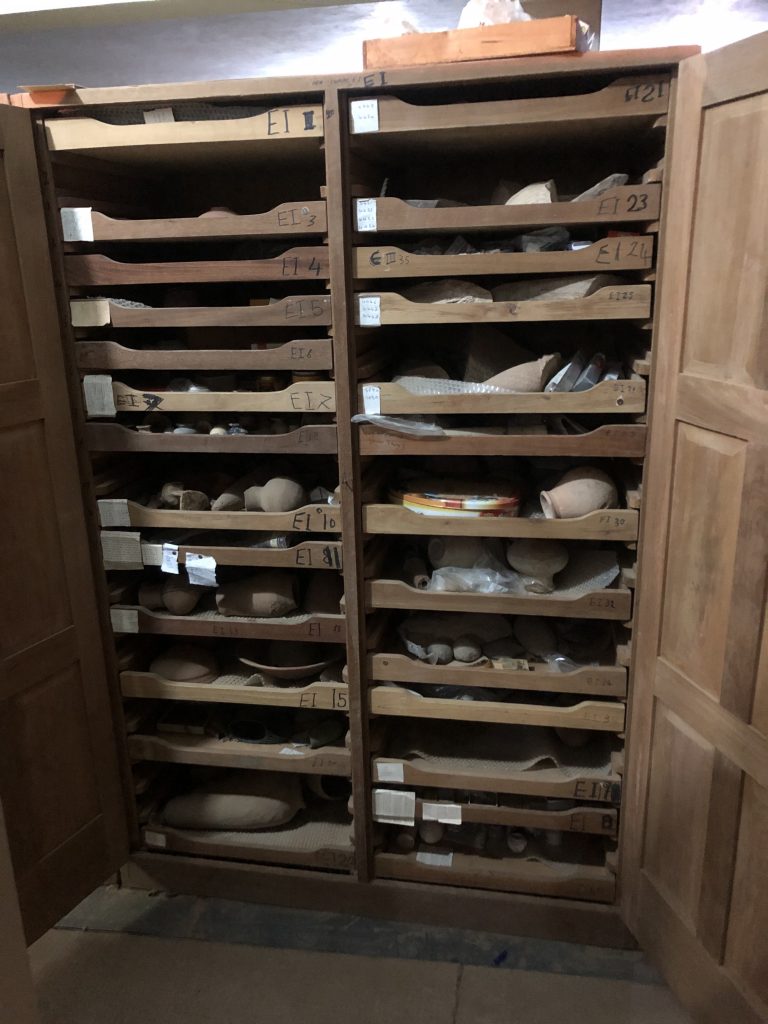
The storeroom of the Sudan National Museum is an endless source of invaluable information about all things Sudan and Nubia. It’s a great privilege and amazing experience to be able to go through drawers and shelves containing not only all sorts of objects, but also glimpses of the history of archaeology in Sudan, including the drawer cabinets themselves, which were designed by Arkell to contain ancient objects (fig. 1). Arkell later brought the same design to the Petrie Museum in London.
Fig. 1: drawer cabinet designed by Arkell at the Sudan National Museum in Khartoum (photo by R. Lemos, courtesy of the SNM)
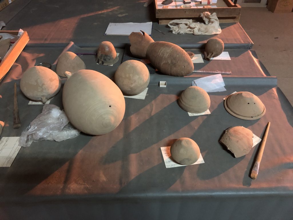
The objects kept at the SNM hold an enormous research potential not only for us to re-contextualise archaeological sites, but also to carry out new analyses and answer questions that archaeology back then didn’t really think about asking. For example, reassessing the pottery from various tombs is important for us to understand the (re)use history of archaeological contexts inside and around cemeteries (fig. 2).
Fig. 2: a selection of the vessels I’m re-documenting, mostly from tomb 3-P-50 at Ginis West (photo by R. Lemos, courtesy of the SNM)
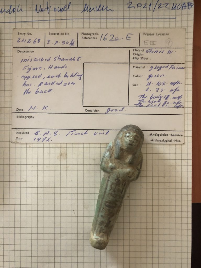
Fig. 3: one of the green faience shabtis of lady of the house Isis from tomb 3-P-50 at Ginis West + SNM object card (photo by R. Lemos, courtesy of the SNM)
It’s a great opportunity to be able to work in the Sudan National Museum storeroom. As a material culture person, I feel privileged and humbled to be able to handle with my own hands the results of years and years of archaeology in Sudan, carefully kept by our wonderful colleagues at NCAM. Working inside the SNM is certainly a great way of closing this dreadful year. May the next year be better for all of us! Cheers from Khartoum!
I am very happy that from yesterday onwards, Iulia Comşa has joined the ERC DiverseNile project as a new student assistant. She will complement Sawyer Neumann and together they will help us with post-fieldwork processing, image editing, digital drawings, scanning and other tasks.
Iulia is a BA student in Egyptology at LMU and joint our last course in practical fieldwork about which she also wrote a blog post earlier this year. She is much interested in field archaeology in Egypt and Sudan and makes a perfect addition to our team. During the practical class (which was held online due to the pandemic), Iulia turned out to be also a very talented cook baker – her “stratigraphy cake” was very impressive!
Stratigraphy cake by Iulia for our practical class in March 2021 (photo: Iulia Comşa)
Welcome to the team, we are all very much looking forward to our future collaboration!
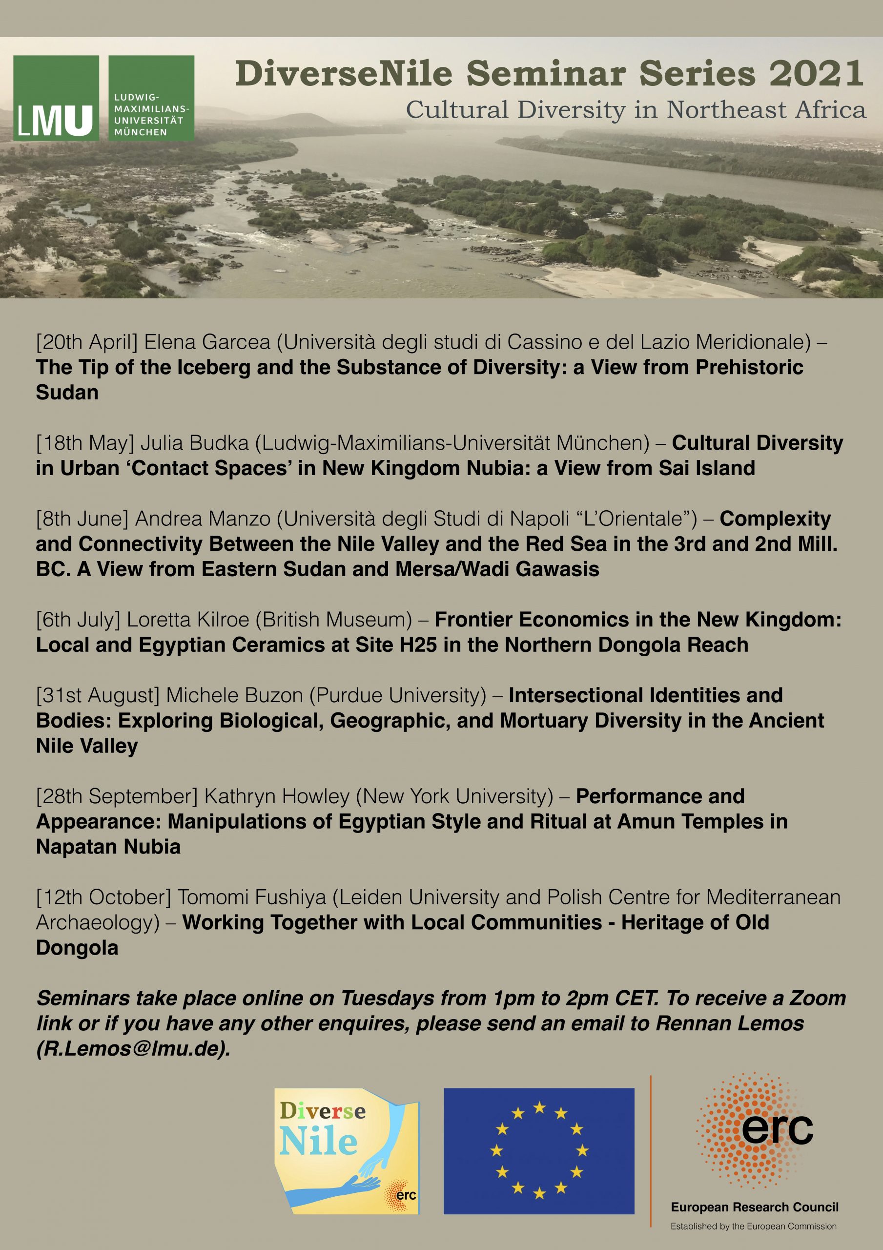
The Seminar Series under the general topic of “Cultural Diversity in Northeast Africa” has a wide chronological and regional scope and we will start with a view from Prehistoric Sudan. I am more than happy that we have one of the renown experts in this field as our first speaker: my dear friend and colleague Elena Garcea from the Università degli studi di Cassino e del Lazio Meridionale.
I first met Elena 10 years ago while we were both working on Sai Island – ever since, she has become a close friend and collaborator to which I owe fruitful comments, advices and plenty of discussion on various occasions. Elena collaborated already with the AcrossBorders project and one of the outcomes is a joint article which appeared in Antiquity in 2017, with Giulia D’Ercole (one of Elena’s former students) as the corresponding author (D’Ercole et al. 2017).
Here, it became very obvious that a shared view from Prehistoric and Bronze Age Sudan can result in interesting insights and pose a number of relevant questions. The long settlement sequence on Sai over millennia provided an excellent opportunity to study continuity and discontinuity in long-term pottery traditions. Thanks to Elena, we presented a preliminary version of this research at the 14th Congress of the Pan African Archaeological Association for Prehistory and Related Studies, hosted from July 14-18 2014 by the University of the Witwatersrand at Johannesburg, South Africa. This trip to South Africa was in many respects rewarding and one of my personal highlights of congress experiences.
Elena’s research is mostly focusing on the last hunter-fishers-gatherers and early food producers and users of domestic plants and animals in Sudan. All of her interpretations are always reflecting recent theoretical perspectives, in particular technical knowledge accumulation, storage strategies and optimal foraging theory. She has undertaken fieldwork not only in Sudan but also in Libya and Niger. In Sudan, she has worked in different parts of the country: Khartoum province and Jebel Sabaloka (central Sudan), Karima and Multaga-Abu Dom areas, Sai Island and Amara West district (northern Sudan).
Elena recently published a book on the Prehistory of Sudan (Garcea 2020). In my view this is an excellent piece of work, not only for students but for anyone who wants to understand the early history of Sudan within a wide framework. The book profits from more than thirty years of field experience and brings together this expertise with analyses in laboratories, conference presentations and numerous publications to develop a differentiated picture of Prehistoric Sudan.
I am personally very much looking forward to this kick-off of the DiverseNile Seminar Series! For those of you who I could convince that it will be clearly worth to attend Elena’s lecture: participation is free but registration via email is mandatory. See you all tomorrow!
References
D’Ercole, G., Budka, J., Sterba, J., Garcea, E., & Mader, D. 2017. The successful ‘recipe’ for a long-lasting tradition: Nubian ceramic assemblages from Sai Island (northern Sudan) from prehistory to the New Kingdom. Antiquity,91(355), 24-42. doi:10.15184/aqy.2016.262
Das Analysieren von Luftbildern ist ein wichtiger Bestandteil der archäologischen Prospektion, um einen Bereich zu finden, der sich für eine Ausgrabung anbietet. Hierfür werden die Bilder nach interessanten Strukturen abgesucht, die möglicherweise antik und nicht modern sind. Manchmal sind die erkannten Strukturen ganz klar als spezifische Strukturen einer archäologischen Kultur zu erkennen, so sind z.B. die Umrisse von Hügelgräbern und römischen Kastellen besonders gut in einem Luftbild zu identifizieren, sofern sie nicht von anderen Strukturen gestört sind. Weiterhin kann mithilfe von Luftbildern das ganze Ausmaß eines Fundplatzes ermittelt werden, beispielsweise bei einer Siedlung, wenn mehrere Gebäudereste, wie Mauern oder Pfosten, zu erkennen sind.
Doch wie sind Befunde in einem Luftbild zu erkennen? In einem Gebiet, in dem viel Landwirtschaft betrieben wird und es viele Felder gibt, können anhand der Bewuchsmerkmale der Pflanzen, Strukturen, die im Erdreich liegen, erkannt werden. Pflanzen oberhalb von Gruben und Gräben wachsen oftmals besser, somit sind sie größer und kräftiger als die restlichen Pflanzen. Umgekehrt gilt das Gegenteil, wenn diese auf Mauerresten und Strukturen, die aus Stein bestehen, wachsen. Hier sind sie kleiner und schwächer als die umliegenden Pflanzen. Frischer Schnee ist ebenfalls hilfreich, um Strukturen sichtbar zu machen, wenn er auf Strukturen besser liegen bleibt oder wegschmilzt. Es bietet sich oft an Luftbilder in den Morgen- oder Abendstunden anzufertigen, da hierbei der längere Schattenwurf dank der oben genannten Gründe, besser sichtbar ist. Natürlich sind dadurch auch Schatten von Strukturen erkennbar, die höher oder tiefer gelegen sind als der Mutterboden. Weiterhin können Verfärbungen des Bodens, vor allem auf Flächen oder Regionen, in denen kaum Bewuchs besteht, auf Befunde hinweisen.
Wälder hingegen behindern das Anfertigen von Luftbildern auf die herkömmliche Weise. Hier empfiehlt sich das Benutzen anderer Methoden, wie z.B. der LiDAR (Light detection and ranging) Scan, bei dem mithilfe eines Laserimpulses die Höhenunterschiede zwischen Boden und Scanner unterhalb der Baumkronen gemessen werden und mithilfe des Computers ein akkurates Bild ergibt. Allerdings ist diese Methode um einiges kostenintensiver als das herkömmliche Erstellen von Luftbildern.
Da diese Methode jederzeit von Zuhause aus durchgeführt werden kann, ist sie ein netter Einblick um den Alltag der Archäologie auch ohne eine Exkursion zu erfahren. Wer nun ein bisschen nach Befunden stöbern möchte, kann sich auf den folgenden Webseiten ein paar Luftbilder anschauen:
Das bayerische Landesamt für Digitalisierung, Breitband und Vermessung bietet kostenpflichtige, dafür aber hochauflösende Luftbilder für den gesamten Raum Bayerns an.
Allerdings bieten sie auch ein Portal an, das zwar weniger auflösend ist, wo man jedoch ganz Bayern betrachten kann und sich von dort aus, dann spezifische Luftbilder heraussuchen kann, falls man diese erwerben möchte.
Archaeoflug.de dagegen bietet ein Online Luftbild Archiv, das für die Archäologie spezifisch ist.
Generell ist aber auch Google Earth, dass dank Satellitenbildern den ganzen Globus erfasst hat zu empfehlen, um sich interessante Orte herauszusuchen und größere Strukturen zu entdecken.
Stratigraphie (Sarah Regina Krinner)
Wenn man sich mit der Archäologie beschäftigt ist die Ausgrabung ein Bestandteil, der nicht wegzudenken ist. Genauso wie die Bedeutung und die Methoden der Stratigraphie.
Eine mögliche Definition des Wortes Stratigraphie ist, dass es sich um eine Abfolge von Schichten handelt. Welche beschreibt, dass die unteren Sedimentschichten älter sind als die Sedimentschichten, die sich darüber befinden. Auch ist diese Definition unter dem Gesetz der Überlagerung oder des Stratigraphischen Prinzips bekannt. Eine weitere Definition beschreibt die Stratigraphie als das Darstellen einer Stratifizierung, die Interpretation, Dokumentation und die Beobachtung von einem archäologischen Fundplatz. Mit beiden Definitionen als Anhaltspunkt ermöglicht die Stratigraphie zum einen die chronologische Abfolge der Schichten relativ zueinander in ein Verhältnis zu setzen und zum anderen durch die Vergesellschaftung von Funden diese kontextuell einordnen zu können.
Um mit dem Zusammenspielen der Schichten auch nach dem Dokumentieren vor Ort visuell sichtbar zu arbeiten entwarf Edward Harris ein Modell, welches einem ermöglicht die stratigraphischen Schichten in ein graphisches Modell umzusetzen. Hierfür nutzte er für die Beschreibung der Schichten zueinander die Bedingungen unter, über, neben und unbekannt. Das Kriterium, welches die Schichten voneinander abgrenzt, ist die Grenze/Interface zu den jeweiligen Schichten. Das Ziel ist das Erstellen einer Sequenz von Kontexten und der Beobachtung, welche zu einem Schema der zeitlichen Staffelung von Schichten führt.
Jedoch gibt es bei diesem Modell einige Voraussetzungen und Probleme. Es setzt das Graben in natürlichen Schichten voraus und das Erstellen der Stratigraphie im direkten Anschluss an die Grabung. Das wichtigste ist das Verständnis der Schichtgrenzen/Interfaces. Die Natur der Kontexte, der Kulturschichten, die Störung oder der Sedimente sind für das Modell nicht erforderlich oder von Bedeutung. Zudem erklärt das Modell weder die Schichten, noch steigert es das Verständnis an ihnen.
Um einige dieser Probleme zu beheben empfiehlt sich das Nutzen des Harris Matrix Composers. Welches ein Computerprogramm ist, um Schichten sichtbar voneinander abzugrenzen und zu organisieren. So kann man in dem Programm Perioden und Phasen in Boxen darstellen, welche mit Kommentaren versehen werden können, auf die Ausgrabungsseite verweisen, Einheiten mit „noch nicht ausgegraben“ beschriften und eine Veränderung des Graphikdesigns erkennen, je nach Veränderung des Erscheinungsbilds des Modells.
Fazit:
Die grundlegende Schwierigkeit ist, dass die Kontexte dreidimensional sind, während die Dokumentation zweidimensional ist. Zudem sind die Schichten nicht immer natürlich entstanden, sondern von Menschenhand gemacht. Wie das Graben einer Grube, das Füllen einer Grube, das Wegwerfen von Müll oder das Bauen einer Mauer. Auch verlaufen die Schichten nicht horizontal, was ein Problem bei der Verfolgung von Schichtgrenzen ist.
Die Harris Matrix bietet die beste Möglichkeit Schichten in eine zeitliche Staffelung zu setzen. Der Harris Matrix Composer ist für jede*n Archäolog*in ein praktisches Tool und die Auseinandersetzung mit dem Programm lohnt sich bereits für Studienanfänger*innen.
Digitales Zeichnen in der Archäologie (Tuğçe Zinal)
Das digitale Zeichnen ist für die Archäologie ein wichtiger Arbeitsschritt, um Funde zu dokumentieren. Wie wir alle wissen, ist das Zeichnen und Dokumentieren der Funde ein wichtiger Bestandteil für die Archäologie, sei es nur eine Münze, eine Keramikscherbe, ein Teil einer Statuette oder auch die verschiedenen stratigraphischen Schichten, all das muss aufgrund der „kontrollierten Zerstörung“ aufgezeichnet werden. Jedoch können Details der Funde „verloren gehen“, wenn nicht sorgfältig dokumentiert wird.
Ein Foto der Objekte allein ist meist nicht ausreichend, da bestimmte Aspekte wie die Form, Farbe oder besondere Merkmale wie Information über die Herstellung usw. verloren gehen können.
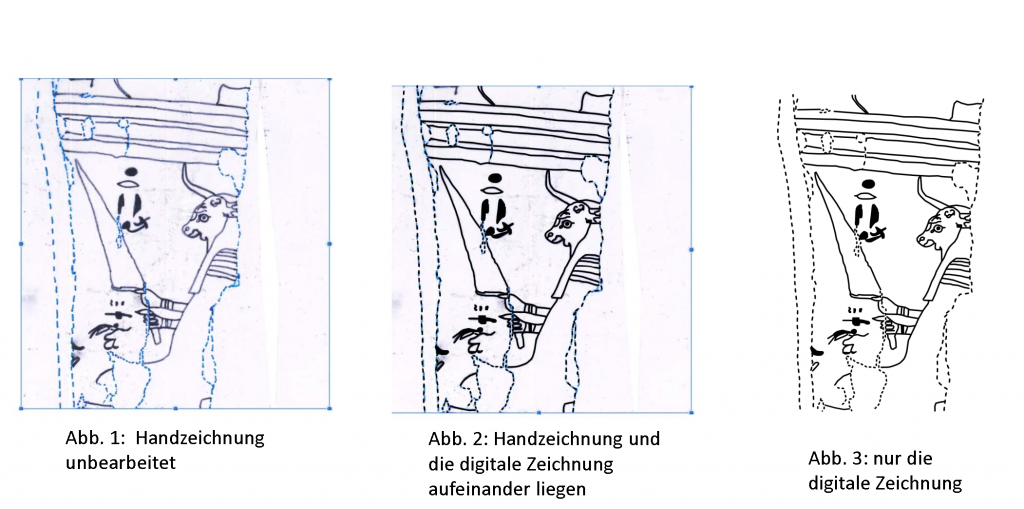
Durch die Handzeichnungen können die Exponate viel detaillierter analysiert und dokumentiert werden, da man sich hier mit dem Fund auf Anhieb differenziert auseinandersetzt und es sehr genau betrachtet. Da diese aber mit der Zeit aufgrund von äußerlichen Faktoren wie Wasser, Schmutz, Risse etc. verblassen, ist es sehr wichtig sie nochmals als digitalisierte Handzeichnung zu fertigen.
Wie genau funktioniert das?
Als erstes wird die Handzeichnung mittels eines Scanners eingescannt und anschließend mit einem Grafikprogramm, wie beispielsweise „Adobe Illustrator“ oder „Affinity Designer“ bearbeitet. In unserem Seminar „Grabungspraktikum“ wurde uns „Affinity Designer“ empfohlen, da hier die Handhabung, in Gegensatz zum „Adobe Illustrator“, einfacher ist. Nachdem die eingescannte Zeichnung in dem Programm geöffnet wurde, fängt man an durch die gezielte Schaffung der jeweiligen Ebenen darauf zu zeichnen, die Linien nachzufahren, miteinander zu verbinden oder Felder auszufüllen. Am Ende hat man von der Handzeichnung eine digitalisierte Version, auf der Fehler direkt korrigiert werden können.
Hierdurch entsteht noch eine Möglichkeit, die Zeichnungen digital abzuspeichern und diese dann direkt in den wissenschaftlichen Publikationen zu verwenden.
Das positive an unserem Online Seminar über „Zoom“ war, dass durch die Funktion der Bildschirmfreigabe jeder sein Bildschirm teilen konnte, damit die Dozentin bei Schwierigkeiten mit dem Programm gleich eingreifen und uns weiterhelfen konnte. Die Handhabung der ganzen verschiedenen Werkzeuge, Techniken oder Anwendungsmöglichkeiten der einzelnen Funktionen konnte uns ohne weiteres auch digital übermittelt werden. Nach mehreren Anläufen waren wir alle selbstständig in der Lage, digitale Handzeichnungen zu fertigen (siehe Abb.1-3.)
Als Fazit kann man sagen, dass ein Onlinekurs über „Digitales Zeichnen“ durchaus viel Wissen mit sich brachte und optimal von zu Hause ausgeübt werden kann.
Fotos und Bilder verschiedenster Art sind schon seit langem ein wichtiger Bestandteil in der Archäologie. Mit zahlreichen Methoden und Herangehensweisen können den Betrachtenden die unterschiedlichsten Informationen über Funde und Befunde vermittelt werden. Von einfachen Fotografien bis zum virtuellen 3D-Modell ist heute beinahe alles möglich.
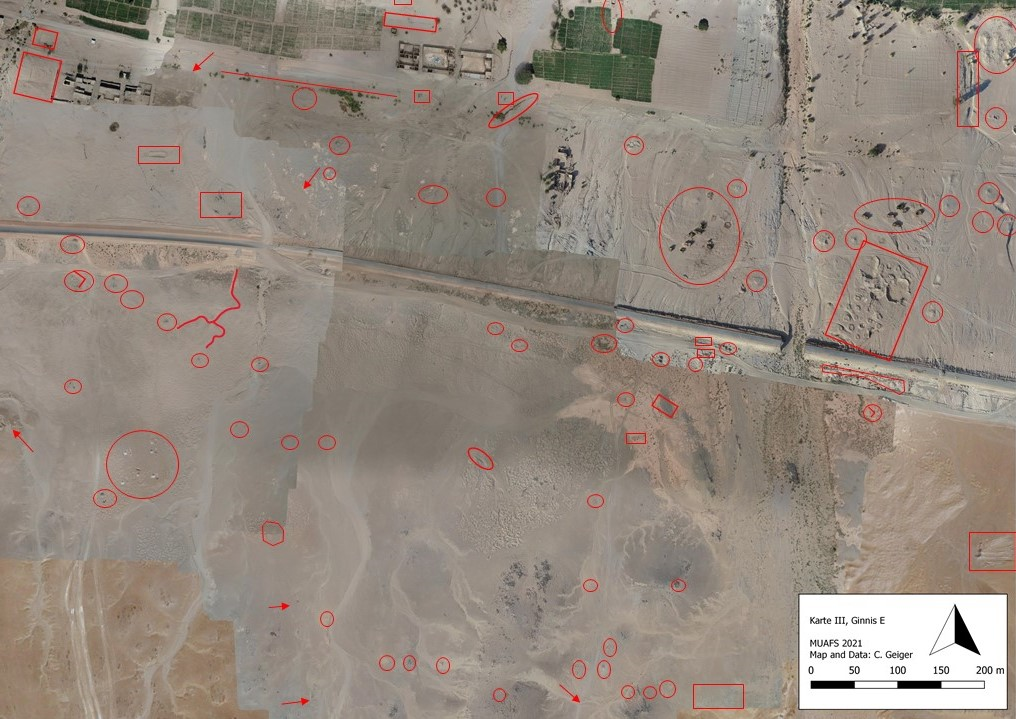
Sogar auf der Suche nach archäologisch relevanten Strukturen können Fotos äußerst nützlich sein. Mit Hilfe von Aufnahmen aus Flugzeugen, Drohnen, Satelliten etc. ist es möglich, Spuren längst vergangener Kulturen zu entdecken. Dieses Verfahren, die so genannte Luftbildarchäologie/Fernerkundung, wird bereits seit über 100 Jahren angewandt. Aufgrund des technischen Fortschritts werden immer bessere Ergebnisse erzielt. Neben der Technik braucht es allerdings auch geschulte Expert*innen, welche die relevanten Strukturen auf den großflächigen Geländeaufnahmen erkennen können. Als Anfänger*in steht man dabei vor einer gewissen Herausforderung. Zu Beginn sollte man sich deshalb eine passende Strategie zurechtlegen, wie das oft mehrere km² große Areal aufgeteilt werden kann, um nicht den Überblick zu verlieren. Wenn man im Anschluss Teilbereich für Teilbereich genauer betrachtet, fallen einem schnell einzelne markante Bodenverfärbungen, Bewuchsmerkmale oder Steinformationen auf. Mit einem Augenmerk auf unnatürliche Formen, beispielsweise rechte Winkel oder konzentrische Kreise, können noch weitere archäologische Spuren gefunden werden (Abb.1). Allerdings wird man als unerfahrener Studierender beim Markieren der einzelnen Strukturen über kurz oder lang immer unkonzentrierter und unsicherer. Häufig stellt sich dann die Frage: „Ist das jetzt antik, oder doch eher neuzeitlich?“ So werden im Zweifelsfall auch zahlreiche aktuelle Bauten auf den Aufnahmen gekennzeichnet. Bei der späteren Geländebegehung vor Ort präsentiert sich dann die ernüchternde Realität. Durch häufiges Üben und mit der Hilfe geschulter Archäolog*innen lassen sich jedoch viele dieser Fehlinterpretationen vermeiden; denn Übung macht ja bekanntlich den Meister.
Abbildung 1A: Luftaufnahmen zur Fernerkundung aus dem Sudan (Quelle: C. Geiger, MUAFS Projekt, bearbeitet). Markierung archäologisch relevanter Strukturen durch Studierende (viele neuzeitliche Elemente gekennzeichnet)Abbildung 1B: Markierung der wichtigsten realen archäologischen Fundplätze (MUAFS Projekt).
Dies lässt sich auch über die Fotographie am Boden sagen. So findet man leider in Publikationen, die man selbst vielleicht gerade für einen Vortrag oder eine Facharbeit benötigt, immer wieder unbrauchbare Bilder. In den meisten Fällen sind Fotos, die teilweise über- bzw. unterbelichtet, schlecht beleuchtet oder unscharf aufgenommen wurden, später für die Betrachtenden nutzlos. Bilddateien, die möglichst viele Details der einzelnen Objekte, Befunde, Landschaften etc. beinhalten, sind demnach für die Archäologie unabdingbar. So können möglichst detailgetreue Aufnahmen durch archäologisch versierte Fotograf*innen sowohl die Recherche, als auch die weiterführende Forschung ungemein erleichtern. Mit heutigen Spiegelreflexkameras und dem richtigen Equipment sind der Anzahl an neu aufgenommenen Bilddateien in der Regel keine Grenzen gesetzt. Schnell am PC nachbearbeitet, können sie zeitnah anderen Personen zugänglich gemacht werden. Aufgrund dieser technischen Entwicklung sind auch Verfahren, wie die Photogrammetrie, möglich. Hierbei werden aus zahlreichen, sich überlappenden Fotos digitale 3D‑Modelle erstellt. So kann beispielsweise bei einer Ausgrabung jeder einzelne Grabungsschritt dokumentiert und später virtuell noch einmal nachvollzogen werden. Abschließend lässt sich also festhalten, dass die Fotografie aus der Archäologie nicht wegzudenken ist. Mit den zahlreichen Anwendungsmöglichkeiten aus der Luft und am Boden bildet sie einen wichtigen Bestandteil bei der Dokumentation. Mit entsprechender Übung und der Hilfe von Expert*innen, können grobe Fehler vermieden und passende Fotografien angefertigt werden. Obwohl die Fotodokumentation schon seit vielen Jahren in der Archäologie eingesetzt wird, dürfen wir gespannt sein, wie sich die Arbeit der Archäolog*innen von Morgen durch die technischen Weiterentwicklungen im Bereich der Fotografie verändern wird.
Die Autoren sind BA Studierende der Archäologie an der LMU.
Um im Studium auch Grabungspraxis zu erlernen, haben wir uns für die Grabungsarchäologie eingeschrieben und waren schon sehr gespannt im Englischen Garten besondere Funde machen zu können. Leider kam auch hier Corona dazwischen und unsere Dozierenden mussten einen kreativen Weg finden, trotz dieser Umstände, doch noch graben zu können. Durch ein Online-Grabungspraktikum wurde dies möglich.
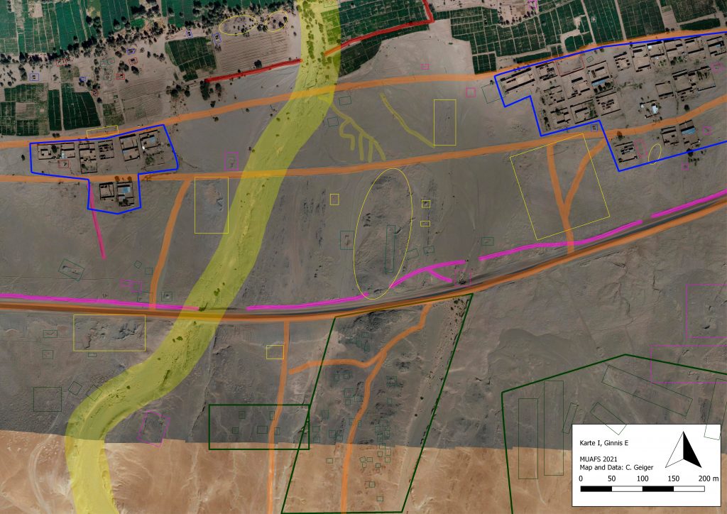
Wie bei der ursprünglich geplanten Präsenzveranstaltung wurden 3 Tage für das Onlinepraktikum angesetzt. Am ersten Tag erhielten die einzelnen Teams jeweils Luftbilder des MUAFS-Projektes mit einem Ausschnitt unterschiedlicher Bereiche. Anhand dieser Bilder führten wir einen Fernerkundungssurvey durch und erkundeten die Gebiete im Detail am Bildschirm. Dabei lag der Fokus darauf die gefundenen Strukturen in Kategorien einzuteilen; unser Team hat sich dabei für eine farbliche Kodierung entschieden. So konnten verschiedene Strukturen und allgemeine Beobachtungen sichtbar gemacht werden.
Um keine Strukturen zu übersehen, analysierten und diskutierten wir gemeinsam unser Gebiet von Norden nach Süden und von Westen nach Osten. Anschließend bereiteten wir unsere Ergebnisse auf, um sie am nächsten Tag unseren Mitstudierenden und dem Lehrteam vorzustellen. Die von uns identifizierten Funde, waren oft nicht genau das was wir vermutet hatten und moderne Bauten und Spuren von Bauarbeiten und Feldarbeiten hatten leider oft Strukturen überdeckt, die archäologisch sehr interessant gewesen wären. Daher ist es unbedingt notwendig, das Areal auch real zu begehen, da nur so gewissen Formationen sichtbar sind oder erkannt werden können. Allerdings kann der Luftbildsurvey einen ersten Eindruck über das Gebiet geben, bevor man mit der Grabung beginnt.
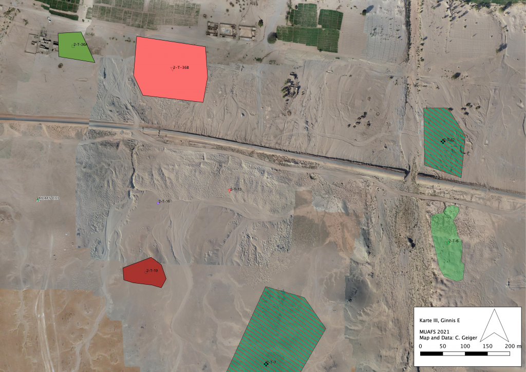
Abbildung 1: Luftbild von Ginis/Kosha Ost (MUAFS Konzession) mit eingezeichneten Strukturen (Karte: Cajetan Geiger, Einzeichnungen: Markus Kutschka).
Am folgenden Tag erhielten wir einen Einblick in Bereiche der Photogrammatrie (Photoscan/3D-Erstellung). Dabei wurde uns von Cajetan Geiger der Vorgang bei der Erstellung einer 2D-, „2,5“D- und 3D-Abbildung von Grabungsbefunden gezeigt. Diese Abbildungen basieren auf geodätischen Daten, welche durch die Einmessung mit einem Tachy(meter), einem Gerät zur Messung von Horizontal- bzw. Vertikalwinkel und der Distanz, gewonnen wurden, und Bildern, die vor Ort aufgenommen werden. Es werden zuerst die Bilder ins Programm eingelesen, die im nächsten Schritt überprüft werden sollten, um ungeeignete Bilder, die zu unscharf waren oder auf denen zu viele Schatten zu sehen sind, auszusortieren; dies ermöglicht ein möglichst gutes und weiterverwendbares Ergebnis.
Im nächsten Schritt werden Marker mit Koordinaten der Einmessung auf den Bildern an den jeweiligen Stellen gesetzt. Damit lässt sich nun eine sogenannte Punktwolke („Dense Cloud“) erstellen, indem die Software gleiche Punkte auf den Fotos erkennt und diese „verbindet“. So kann eine Rekonstruktion erstellt werden, die im besten Fall nur wenige Millimeter vom Original abweicht. Als nächstes wird die Dense Cloud verdichtet zu einem Mesh, damit eine zusammenhängende Oberfläche entsteht, indem das Programm die dazwischenliegenden Punkte berechnet und zu einer zusammengehörigen Fläche verbinden kann. Für weitere Analysen und publikationsmögliche Abbildungen sind ein Digitales-Gelände-Modell (DEM; „2,5“D-Model) und ein Orthomosaik, bei dem alle Bilder zu einem Bild zusammengefasst werden, notwendig.
Trotz der ganzen fortschrittlichen Technik ist in den meisten Fällen eine Zeichnung des untersuchten und fotografierten Gebietes unerlässlich. Denn auf der Zeichnung können noch viel feinere, oft auch persönlich betrachtete Strukturen und Abgrenzungen eingezeichnet werden, welche bei Fotographien und Konstruktionen verloren gehen könnten. Daher kann die Kombination aus Orthomosaik und Feldzeichnung als eine sehr geeignete Variante angesehen werden.
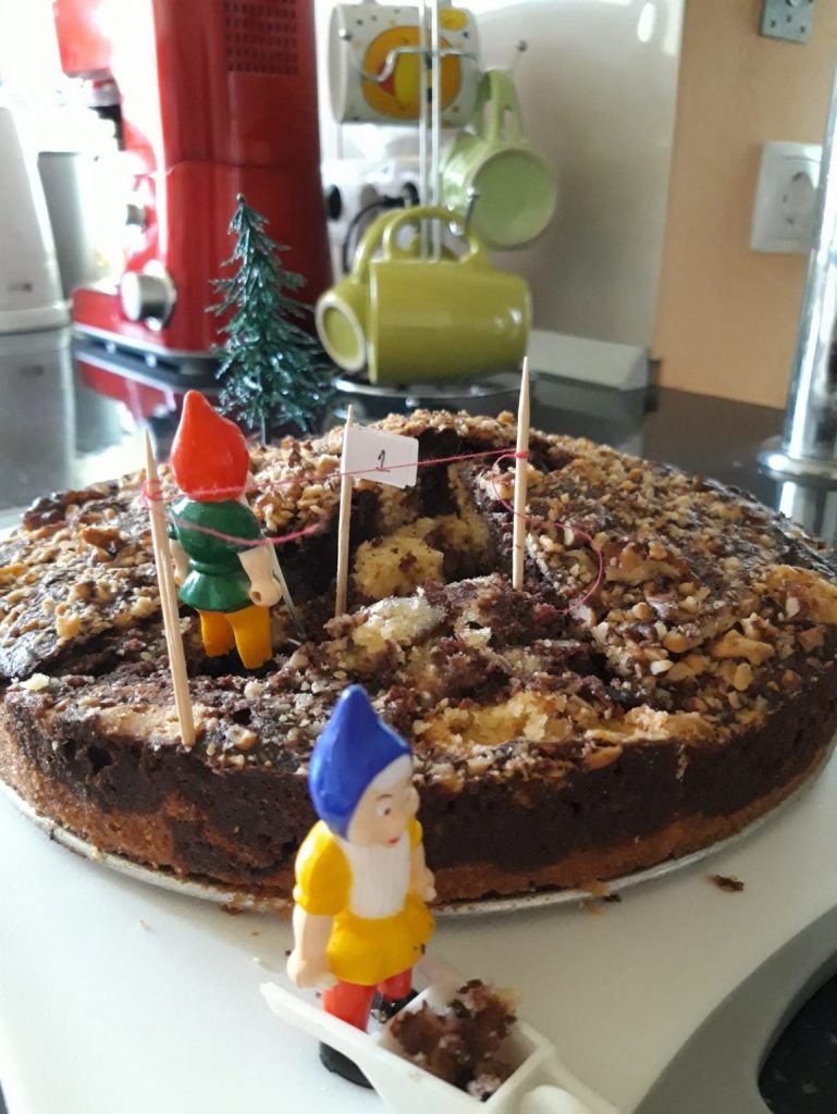
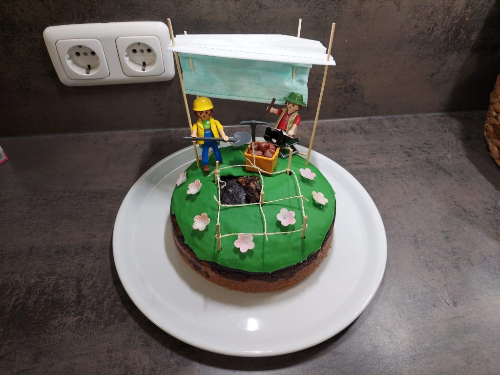
Als nächste Aufgabe erwartete uns eine Übung zur Stratigraphie bzw. Grabungstechnik. Doch wie sollten wir online graben? Patrizia Heindl hatte hier die Idee, dass sich jeder einen eigenen „Fundplatz“ machen sollte in Form eines Marmorkuchens, in diesen man „Fundstücke“ wie Nüsse, kleine Früchte, Butterkekse oder ähnliches einbacken sollte. Dabei ist wichtig, dass der helle und dunkle Teig im besten Fall immer einzelne Schichten ergeben sollte und die Funde so eingebacken werden sollten, damit sie auch der jeweiligen Schicht zugeordnet werden können. Dies hatte es uns ermöglicht einen kleinen Einblick in die Grabungspraxis zu erhalten. Da Sandra ihren fertig gebackenen Kuchen noch sehr traurig aussehend fand, hat sie den Kuchen noch etwas dekoriert.
In der praktischen Übung wurden dann die einzelnen Arbeitsschritte einer Grabung an einem Stück unseres Kuchens ausprobiert. Mit einem großen Messer haben wir den ersten Schritt vollzogen, das Erstellen des Baggerplanums, und uns angesehen, welche Befunde hier schon vorliegen. Diese würden in Realität mit Befundnummern versehen und dokumentiert werde. Für die nächsten Schritte gibt es verschiedene Möglichkeiten weiter zu graben: entweder nach natürlichen oder künstlichen Schichten, die je nach Notwendigkeit und Bedarf ausgewählt werden. Es werden Profile angelegt und diese dokumentiert. Auf diese Weise arbeiteten wir uns durch unseren Kuchen und machten verschiedenste „Funde“. Selbstverständlich kam das Kuchenessen dabei auch nicht zu kurz.
Abbildung 2: Dekorierter Stratigraphiekuchen (Foto und Kuchen: Sandra Kraus).Abbildung 3: Dekorierter Stratigraphiekuchen (Foto und Kuchen: Iulia Comsa).
Da Iulia schon an einem realen Grabungspraktikum in Italien teilnehmen durfte, kann so ein Vergleich gezogen werden. Erstens: es war natürlich bequemer innerhalb einer Küche oder eines Zimmers einen Kuchen zu backen und später aus diesem auszugraben, als draußen in der Hitze und/oder im Schlamm stundenlang zu sitzen. Zweitens: die Bekleidung, die man bei einer Ausgrabung braucht (in Italien: schwere Arbeitsschuhe, Handschuhe, Arbeitshosen und weiße Hemden) werden beim Backen und bei der „Ausgrabung“ der Torte nicht benötigt. Drittens: die Werkzeuge der Ausgrabungsaktivität unterscheiden sich. Bei einem Kuchen benötigt man Küchengeschirr, das bei einer in-Vivo-Ausgrabung durch Kellen und Bürsten ersetzt wird. Viertens: die Zusammenarbeit mit anderen Archäolog*innen ist bei einer Ausgrabungsstelle „Herz und Seele” und kann bei einer Online-Kuchen-Ausgrabung nicht umgesetzt werden. Fünftens: man kann überraschenderweise eines bei beiden Methoden machen, und zwar Singen. Bei einer Ausgrabung, wird oft Musik benutzt, um diese entspannter zu gestalten. Beim Mitsingen wird man gegebenenfalls von Touristen seltsam angestarrt, aber davon sollte man sich einfach nicht ablenken lassen. Zusammenfassend kann man feststellen, dass es viel bequemer ist durch eine Ausgrabungstorte die stratigrafische Ausgrabungsmethode zu lernen. Aber es ist nicht mit einer realen Ausgrabung zu vergleichen, insbesondere da man die anderen Mitglieder des Ausgrabungsteams beim Essen des Kuchens sehr vermisst.
Den zweiten Tag beendeten wir mit dem Zeichnen von Keramik. Dabei durften wir uns ein Stück Keramik aussuchen, welches von Julia Budka dann für uns gezeichnet wurde. Dabei lag der Fokus darauf, dass wir mit ihr die einzelnen Arbeitsschritte durchgingen und gemeinsam erörterten wie man die Scherbe orientiert, abmisst und in korrekter Weise auf das Papier bringt. Dabei spielen die korrekte Handhabung der Messgeräte, räumliches Denken, sowie Präzision eine große Rolle. Zuerst werden Richtlinien mit der Höhe einer Scherbe angelegt, an denen man sich für die Zeichnung orientieren konnte. In der Ägyptologie wird allgemein die Außenansicht links einer senkrechten Mittellinie und die Innenansicht rechts dieser Mittellinie gezeichnet. Nun wird die Keramik unter regelmäßiger Abmessung detailgetreu (nach-)gezeichnet. Es war toll zu sehen, wie die Abbildung immer mehr Form annahm und man das Scherbenstück darin wiedererkennen konnte. Vor allem das Einzeichnen bestimmter Merkmale verlieh der Zeichnung Charakter und machte es letztendlich sehr realistisch.
Am dritten und letzten Tag wurden wir in die Basics der digitalen Zeichnung von Patrizia Heindl eingeführt. Dies ist der weiterführende Schritt der mit der Hand gemachten Zeichnung, damit diese auch später in Publikationen abgedruckt werden kann. Für die Digitalisierung ist eine gute Grundlage unerlässlich und entspricht einer digitalen Umzeichnung. Die Erschaffung der digitalen Zeichnung ist wirklich faszinierend und hat uns sehr viel Spaß gemacht.
Als nächstes folgte die Fotografie von Objekten, z. B. für Publikationen. Dabei wurde uns von Giulia D’Ercole, Cajetan Geiger und Julia Budka zunächst erklärt wie wichtig die korrekte Einstellung der Kamera ist. Sowohl optimale Lichtverhältnisse, als auch ein passender Hintergrund haben auf ein optimales Bild sehr viel Einfluss und können die Nachbearbeitungszeit erheblich verkürzen, wenn nicht sogar komplett überflüssig machen. Die Nachbearbeitung und Optimierung der geschossenen Fotos dürften wir auch mitverfolgen und es war sehr spannend zu sehen, welche Auswirkungen die einzelnen Einstellungen auf die Qualität der Fotos haben.
Als abschließende Einheit durften wir uns mit Marion Scheiblecker verschiedenste Luftbilder aus Teilen Bayerns ansehen, um zu entscheiden welche Prospektionsmethode, d.h. zerstörungsfreie Methoden zum Auffinden von Strukturen und Stätten im Boden, am geeignetsten wäre. Diese Methoden sind sinnvoll, um erste Informationen bezüglich der darunter vermuteten archäologischen Befunde zu erhalten. Man unterscheidet grundlegend zwischen Prospektion über Magnetprospektion, über die elektrische Leitfähigkeit und über Radarmessungen des Bodens. Auch hier war es sehr interessant zu sehen, was man aus den bayerischen Luftbildern schon alles „ablesen“ konnte und was unter unseren Feldern versteckt liegen könnte.
Als Fazit dieser drei Tage lässt sich grundlegend feststellen, dass wir in unserem Team vergleichsweise unsicher an diese Art eines Grabungspraktikums herangegangen sind und keinerlei Vorstellungen hatten, wie man diese Art von Praktika online umsetzen könnte. Letztendlich war die Umsetzung aber mehr als überragend und im Gesamten wurde uns ein wunderbarer Einblick in die verschiedenen Methoden und praktischen Anwendungen gegeben. Wir freuen uns sehr darauf, das Gelernte in der Corona-freien Zeit anwenden zu können.
Die Autor*innen sind BA Studierende der Ägyptologie an der LMU.
Since almost two decades, my research and teaching complement one another. Probably influenced by my own education in Vienna – at a department with traditional connections to a museum collection and a strong record in the archaeological fieldwork in Egypt, thus resulting in a very practically oriented academic curriculum – I believe that subjects like Archaeology and Egyptology need a practical approach as well as a good basic understanding of its methodologies and theories. There are things students will never learn from textbooks but can only experience on site and face-to-face with the object. Furthermore, for me the general goal is not only to submit the tools, methods and knowledge but also to pass on our own enthusiasm for the subject to the future generation. The latter makes the hard work, all the accuracy and patience needed to become an academic scholar endurable – and magnificent.
It goes without saying that in times of the Covid-19 pandemic, there are many challenges for academic teaching (and learning), in particular for practical classes. The block seminar “Introduction to field archaeology” I was offering this winter term together with DiverseNile team members had to be completely revised as an online format because of the lockdown in Munich.
This online seminar run via zoom, we used several breakout rooms and offered plenty of material to the participants via a moodle class, in particular short videos on subjects like photogrammetry and drawing and photographing objects/pottery sherds.
Although this was a kind of ‘test’ and we were a bit unsure about the success the seminar will have, the results were amazing. The participants, arranged in three teams, submitted very strong results on the task “remote sensing” (for which we used satellite/drone pictures of the MUAFS concession) and were all really active in the individual sessions of the seminar.
In order to emphasise the strong links between teaching and research and to highlight the importance of outreach, one of the tasks for the participants was to write a short blog post about their experiences in the seminar. Therefore, I am more than happy that I can introduce three guest blogs by our teams of students – they are written in German but they offer an insight and personal view of experiences of LMU students in challenging times. All of the students of our seminar showed an impressive motivation for archaeology – this is all a teacher can ask for and thus many thanks again from my side and on behalf of my team! Enjoy these guest blog posts and any feedback is of course very much appreciated.
With the very nice blog posts by our new team members Rennan and Giulia in the last weeks, focusing on scientific aspects of the ERC DiverseNile project, it’s now my duty as the project leader to communicate ‘other’ aspects of our project – today, I will give you some insights about our team building strategy and the present challenges because of covid-19.
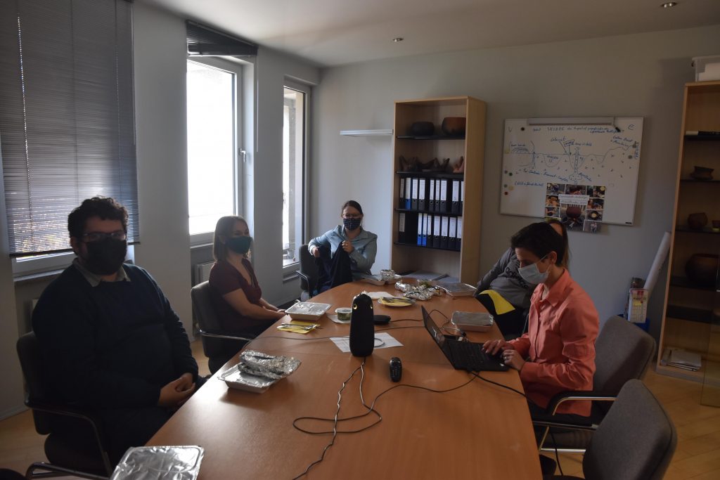
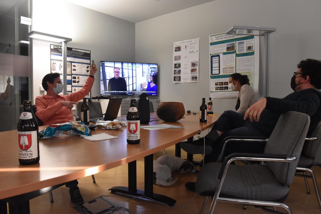
Honestly, I really did not envisage in August when we planned a hiking day for the DiverseNile team how bad the corona situation will become in Bavaria. We were more afraid about the weather when we finally scheduled our trip to Andechs to mid-November, believing that outdoor activities should be ok in these challenging times. Well, with the current regulations, it was of course clear that we need to find an alternative programme. Marion came up with the splendid idea of a virtual museum visit and this was indeed much fun!
We organized the virtual museum trip as a hybrid meeting, using a meeting owl and zoom and of course keeping distance and wearing masks. I was happy to be able to make a small contribution to support the local gastronomy and beer production by ordering food and drinks for the team – the ones joining via zoom of course had their own lunch.
Getting ready for our first social team meeting in times of covid-19! (photo: C. Geiger).
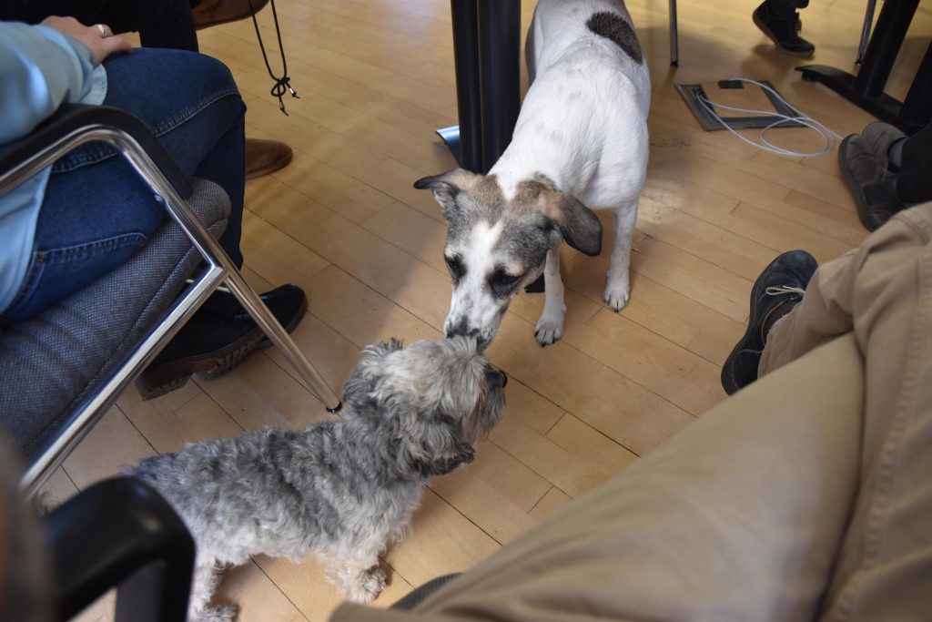
The food was delicious, beer from Munich as well and also our office dogs enjoyed this culinary part of the afternoon.
Really everybody in the room was happy with the food… (photo: C. Geiger).
Afterwards, we visited the Deutsches Museum (https://www.deutsches-museum.de/index.php?id=1&L=1) which of course is currently closed, but offers a lot of various videos and 3D tours – really much fun to watch! We found a fitting theme to start with – From cholera until corona and learned also much about the universe, aeronautics and other topics.
without words… (photos: C. Geiger).
Marion used the opportunity to shoot a short video for our new instagram account and Cajetan, as always, was our photographer of the day.
Of course, we are very much looking forward to better times when a real hiking day in the beautiful landscape of Bavaria will be possible – but as an alternative programme, our improvised excursion was much fun. Many thanks to all and we will probably have a follow-up hybrid meeting soon for our Christmas party.
Today is Friday
and after some crazy first weeks because of our initial problems, we’re finally
in an ordinary working schedule, making a day-off to relax and to study finds. And
there was also some unusual excitement: We had a very nice surprise visit by a
group of tourists travelling through Sudan with Lendi Travels, the company of
my dear friend Waleed in Khartoum. I gave them a short tour at GiE 001,
explaining the challenges we are currently encountering, but also the huge
potential of the site. For them it was of course a big difference compared to
all the nicely preserved New Kingdom sites with stone architecture like Sai and
Soleb.
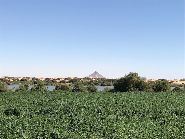
After the nice group left, I took the opportunity for a relaxing walk back from the site to our house. And I am happy to share here some impressions of the stunning beauty of the landscape at Ginis, wishing everybody a relaxed weekend:
The fields along the river bank contrasting with the sandy dunes on the west bank.View towards the west bank with some rocky outcrops.The nice local house we rented as a digging house for this season.
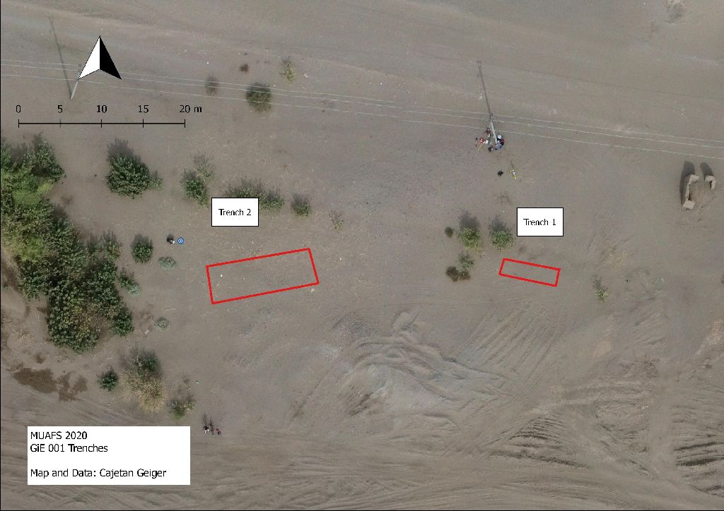
Our third week of the 2020 just ended and was very successful. We concentrated during the week on site GiE 001. Recorded by Vila as site 2-T-36B in the 1970s, this domestic site at Ginis East can be assigned to the Egyptian New Kingdom, showing also an intriguing Kerma presence according to the surface finds as well as Napatan ceramics. Magnetometry was conducted by MUAFS in 2019.
In the 2020
season, two trenches were laid out above promising anomalies in the
magnetometry in the northeastern part of the site, just south of the modern car
track. Trench 1 (6 x 4 m) yielded, apart from surface finds which were mixed
and dated from the Kerma Period, the New Kingdom, the Napatan Period and
Christian times, some Kerma Classique sherds from lower levels. However, no
structures were found and the magnetometry seems to show natural features,
especially more sandy areas which contrast to clay layers.
Trench 2 (10 x 4 m) is the area where we found plenty of evidence for marog digging. The pottery was abundant and is again a mix of predominantly New Kingdom material with Kerma, Napatan and Christian wares. Work in Trench 2 is not yet finished and will continue in the upcoming week.
All in all, remains in GiE 001 are clearly not as we were hoping according to the magnetometry, but it is still a very interesting site to study, especially within the context of the question of Egyptian presence during the New Kingdom in the area of Attab/Ginis/Kosha, thus in the periphery of Amara West and Sai Island.


