
We are very pleased to announce the DiverseNile Seminar Series for 2022. As a follow up of this year’s event, we will now focus on material culture and society in Bronze Age Nubia and respective perspectives from landscape and resource management.
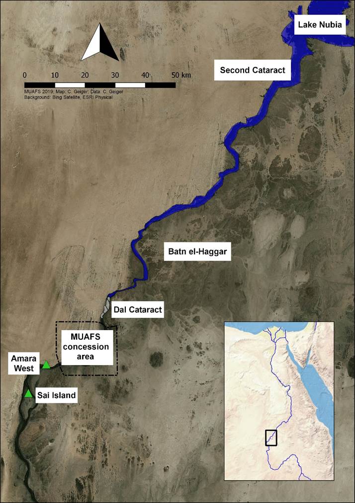
It is my pleasure to open the Seminar Series on January 25 with an introduction and some ideas about global networks and local agents in the Middle Nile. Middle Nile contact space biographies we are currently reconstructing for the Attab to Ferka region provide a complex picture of a social space as a home to diverse groups and actors, rather than a static landscape and the periphery of centre-oriented narratives of New Kingdom Nubia. Our aim within the DiverseNile project is to decode, through our interdisciplinary studies, the economic role of the Attab to Ferka region for the principal centres, as a production area, and as land for animal husbandry and agriculture as well as for mining activities and gold production.
Rennan Lemos managed to gather a splendid group of speakers for the talks, covering a large set of topics from pottery technology to animal husbandry, gold extraction and much more.
We are looking much forward to this event and registration for the online DiverseNile Seminar Series 2022 is already open! Hoping to see many of you there – we will keep you updated about the specific schedule of the talks (always Tuesday, 1pm CET)!