We are very pleased to share that our article “An Egyptian Villa with Animal Pens in New Kingdom Nubia: Reinterpreting Building H4 and Area H4W on Sai Island”, published last year in the Journal of Urban Archaeology, is now available in open access. The study presents a new interpretation of part of the residential quarter of Sai City and explores how recent advances in digital reconstruction can contribute directly to archaeological research.
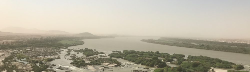
Sai City was a walled Egyptian temple town on Sai Island in modern Sudan. Our article revisits Building H4 and adjoining Area H4W, a mid-Eighteenth Dynasty residential complex excavated in the 1970s and reconstructed by Ingrid Adenstedt in 2016 as part of the ERC AcrossBorders project.
The reinvestigation began with Robert Kalasek’s terrestrial laser scan. Re-examining the data revealed curved structures beneath a later building in H4W, while sections generated from the scan placed them at approximately the same level as the original surrounding walls. Their dimensions, construction and position within rectangular enclosures argue against an interpretation as silos or ovens and closely parallel animal pens, most likely pigsties, excavated at Amarna. The wall thicknesses and shared-yard arrangement are comparable, while faunal remains elsewhere at Sai indicate that pigs were bred locally. We therefore suggest that H4W contained a small-scale pig-keeping area with at least two pens and a shared yard.
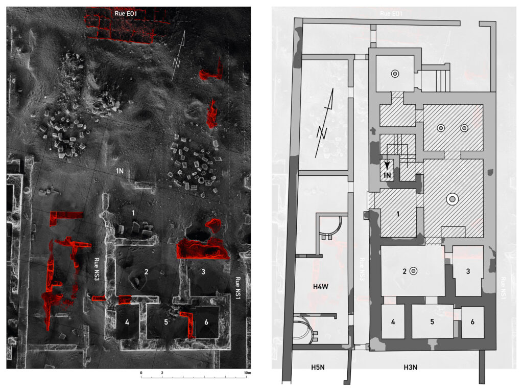
Re-examination of the scan also revealed a bed niche in Room H4/3 and an L-shaped internal wall characteristic of contemporary stairwells in H4/1N. These features allow H4 to be reconstructed as a typical Egyptian villa with a tripartite plan: private rooms at the rear, a main hall and stairwell in the centre, and an entrance section at the front. A preserved threshold at the southern end of the narrow passage between H4 and H4W further indicates that what had previously been understood as a public street was instead a private alleyway. H4 and H4W thus formed a single enclosed estate comprising an elite residence and its associated infrastructure.
Digital reconstruction played an important role in reaching these conclusions. Recent advances in real-time rendering allow highly detailed scans of architectural remains, objects and landscapes to be used at their correct scale without first reducing them to heavily simplified geometries. Using Unreal Engine 5, we created a photorealistic, on-the-ground reconstruction around the original scan data. Hypothetical walls, roofs and other architectural features were reconstructed directly around the surviving remains and explored interactively at human scale.
Unreal Engine’s photorealism allows materials, spatial relationships and environmental conditions to be investigated with sufficient specificity for the reconstruction to function as a research environment. Individual construction layers can be added or removed, alternative solutions can be compared, and the reasoning behind particular choices can be made interactively transparent. Navigating the reconstruction at human scale also makes features such as narrow passages, restricted access and the confined nature of Sai’s urban planning immediately tangible.
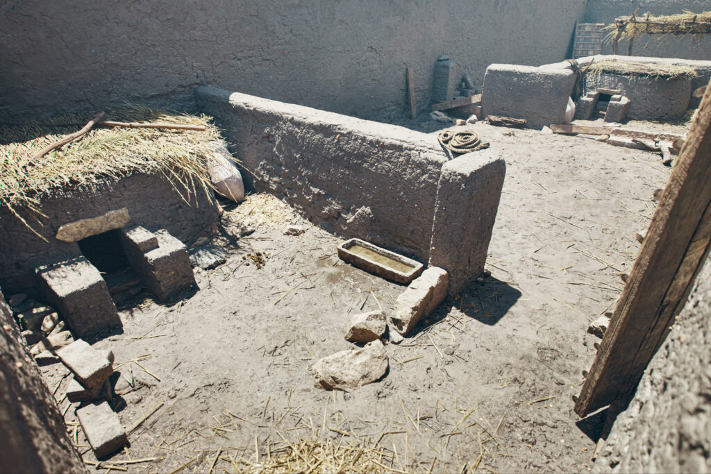
The geopositioned model additionally reproduces the changing position of the sun at Sai according to the time of day and season. This proved particularly important when considering how the proposed pig pens were roofed. Pigs are highly susceptible to heat stress, making adequate shade essential. We tested an elevated grass-and-pole roof that would have allowed a person to pass beneath it for maintenance. During the hottest months, however, this solution would have left the interiors of both pens exposed to direct sunlight for several hours at critical times of day. The more plausible reconstruction is therefore a light, removable roof placed directly on top of the low pen walls. This accords with the archaeological evidence from Amarna and would have kept the animals shaded while still allowing the roof to be removed for cleaning and maintenance.
This example illustrates the wider potential of real-time digital reconstruction. The model is not merely a final illustration of conclusions reached by other means. It brings together scan data, excavation records, architectural parallels and environmental conditions in an interactive space in which the physical consequences of different hypotheses can be tested. In this case, the process helped us recognize previously overlooked features, reconsider the organization of an entire estate and investigate a practical aspect of animal husbandry that would otherwise have remained difficult to assess.
The close parallels between the H4 estate and houses at Amarna are also significant for our understanding of Egyptian domestic architecture. Amarna is still frequently treated as an exceptional city, yet its villas adhered to traditions found elsewhere in Egypt and, as the evidence from Sai now shows, beyond Egypt’s borders. The villa and its associated animal pens represent a distinctly Egyptian form of domestic and social organization adapted to the confined setting of a Nubian temple town: another manifestation of “Egypt in microcosm” in New Kingdom Nubia.
The publication is available here:
Carl G. Elkins, Julia Budka & Chloë Ward, “An Egyptian Villa with Animal Pens in New Kingdom Nubia: Reinterpreting Building H4 and Area H4W on Sai Island”, Journal of Urban Archaeology 12, 2025, 33–51, https://doi.org/10.1484/J.JUA.5.151426.