The ERC DiverseNile project is embedded in the MUAFS project. In a recent post I explained the meaning of the new DiverseNile logo. The MUAFS logo was already created in 2018, but what exactly does it show?
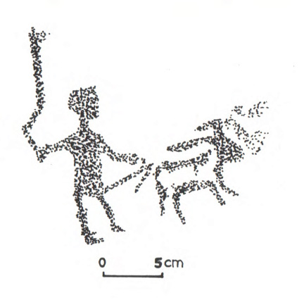
We tried to illustrate the main aims of the project in the logo which is based on a rock art drawing in our concession (see Vila 1976, fig. 22).
Rock art motif at 3-L-24 after Vila 1976, fig. 22.
Within the MUAFS project, the area between Attab and Ferka will be investigated with a biography of a landscape approach and a long durée approach, considering all attested periods; the area is a natural and cultural border zone and therefore relevant for border studies.
We are very much interested in humans and cultural groups inhabiting and shaping the area. Objects and the material culture throughout the time is another of our research aims. Animals and other non-humans like plants will also be considered with priority. And finally, bringing these aspects together, we also focus on general activities and production within this area.
Although I was not aware of it when I chose the specific piece of rock art as the future MUAFS logo, the logo is also graphic evidence for the emergency affecting the project: Modern gold mining, construction works and building activities are endangering the cultural heritage of the area.
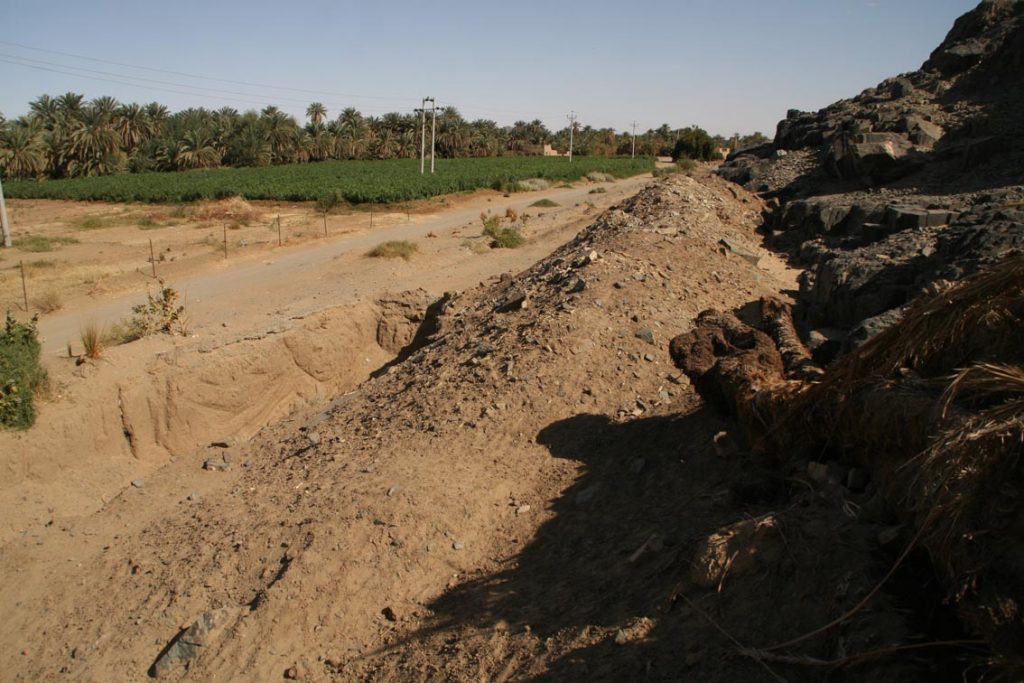
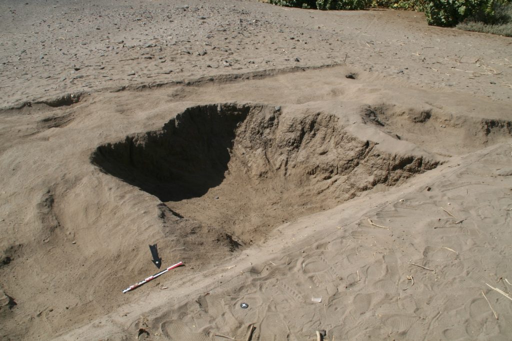
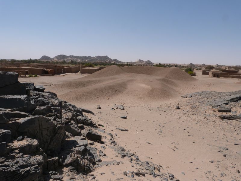
The rock art site 3-L-24 in Mograkka East comprising the picture of a herdsman we used for the MUAFS logo is presently buried below sand and debris from recent channel construction.
Present situation of the site 3-L-24: rock art including the MUAFS logo is buried below the debris of modern construction work and no longer accessible.
The area between Attab and Ferka has changed tremendously since the time of Vila – and this will also be illustrated and studied by both the MUAFS and the DiverseNile project in the next years.
Reference
Vila 1976 = Vila, A. 1976. La prospection archéologique de la Vallée du Nil, au Sud de la Cataracte de Dal (Nubie Soudanaise). Vol. 4. Paris.
Research projects are of course not comparable with companies selling products and thus the relevance and importance of a proper logo is for sure much lower.
Nevertheless, especially for dissemination purposes, the online presence and to reach our target groups, logos are also essential for us scientists.
A logo graphically represents the corporate identity of a project and is therefore part of its visual appearance. Just as one example, I was extremely proud of the logo for my previous ERC project AcrossBorders which is easy to recognize (I believe).
A logo should hold ideally a signal effect and provide information about the project at one glance – thus, it is not an easy task to design such a logo which also meets aesthetic values underlining the independence of the specific project.
Today, I am very proud to introduce the new DiverseNile logo – as with the MUAFS logo, the original ideas came from my side, but the realisation, complex design and final version are indebted to the creativity of hertha produziert, the Viennese graphic specialists who also produced already the great AcrossBorders image video.
The new logo of my ERC project DiverseNile
So let’s see together what the new logo wants to sell:
The outline of the logo is the exact outline of our concession area. The DiverseNile project will investigate this specific region of the Middle Nile in Sudan as a case study.
The two outstretched arms represent both the very specific course of the Nile in our concession as well as the cultural contacts between Egyptians (coming from the north) and Nubians (coming from the south). We are by now much aware that this cultural contact during the Bronze Age in Nubia did not happen in a one direction only, with the Egyptians as the prominent actors but that technological transfer, exchange and contact occurred in both directions and was very dynamic, including diverse groups of people. To reconstruct the actual cultural diversity in our research concession is one of the prime goals, highlighted by the colourful letters of “Diverse” in the logo. The arms almost touching each other in the logo also illustrate our understanding of contact spaces. Within the DiverseNile project, we comprehend contact spaces as “social spaces where human actors meet, perceive and constitute otherness, clash, and grapple with each other” (Stockhammer and Athanassov 2018: 106).
The slightly different colour shades of the DiverseNile logo symbolise the landscape approach of the project – the Nile as a changing environment and the concession area as a geological border zone are important factors. The colour shades also illustrate the major differences between the East and West banks of the Nile in our concession – with desert environment and open hinterland towards oases and transport routes on the West bank and rocky hills and mountains on the East bank with ancient mining and quarrying activities.
I really hope our efforts in pointing out the most relevant aspects of DiverseNile in this graphic design were successful and will help introducing the new project to our target groups. Feedback is of course much appreciated!
Reference
Stockhammer/Athanassov 2018 = Stockhammer, P.W. and Athanassov, B. 2018. Conceptualising Contact Zones and Contact Spaces: An Archaeological Perspective, 93‒112, in: S. Gimatzidis, M. Pieniążek and S. Mangaloğlu-Votruba (eds.), Archaeology across Frontiers and Borderlands. Fragmentation and Connectivity in the North Aegean and the Central Balkans from the Bronze Age to the Iron Age. OREA 9. Vienna.
Today is
the day – after months of preparation, my new ERC project DiverseNile is now
officially running under the grant agreement No. 865463! Many thanks go here
first to all the officers in Brussels and the persons here at LMU who made this
possible, even in challenging times like we are all experiencing in the last
weeks. And of course I am very grateful to my core team who supported the application
and without whom this project would not take place!
More information about the main hypothesis and the objectives of the project are now available here. We are still in the process of recruitment and due to the corona crisis this process will take longer than we thought. Nevertheless, for now we can start working at home collecting and processing data which will enable us to challenge the present categories of “New Kingdom”, “Egyptian”, “Nubian” and “Kerma”. Five exciting years have just started!
As already reported, the 2020 test excavations of the MUAFS project focused on Bronze Age sites at Ginis East, including Gie 001, where much Egyptian New Kingdom material was found. The following is a very short summary of our work at the Kerma sites GiE 004, 005 and 006.
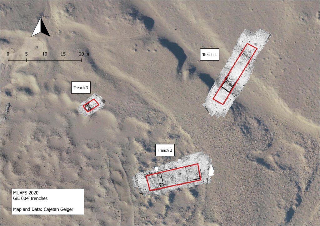
GiE 004
In 2019, we assumed
that the site GiE 004 was documented by Andrè Vila in the 1970s as site 2-T-5.
However, new georeferenced data and fresh GPS waypoints made it clear that this
needs to be corrected and that GiE 004 was not documented by Vila, being
located further to the south than 2-T-5.
The magnetometry survey of the site by MUAFS in 2019 yielded promising results which, according to the finds and the structures visible on the magnetogram, were interpreted as remains of a Kerma village. Rounded huts, fences and walls seemed to be visible. The borders of the wadi systems were also clearly visible in the magnetogram. Our 2020 test trenches were chosen to proof if there was a kind of fortification along the wadi and whether the interpretation of the anomalies were correct.
Three trenches were laid out (Trench 1: 18 x 3 m, at
the edge of a wadi; Trench 2: 14 x 4 m, at the top of the plateau of the site;
Trench 3: 2 x 3.5 m, within a circular depression around the central part of
the site). After a shallow, sandy surface layer with many finds, no
sedimentation and no structures were found in all three trenches. All features
documented and which were alternating areas of sand and clay are clearly
natural. Thus, the clear result of the 2020 text excavation at GiE 004 was that
the anomalies of the magnetometry were over interpreted as structures and are
actually natural features.
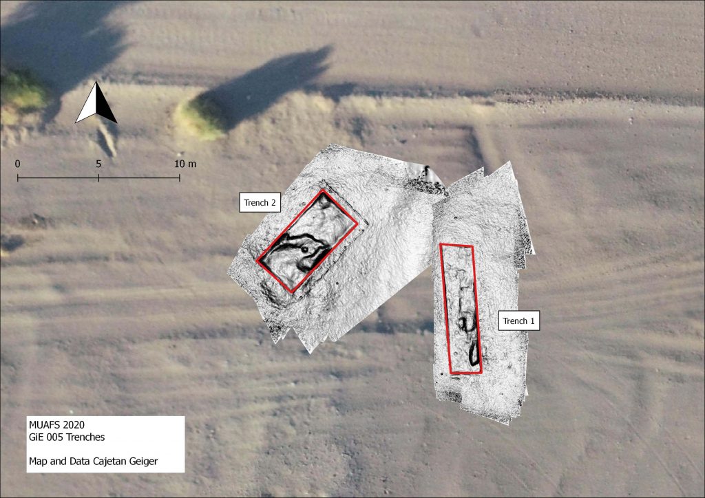
GiE 005 (Vila 2-T-5)
The Kerma site documented by Vila as 2-T-5 was labelled by MUAFS as GIE 005. The site is situated on the alluvial plain, and extends east west on the remains of a shallow, barely visible terrace (25-40 cm high). The site covered in the 1970s an area of c. 500 EW x 35 m NS – part of this is now below modern houses or destroyed because of car tracks. Two test trenches were laid out in 2020 in the eastern part of GIE 005.
Trench 1 (8 x 2 m) yielded some small depressions and pits below a shallow sandy surface. Very few Kerma sherds were discovered in a lower muddy level, without evidence of structures or stratigraphy.
Work in progress at Trench 1.
Trench 2 (6 x 3 m) comprised a small sandy hill with many schist stones scattered around. Here again, no structures and no sedimentation or stratigraphy were observed. The sandy hill seems to be a sub-recent assemblage of wind-blown sand. Interestingly, the same muddy layer like in Trench 1 below the sand yielded one single artefact, a Kerma sherd laying on a solid clay surface.
Overall, the camp site 2-T-5 is badly preserved, and no stratification is present, as already observed by Vila. One important result of our work in 2020, however, is a tentative dating to the Kerma Classique period and the presence of 18th Dynasty Egyptian material which has not been noted before. There were some Egyptian wheel-made pottery sherds between the ceramics – nicely datable to the early New Kingdom!
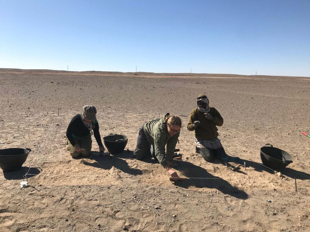
GiE 006 (south of Vila 2-T-5)
Surface finds suggest that the camp site 2-T-5 might also extend further to the south, south of the barely visible terrace of GiE 005. In order to test this, a trench was opened at a site now labelled as GIE 006. Trench 1 (3 x 5 m) only yielded surface finds and showed an irregular muddy, natural surface below the sandy surface layer. As in GiE 005, no stratification is preserved.
Cleaning the surface at GiE 006.
Although the finds are mixed and can also be explained with a multi-period use of the site, most of the material belongs to the Kerma horizon. Thus, this is probably an extension of a Kerma camp identical or similar to GiE 005.
Summary
In sum, the test
excavations at Ginis East – including the results from GIE 001, provided
important new data on 1) the character of the sites, 2) the dating of the sites
and 3) the clarification that the interpretation of the magnetometry survey
from 2019 turned out to show no actual structures, but different natural layers
at GiE 001 and GiE 004.
As it was already observed by Vila, at many sites on the east bank in the MUAFS concession there is little or no sedimentation preserved. This is an important aspect to consider in our next field seasons – the situation is markedly different on the west bank where we also documented some intriguing Bronze Age sites with mud brick remains. There is still much work ahead of us!
Despite of the recent
developments because of the crisis due to the COVID-19 virus, my new ERC project,
DiverseNile, will start on April 1st 2020 here at LMU Munich. I am very
grateful to the wonderful support of the administrative staff both in Brussels
and in Munich – it was quite a challenge, but now all is set to go!
More information on the project, my team and our intermediate goals will follow shortly – for now I would like to share a new dissemination article in which I tried to highlight the challenges and aims of DiverseNile (read it open access or download it here as PDF).
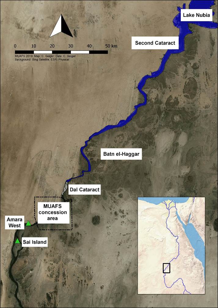
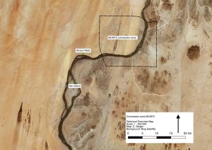
DiverseNile will be conducted within the framework of the MUAFS project – the Attab to Ferka region in Sudan is the perfect area for our new study.
Location of the MUAFS concession in relation to the Batn el-Haggar, Amara West and Sai Island.
I believe that in order to address the actual diversity of ancient groups in the Nile Valley a new approach focusing on the periphery and hinterland of the main centres is needed, considering both landscape and people in an integrative method. This is where DiverseNile will step in with our perfect case study between Attab and Ferka. The main objective of DiverseNile is to reconstruct Middle Nile landscape biographies beyond established cultural categories, enabling new insights into ancient dynamics of social spaces. Can’t wait to get started in April!
The world has changed since last week – COVID-19 has a major influence on archaeological fieldwork, universities and museums. MUAFS was very lucky in this respect – after our odyssey with the extra day in Khartoum and a night in Istanbul, we made it safely to Munich, just in time before borders got closed and flights cancelled. Of course all planned fieldwork in Egypt in April had to be cancelled and I could also not make my home visit to Vienna. But difficult times require flexibility and the most important thing now is of course to flatten the curve and to stay safe (and home)!
Well –
research for MUAFS is of course still possible and all of us are using the time
in home office for reading things and compiling the data from the 2020 season.
The following is just a short summary of our test excavations of the 2020 season – this season was a preparation season for the next, longer field season which will be the start of my new European Research Council Project DiverseNile. Thus, the focus was on promising sites dating to the Bronze Age/Kerma Period in the Ginis East area where also Egyptian presence of the New Kingdom is attested.
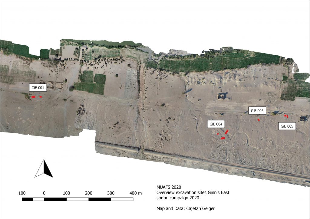
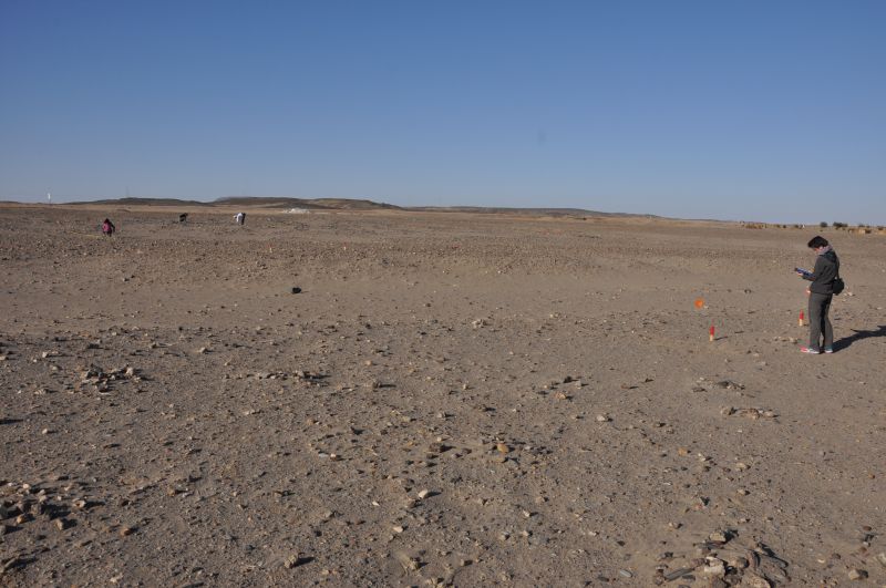
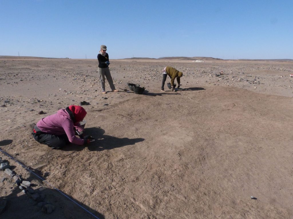
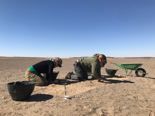
In order to get familiar with the site formation processes and sedimentation in the area, we conducted at four sites in the district of Ginis East small test excavations. A total of 8 trenches were excavated by the team; local workmen will be engaged in the next season.
Location of sites and test trenches at Ginis East 2020.
As you will see in the following – the results from the individual sites were not as we hoped for but are nevertheless very important outcomes of what was designed as a test season.
I will start with site GIE 001 and a separate post will present the results from the other sites at Ginis East.
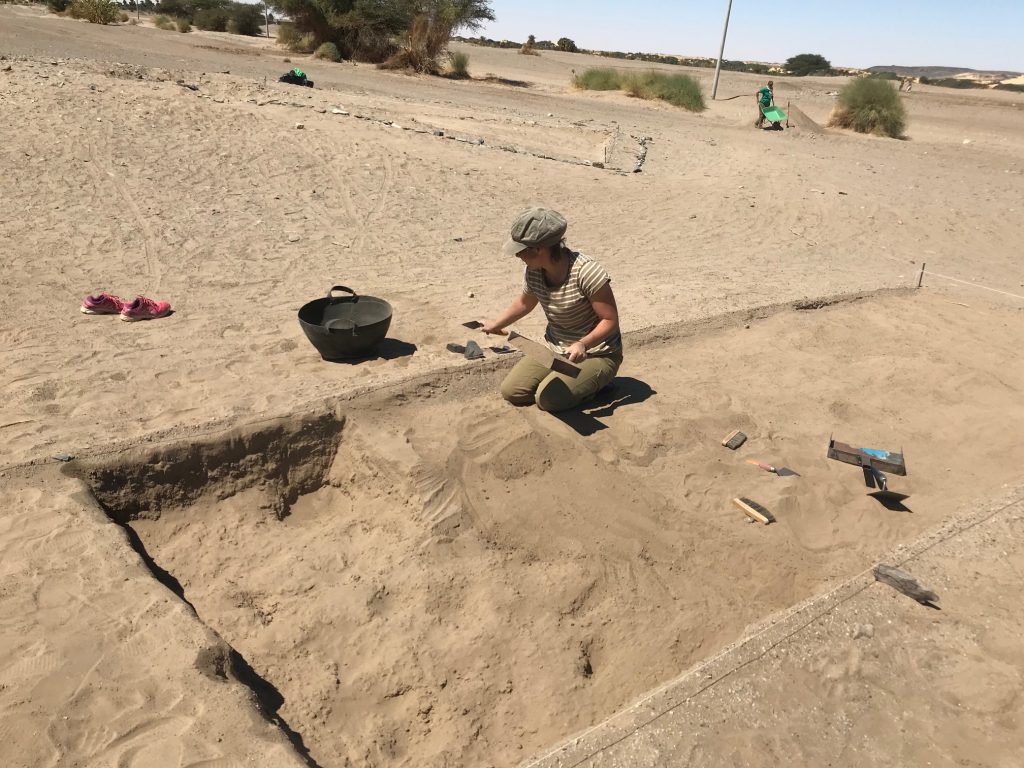
GiE 001 – a New Kingdom (and Kerma?) settlement site
Recorded by Vila
as 2-T-36B, this domestic site at Ginis East can be assigned to the Egyptian
New Kingdom, showing also an intriguing Kerma presence according to the surface
finds. Magnetometry was conducted by MUAFS in 2019. In the 2020 season, two
trenches were laid out above promising anomalies in the magnetometry in the
northeastern part of the site.
Trench 1 (6 x 4
m) yielded, apart from surface finds which were mixed and dated from the Kerma
Period, the New Kingdom, the Napatan Period and Christian times, some Kerma
Classique sherds from lower levels. However, no structures were found and the
magnetometry seems to show natural features, especially more sandy areas which
contrast to clay layers/alluvial sediments.
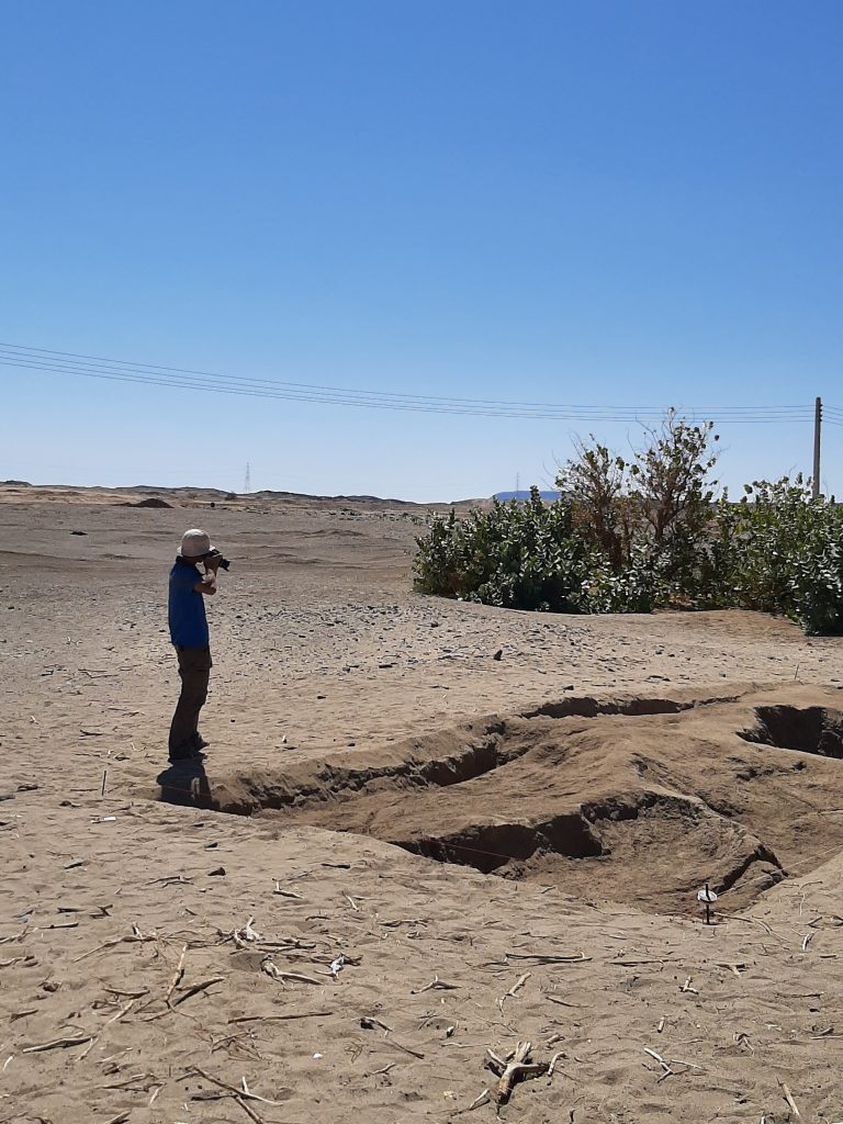
Trench 2 (10 x 4 m) generated large quantities of ceramics and stone tools from the surface. The main archaeological features found in this trench were sub-recent pits deriving from marog activities. The largest of these pits in Trench 2, Feature 1, is 2.40 m in diameter and 75 cm deep. It was filled with fine sand and the traces of the tools the marog diggers used are clearly visible on the sloping edges. We documented everything in 3D according to our standard procedure. The find material comprised mostly mixed pottery from the New Kingdom, Napatan and Medieval era as well as some recent date seeds and small pieces of charcoal and bone.
Feature 1, the marog pit, in Trench 2 at GIE 001.
Both trenches in GiE 001 did not yield mud bricks or
any structures from the New Kingdom; it is likely that this part with the
trenches is already located outside of the former settlement area. That the
area was inhabited and used during both the 18th Dynasty and the
Ramesside period, becomes nevertheless evident from the find assemblages we
collected.
Excavation and processing of data at GIE 001 will continue, but for now the New Kingdom site with later use seems associated with gold exploitation in the periphery of Sai Island and Amara West, as I have already proposed in an earlier post based on the finds (ceramics and stone tools).
We should just have landed in Munich these minutes… but since a sandstorm in Khartoum prevented the airplanes to land yesterday, our flight was cancelled and Jessica and me are now stuck in a hotel close to the airport…
Well, we are still waiting for information when we will have the next try and thus I thought I use the time to go through some of the pictures we took this season.
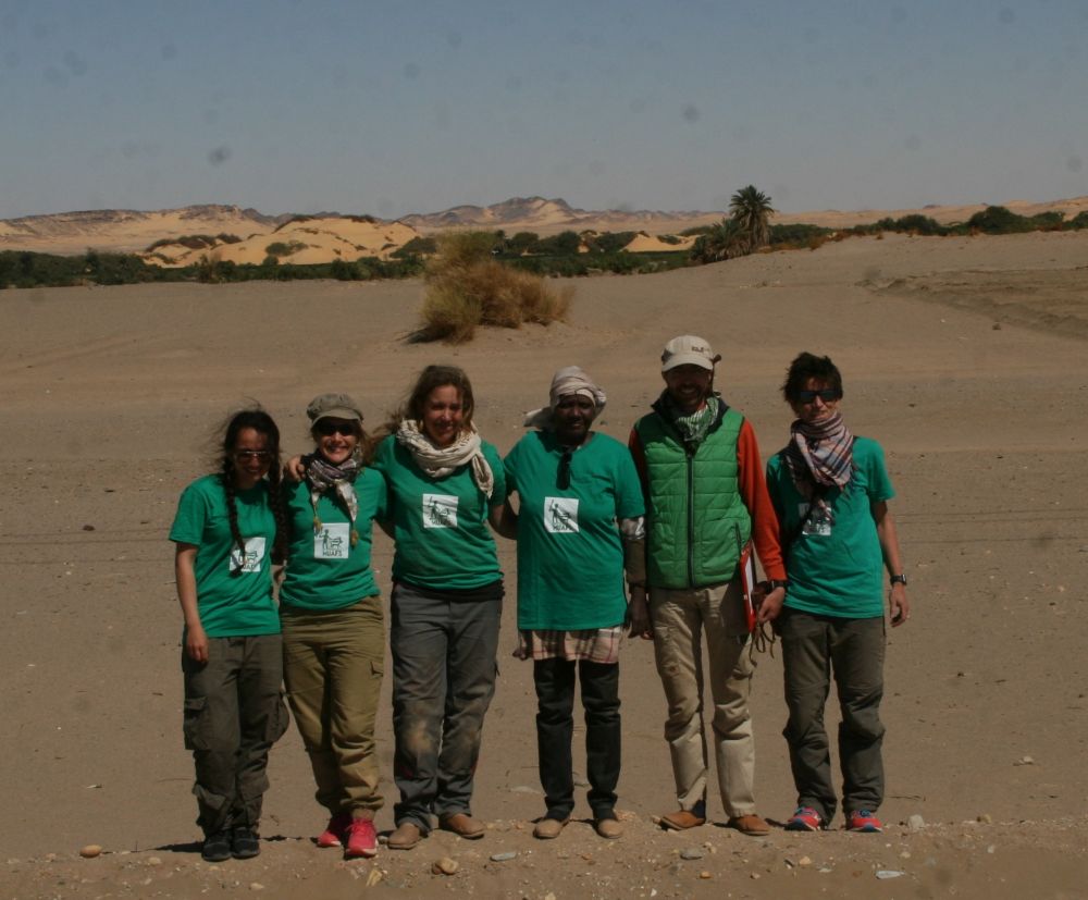
The 4.5 weeks of work at Ginis East and sourroundings were intense and varied, in terms of tasks, weather, nimiti and other things. Here are some impressions with a huge load of thanks to my great 2020 team! Looking much forward to the next season!
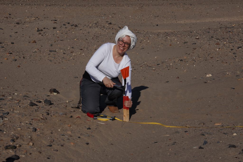
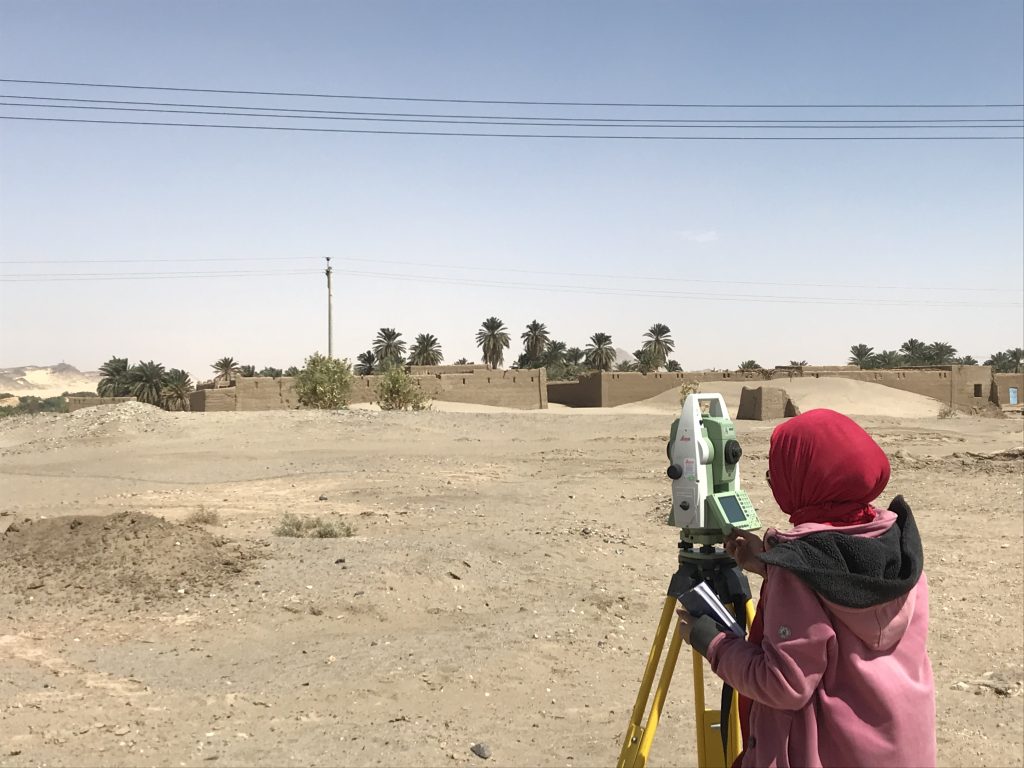
First day in the field, setting up the trenches (photo: C. Geiger)Veronica setting on of the posts for our trench (photo: C. Geiger).
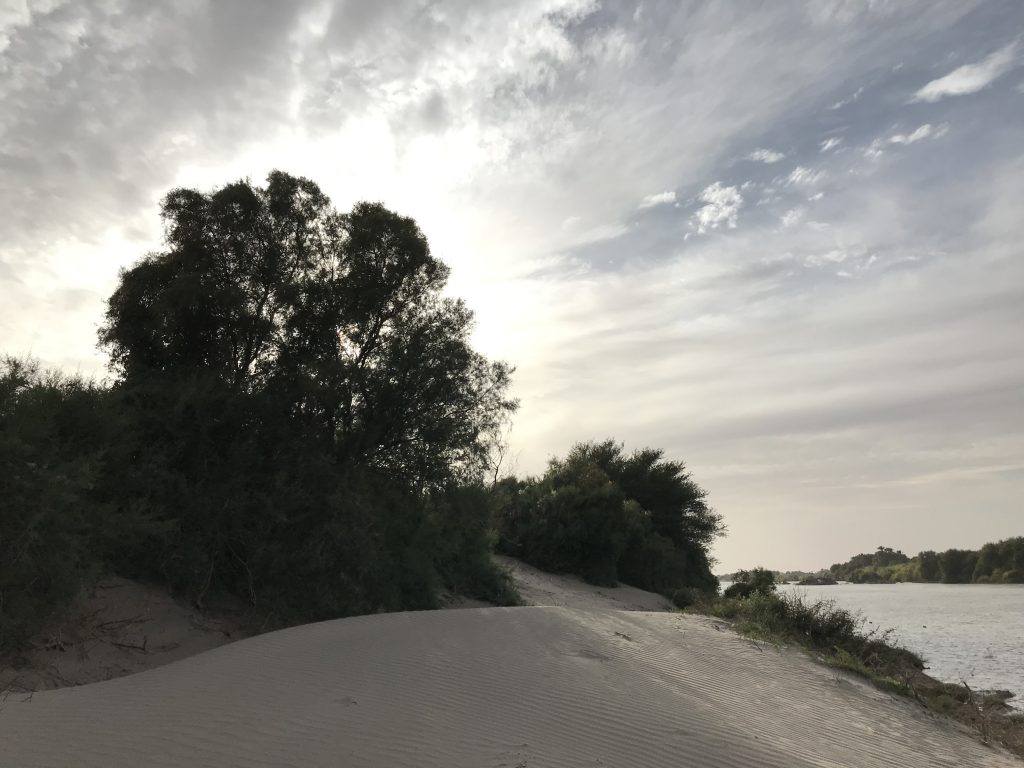
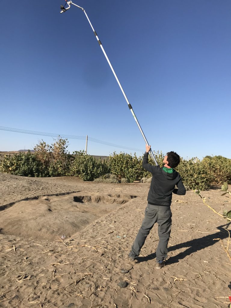
Giulia at work (photo: C. Geiger).Surface cleaning at GiE 001, Jessica and Huda (photo: J. Budka).Jessica documenting the church of Mograkka (photo: C. Geiger).Cajetan at work – image based documentation of the church of Mograkka (photo: J. Distefano).Giulia, Veronica and Huda at GiE 006 (photo: J. Budka).The 2020 Team at Ginis East.The Nile and riverbank at Ginis (photo: J. Budka).Me busy with surface documentation at GiE 001 (photo: J. Distefano).Photographing Trench 2 at GIE 001 (photo: J. Distefano).Jessica taking survey points with the total station (photo: J. Budka).The landscape at Mograkka East (photo: J. Budka).Jessica looking for diagnostic pottery sherds at one of the Christian cemeteries in Mograkka (photo: J. Budka).Jessica taking measurements at the curch of Ferka East (photo: J. Budka).Me photographing Post-Meroitic tumuli at Ferka (photo: J. Distefano).Huda, Jessica and me after we finished the survey in Mograkka.
The MUAFS
2020 season will be officially closed today – we arrived safely in Khartoum
yesterday and will now finish all the paperwork.
The last days at Ginis were busy, finishing off the survey, packing and registering the finds from this season. A more concise summary of the 2020 season will follow shortly, but here are some observations regarding our survey.
Like in 2019, one particular
focus of our survey was on the state of preservation of the sites nowadays –
unfortunately, at almost all sites, we observed modern destruction and/or
plundering. Especially drastic were destructions because of road building, the
electricity posts and modern gold working areas.
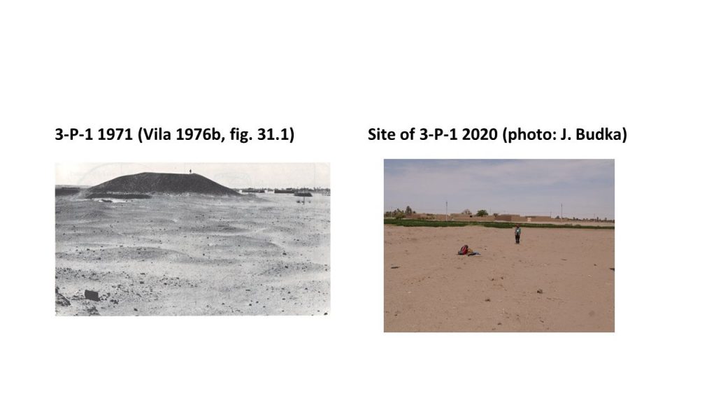
One particular striking example is the large tumulus within the Post-Meroitic site 3-P-1 at Kosha East. This monumental tumulus, comparable to the ones at Ferka, but also to the famous tombs at Qustul and Ballana, has completely gone by now. According to information kindly given by local villagers, it was removed in 2008.
One of the sad discoveries of this season: the huge tumulus at Kosha was completly dismantled.
Where Jessica is standing in this photo, there used to be an elite tomb monument dating back to Post-Meroitic times. Large parts of cemetery 3-P-1 are now under modern fields; the line of electricity cuts the southern extension of the site. The nearby Kerma cemetery was affected by the construction work of the road to Wadi Halfa and the Neolithic sites located in the hills above the Kosha plain just 300m to the southeast are strongly influenced by modern gold working.
Altogether, as successful as our 2020 survey was, re-locating 40 sites of the ones documented by Vila and finding a number of previously unrecorded sites, we were also faced with very frustrating news and massive destruction of the archaeological monuments. There clearly is the urgent need to undertake cultural heritage actions in the region, but this is something where MUAFS will need help and support from several authorities.
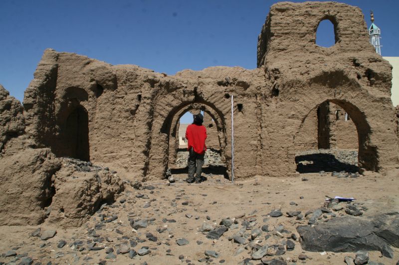
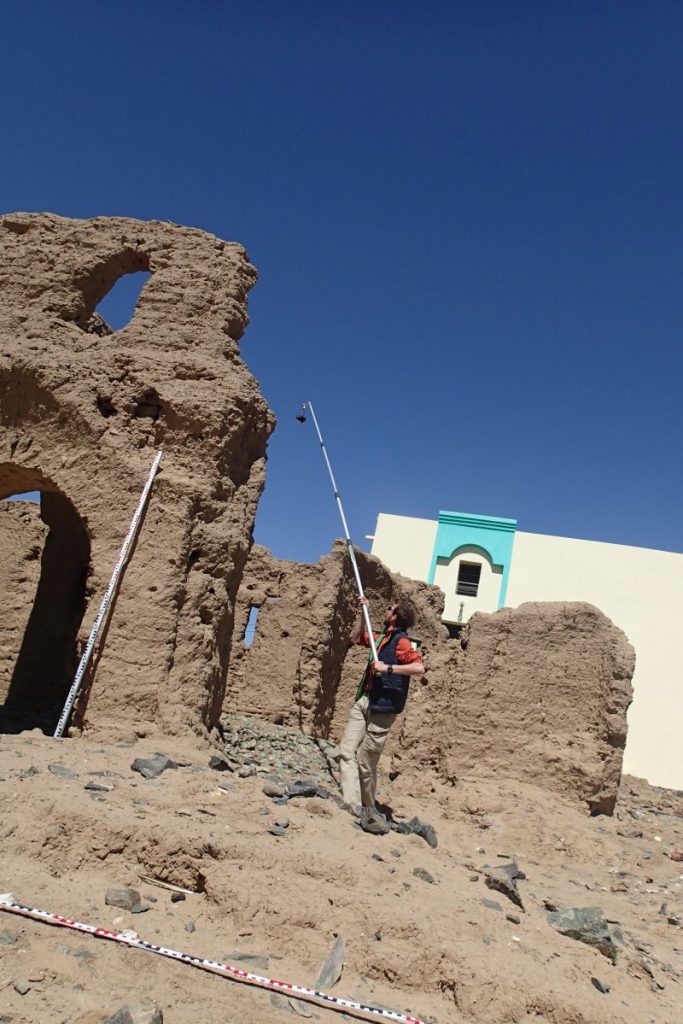
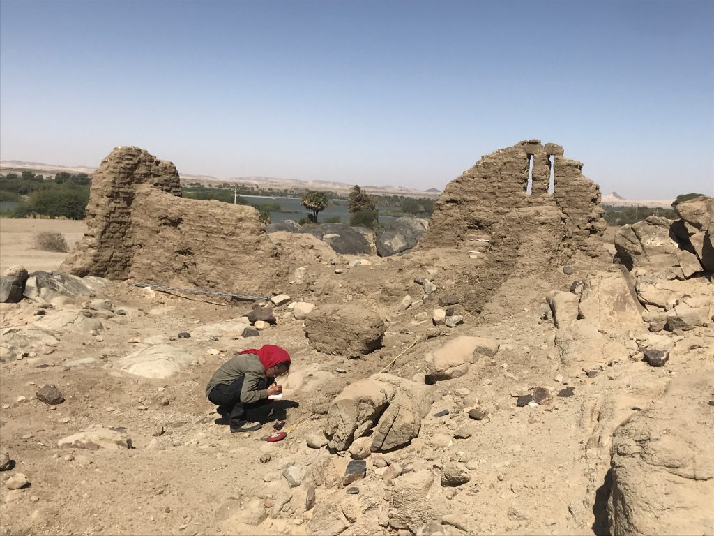
Ferka is the district marking the northern end of MUAFS concession – the area is famous for monumental Post-Meroitic tumuli already excavated by Lawrence Kirwan and a large quantity of Medieval sites, including among other the small mud-brick church 3-G-9.
Documentation at the small church 3-G-9.
The elite tombs at Ferka, 3-G-1, are simply stunning – some of them have a height of more than 12m and clearly bear some resemblances to the famous tombs at Qustul and Ballana (see Kirwan 1939).
One of the monumental elite tumuli at Ferka East.
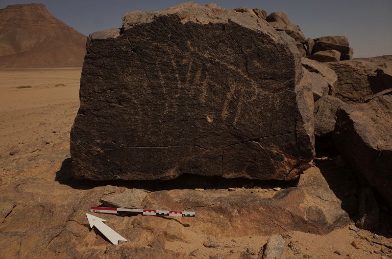
Rock art is another category that is well attested in Ferka East, most of which seems Medieval in date.
Example for rock art at Ferka East.
We documented most of Vila’s sites in the area in the last two days; some are still not found and seem to have gone due to modern house building, road construction work and gold digging.Thus, this compares to what we discovered in Ginis, Kosha and Mograkka. But as I have already noted in 2019, the site distribution in Ferka is very specific and is dominated by remains from late epochs, contrasting with other districts of the MUAFS concession.
Apart from the numerous sites dating to the 1st millennium AD, two large Kerma cemeteries, both located in the area of the large wadi, Wadi Sibée, are notable as earlier evidence. One of them comprises c. 20 tombs, the other one up to 40 tombs. We still found Kerma Classique ceramics associated with both cemeteries. This suggests a late date within the Kerma period fo these burial grounds. It is still an open question where contemporaneous camp sites or villages are located – the majority of domestic Kerma sites is situated in Ginis and Kosha, thus further upstream. These are important questions we will address within the framework of the ERC project DiverseNile which will soon be launched in Munich.
We will finish our 2020 survey in the next days, working a bit more in Mograkka and Kosha. Since Friday, we are fighting with very long power breaks and lacking phone connection and almost no internet access – no ideal parameters towards the end of a season, but we just need to stay patient. Electricity was at least working for a few hours over night, allowing recharging our equipment. So all set for another full day of archaeology tomorrow!
P.S.: and since this blog post did not go live yesterday as planned, it is actually already tomorrow and we will soon start another day!
Reference
Kirwan 1939 = Kirwan, L. P. 1939. The Oxford University Excavations at Firka. London.
We are
already approaching the end of our second season of the MUAFS project.
As planned, we finished our test excavations at GiE 001 and GiE 004 earlier this week and were then busy with surveying areas of the concession on the East bank.
The marog digging activities at GiE 001 were fully documented and surface cleaning at GiE 004 yielded some interesting information regarding the possible function of the site where Kerma Classique material dominates the assemblage.
Thanks to the introduction by Cajetan before he left to Munich, we are also up-to-date regarding our 3D surface models and digital documentation– Jessica managed the processing with PhotoScan and QGis very well.
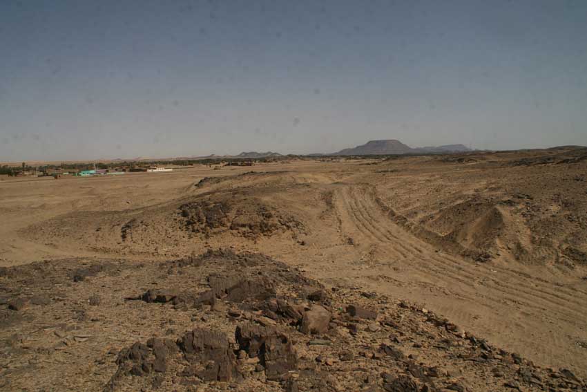
Three days of survey at Ginis, Kosha and Mograkka were exciting, but also partly very frustrating – we relocated a total of 27 sites documented by Vila in the 1970s, but unfortunately a number of these have been completely destroyed, especially because of the road construction work of the asphalt street going to Wadi Halfa. This holds in particular true for cemeteries laid out on sandy plains and alluvial platforms.
Example of changes in the landscape at Kosha East, due to the road construction and modern gold mining.
Further destruction is caused by modern gold mining and some areas of the region have been completely modified since the 1970s, making a crosscheck with Vila’s documentation sometimes were difficult. Sites located further into the hillsides were in most cases more lucky and still represent excellent example for the occupation of the region. We documented camp sites from various periods, especially Neolithic times and Kerma periods, but very often also multi-period sites.
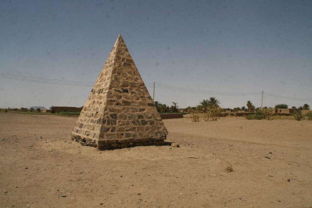
Bristish pyramidal memorial at Kosha East.
An unexpected discovery was a small stone pyramid at Kosha East – I simply did not know that one of these pyramidal memorials set up by the British in Sudan and of which I have already seen quite a number further north, was also erected in our concession. Its label reads: „To the memory of British officers and men who died here in the Anglo-Egyptian campaigns”. This memorial is not the only reminder and evidence for the Anglo-Egyptian campaigns in our area – as already observed by Vila, several of our camp sites located in the hills show traces of recent re-use. Many of these sites were probably re-used by the Anglo-Egyptian soldiers. This is one of the more modern aspects of the landscape biography of the Attab to Ferka region which we will also incorporate into our general assessment.
We will continue with the survey next week, focusing now on the area around Ferka – fingers crossed that the storm that came up tonight will hopefully cease very soon.
